
Every public transportation system tells a story. Mostly, it is one of progress and hope. And then, there’s the Métro de Charleroi. Telling a story of dysfunctional politics and economic decline. A momument to a colossal plannig failure. Join me to explore the metro that shouldn’t exist.
Back in the good old days of Twitter, there was an endless stream of travel inspiraton in posts of fellow transportation fans. But none of these posts from all over the world hit me as hard as Adrian Fuentes photo report about the metro system in Charleroi, Belgium. What I saw was so absurd that I spent half the night on Wikipedia, soaking up every bit of information I could find. And even then, I still couldn’t understand how something like this could even be possible in Europe.
Just a few weeks later, I found myself on the night train to Amsterdam with a friend. I just had to see it with my own eyes. During a short stopover in Brussels, Adrian provided us with documents and tips. We were as well equipped as possible to tackle the incomprehensible absurdity of the Charleroi metro. But what we saw left us speechless more than once.
#BetonBélge was first published as a thread on my meanwhile deleted Twitter acocunt in March 2022. This an extended recreation of the thread in its original format. The content (texts, photos) refers to the state at the time of the first publication. Update boxes indicate major changes up to January 2026.
Dominic Stucki
@dominicstucki
Welcome to Charleroi! 🇧🇪
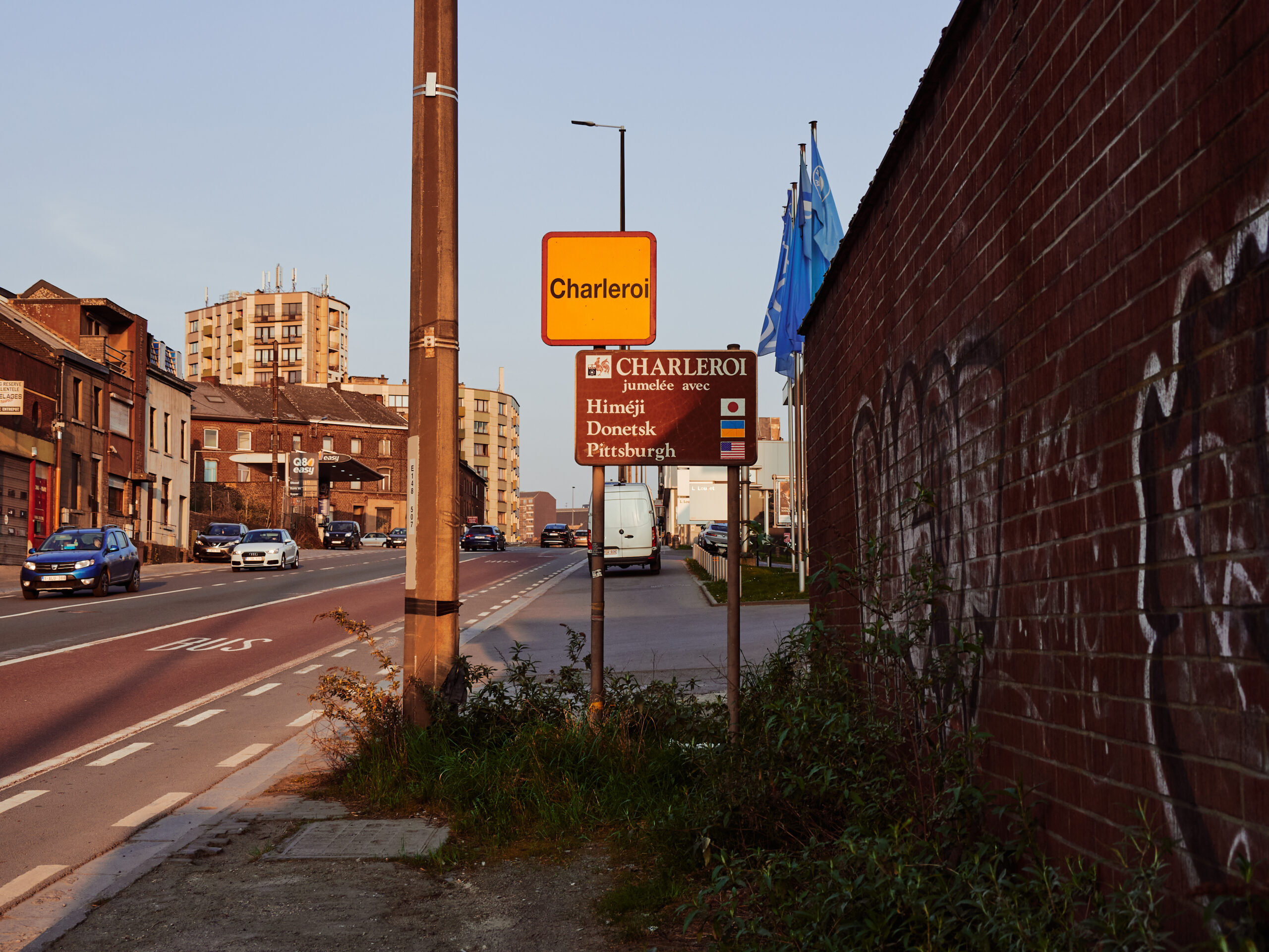
200’000 inhabitants (450k with suburbs), 200 rain days per year, a poverty rate of 30%, an unemployment rate of 25% and a crime rate like Marseille.
This city once was the proud center of the „pays noir“, Europe’s biggest mining district, a motor of industrialisation and the heart of the Belgian labour movement. But the last mine closed in the Eighties, the last blast furnace shut down in 2012.
For decades, the city hoped and worked for a turnaround. Sadly with little success yet. But it’s here, in Wallonia’s biggest city, where we find Europe’s probably most impressive example of failed public transport infrastructure politics: The Métro de Charleroi.
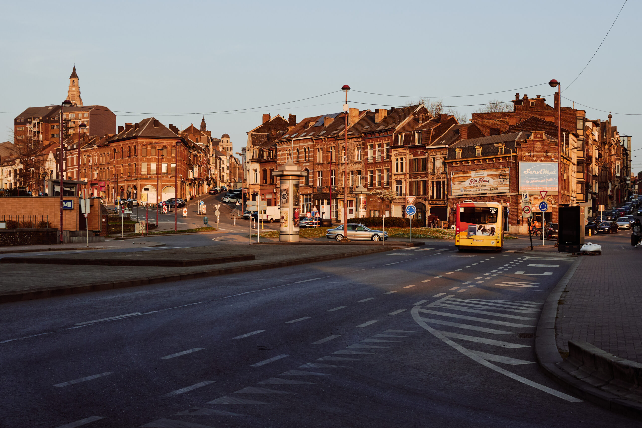
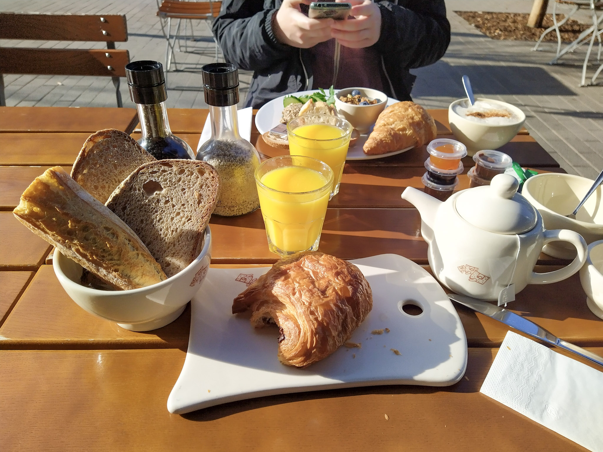
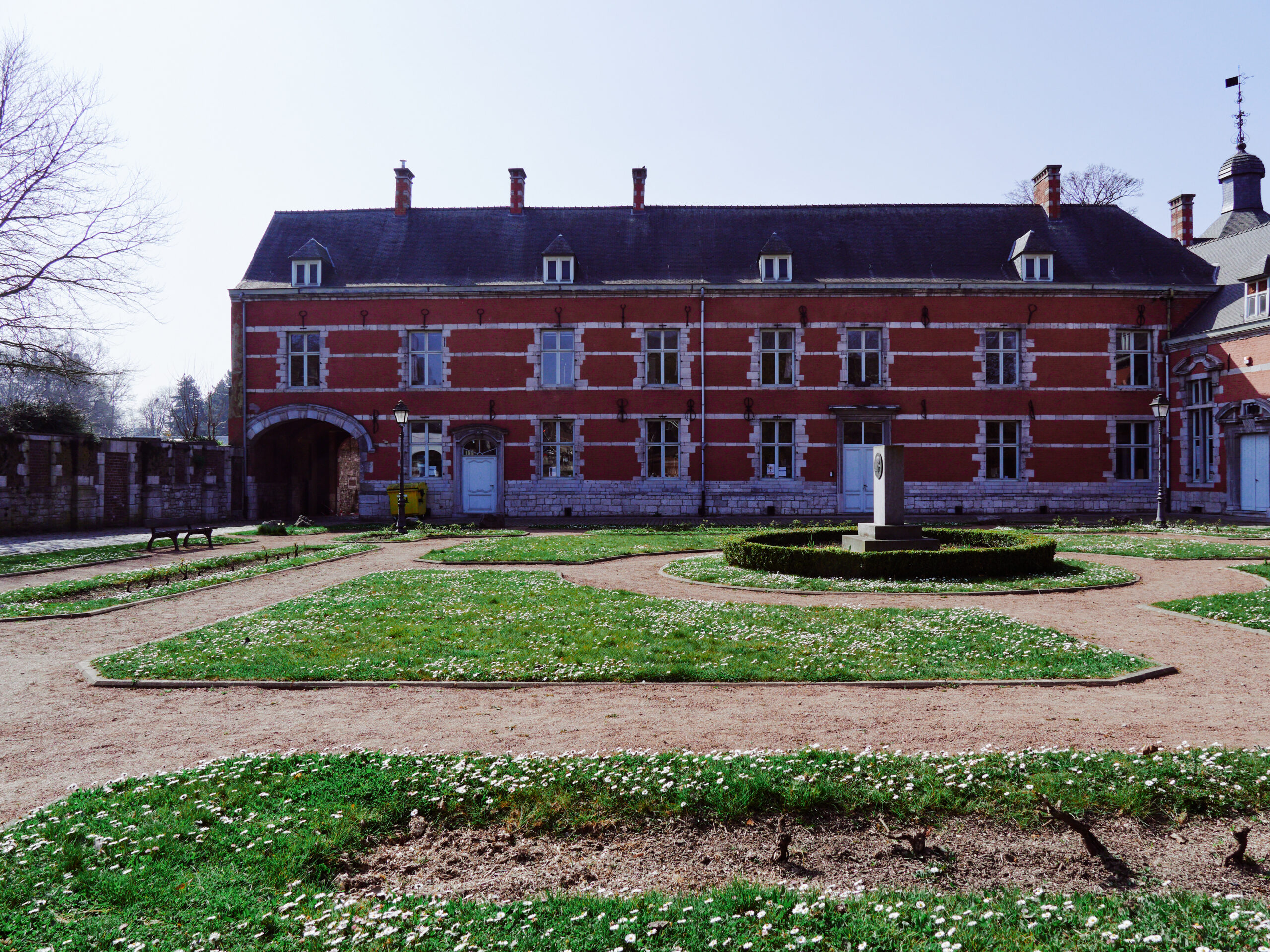
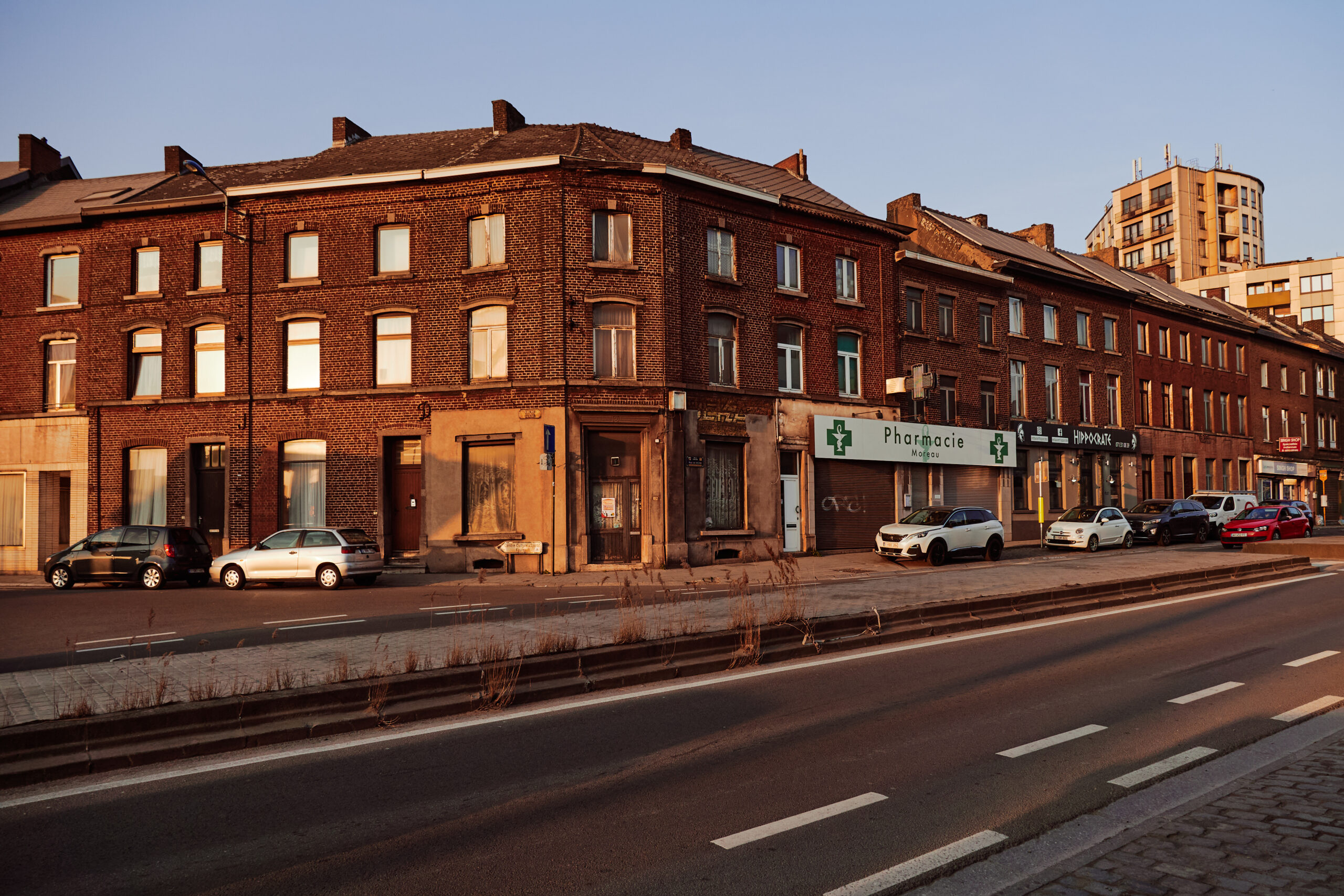
We came all the way from Switzerland to see it and one day was way not enough. Nevertheless, we took the time for a proper breakfast in the city centre, where many shops have closed forever. But it can’t be that bad, as long as there still is baguette & pain au chocolat. 🥐🥖
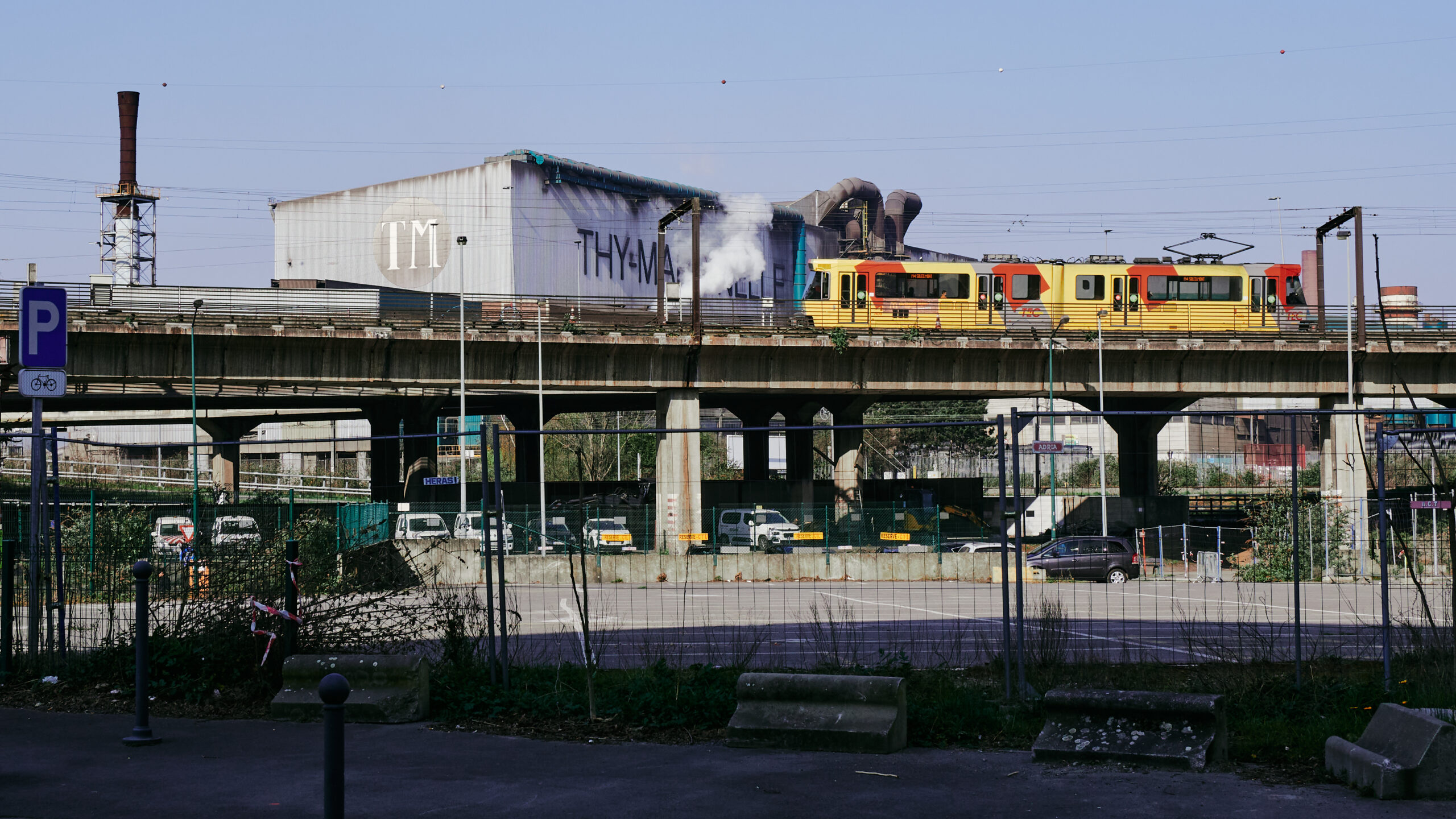
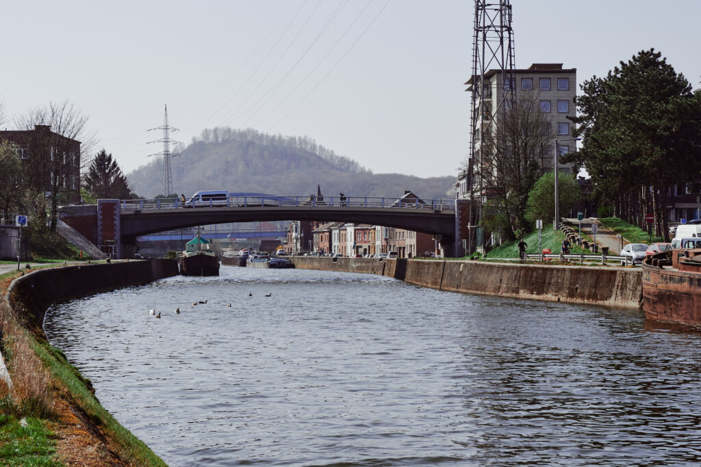
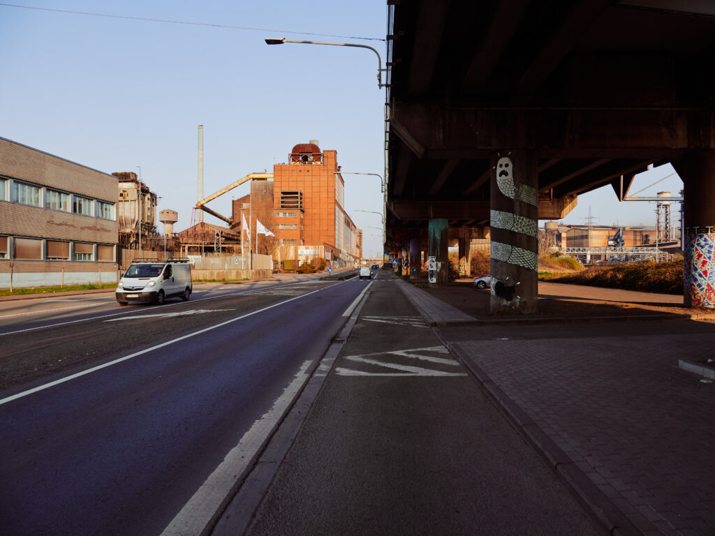
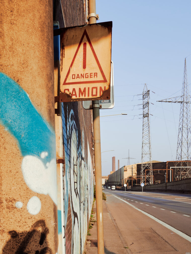
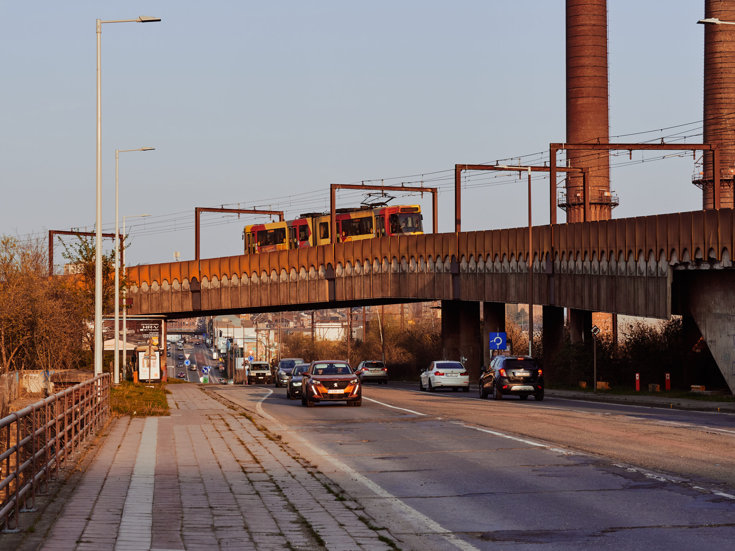
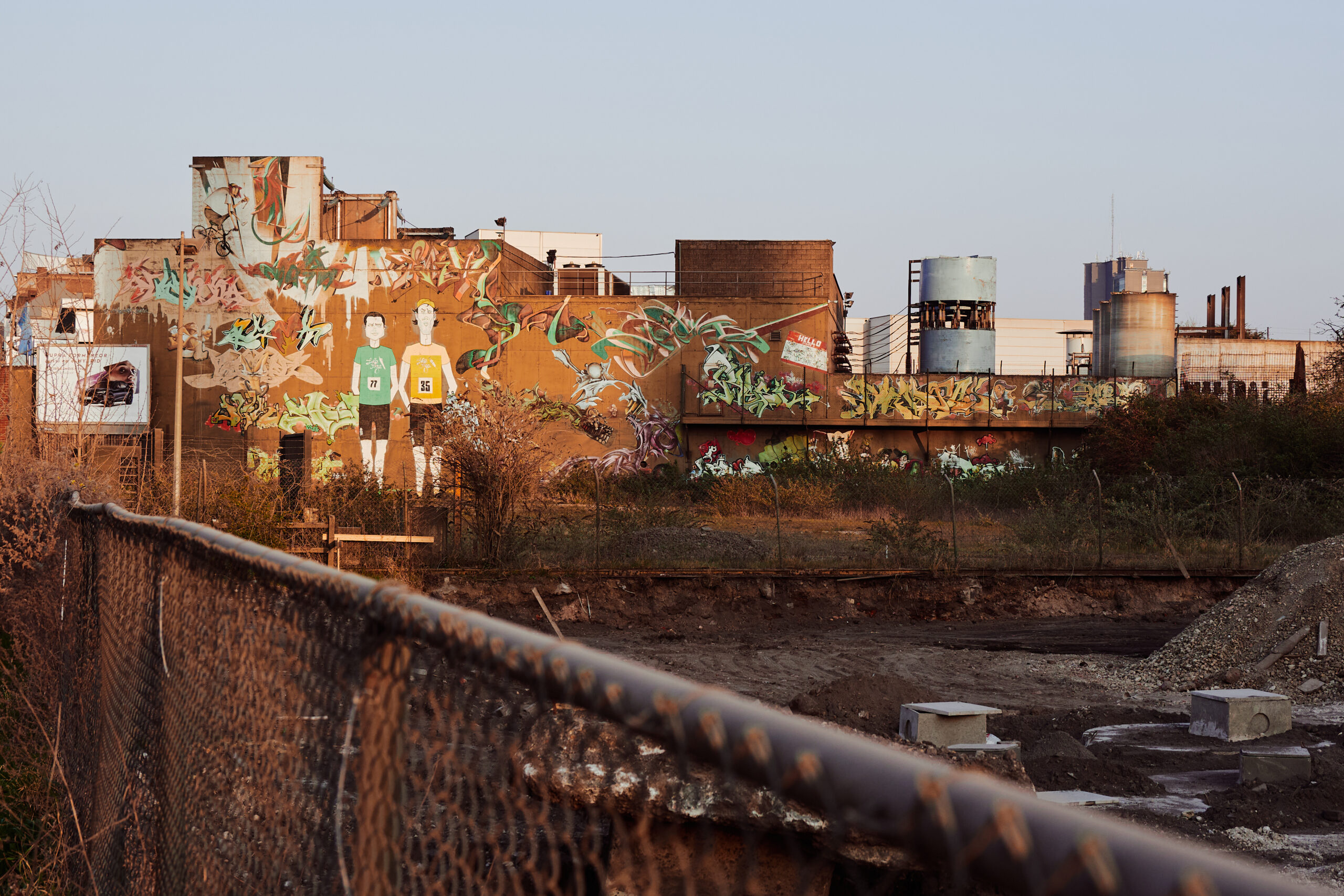
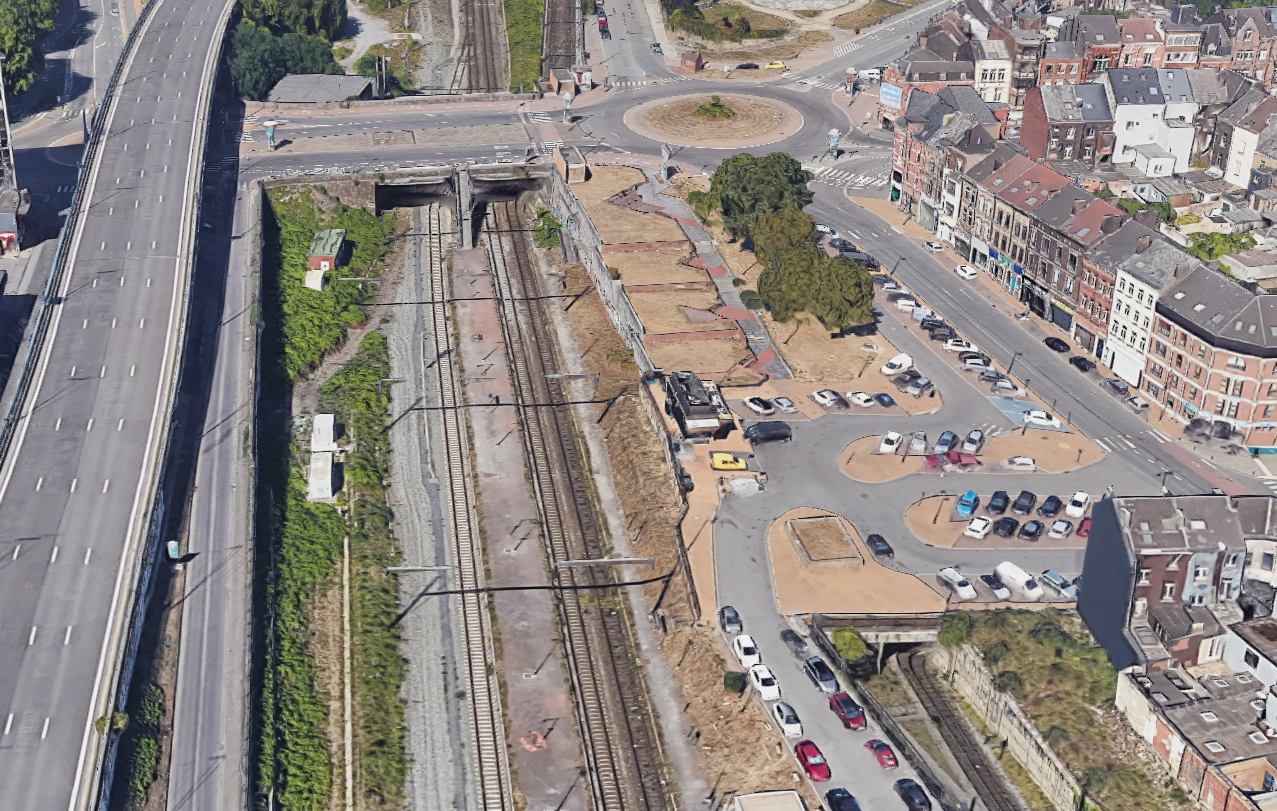
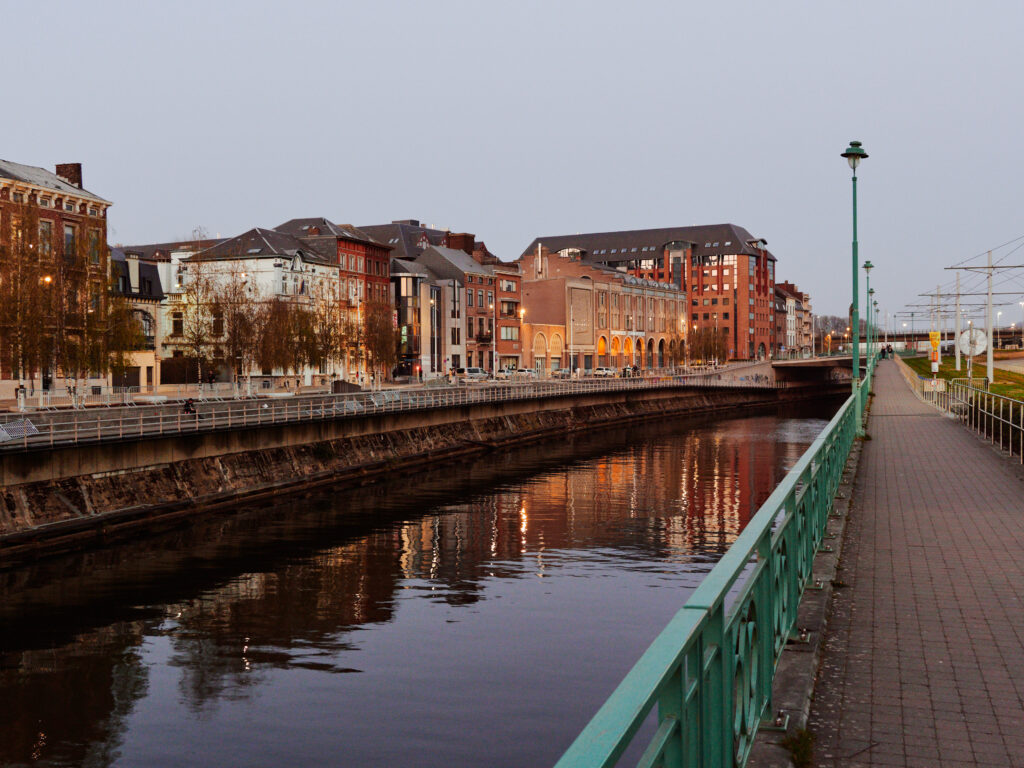
Then, just outside the old town, our first contact with the Metro. Behind it: The elevated motorway ring around the city centre – a monstrosity from the 70s. With a radius of only about 750 metres, it circles – or better: strangulates – the old town like a tight belt.
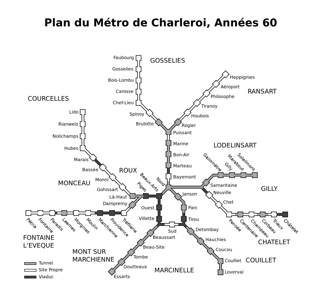
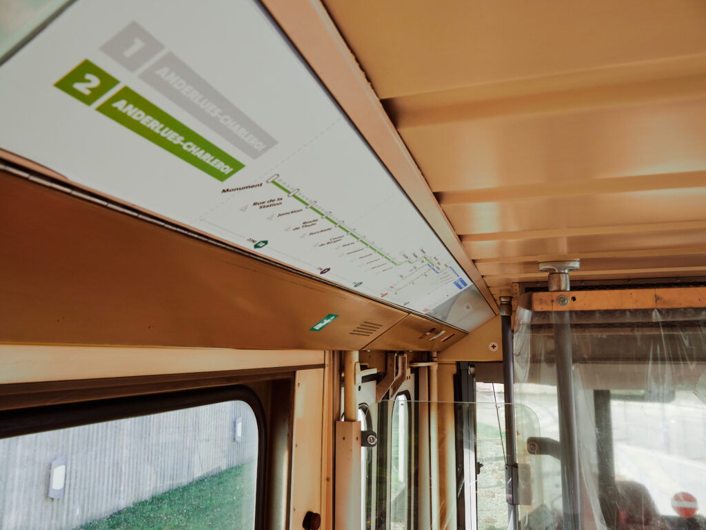
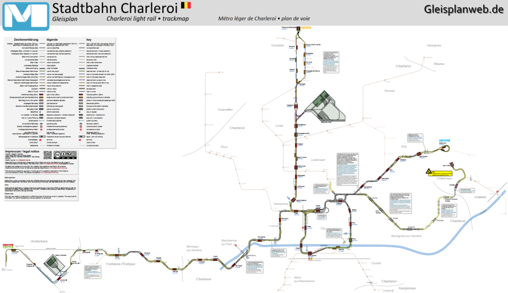
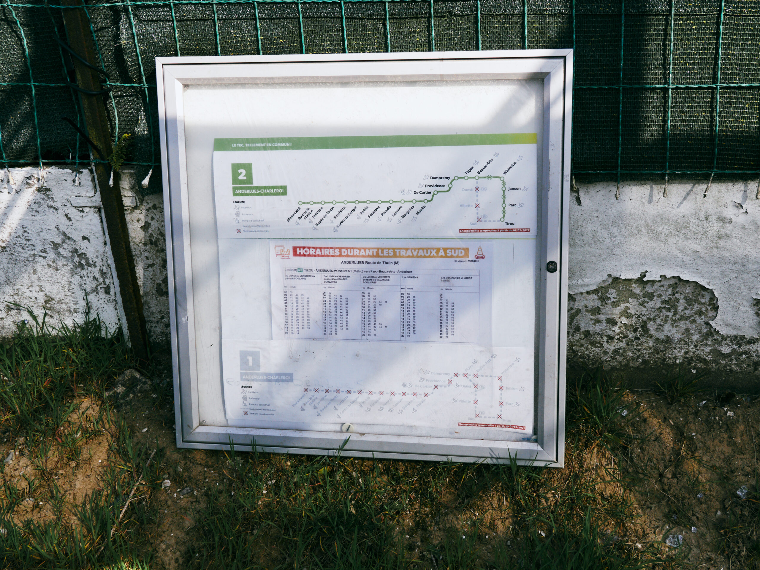
A short look on the map. The network consists of normally 4 lines, branching off from a central loop. Due to construction works at the main station, the loop is interrupted and only 3 lines are operating, one on each branch.
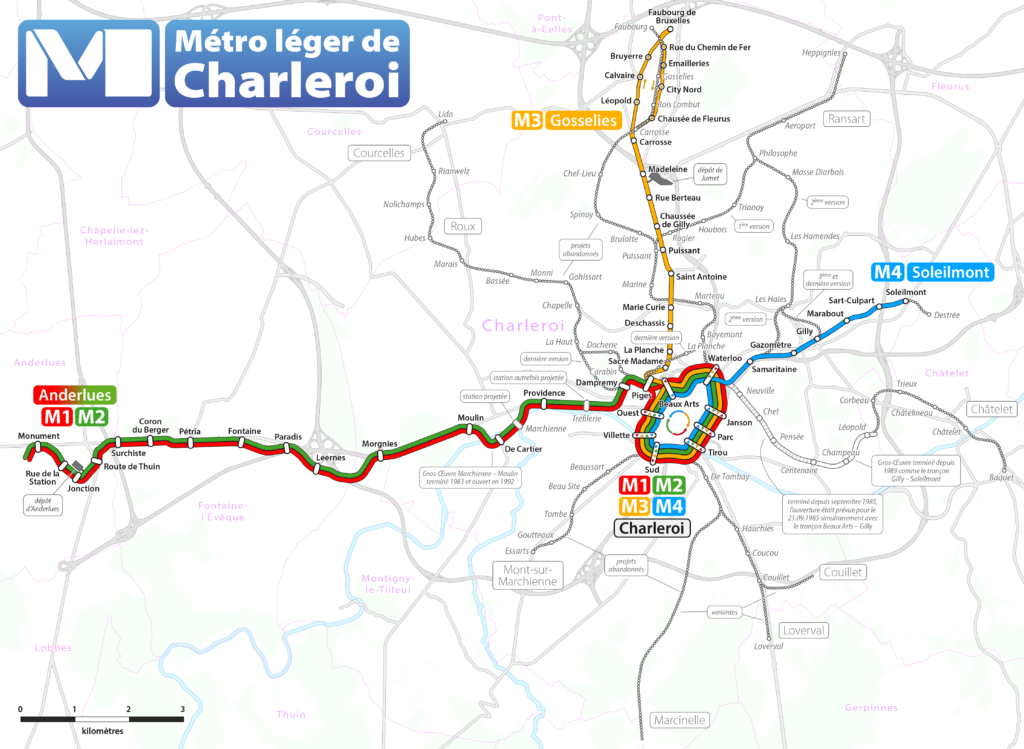
🗺️ Map: Maximilian Dörrbecker, via Wikimedia Commons, CC BY-SA 2.0
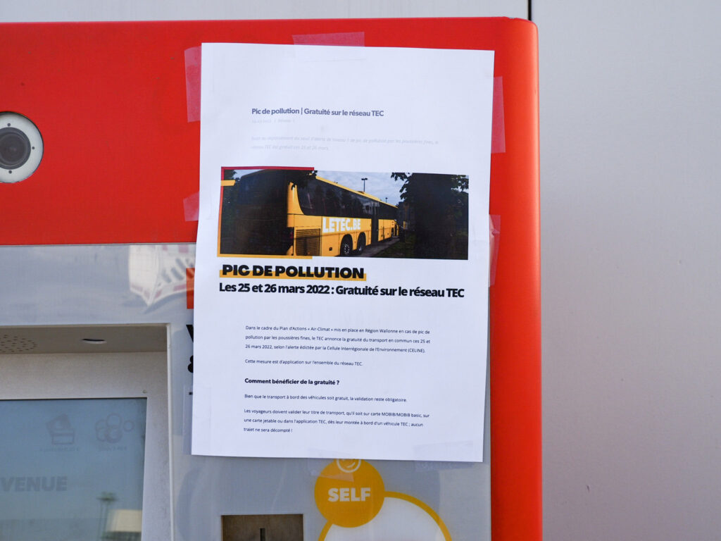
Trying to buy a ticket after the instructions from Adrian. But the ticket machine isn’t working and a friendly TEC employee points towards an imprint of the TEC website posted to the machine: Due to heavy smog, all public transport is free to use today!
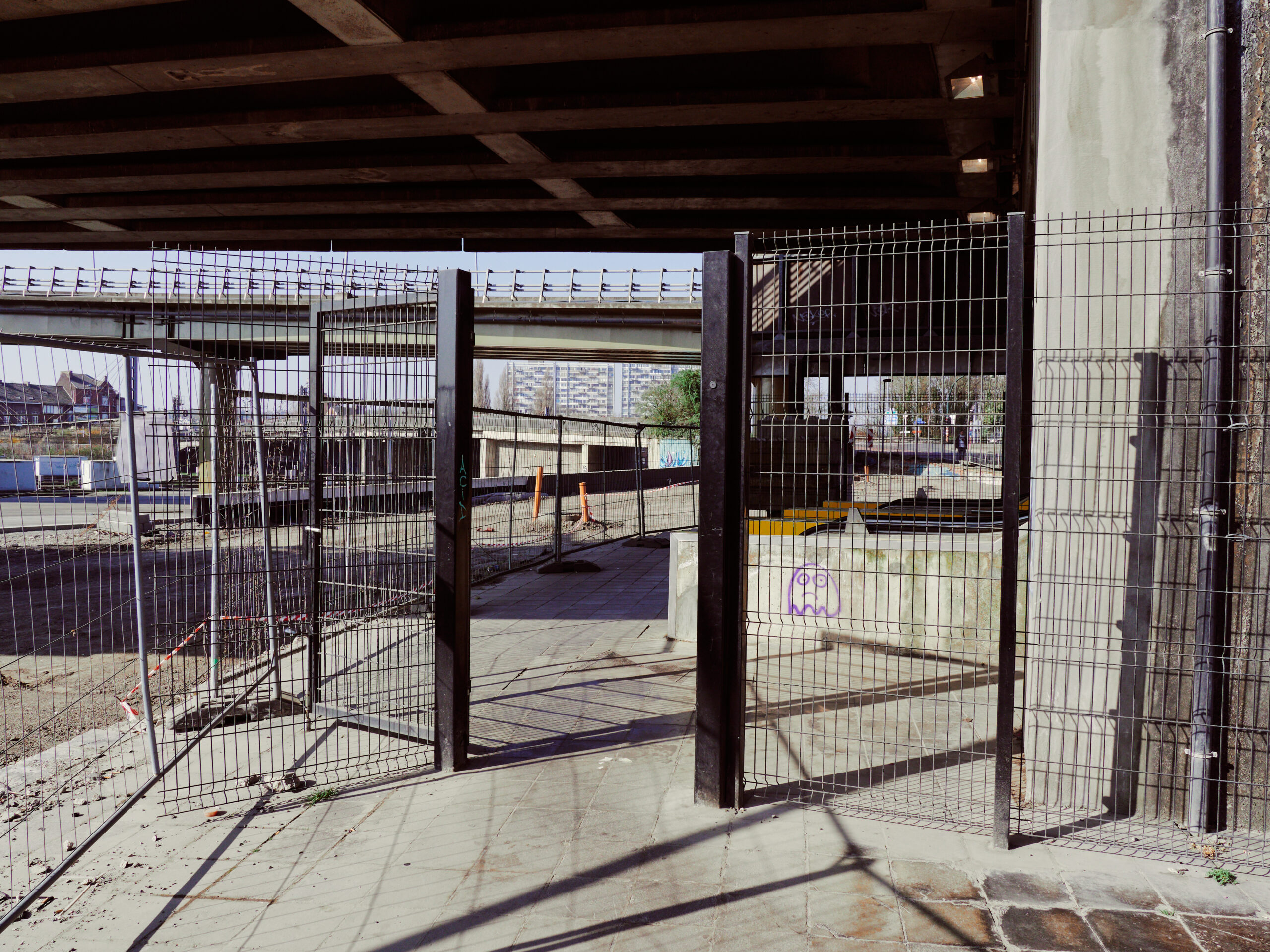
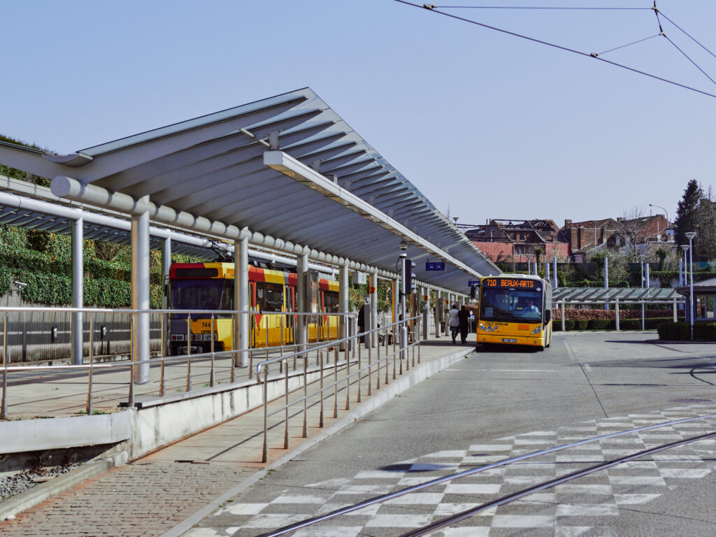
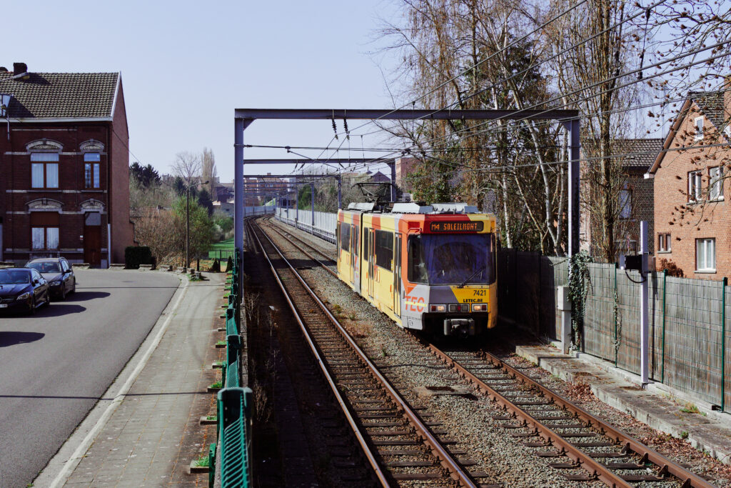
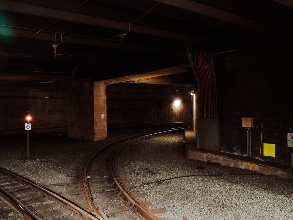
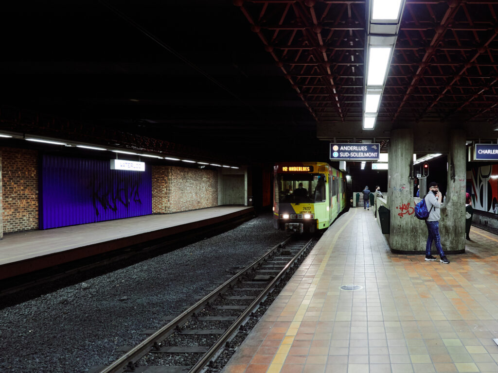
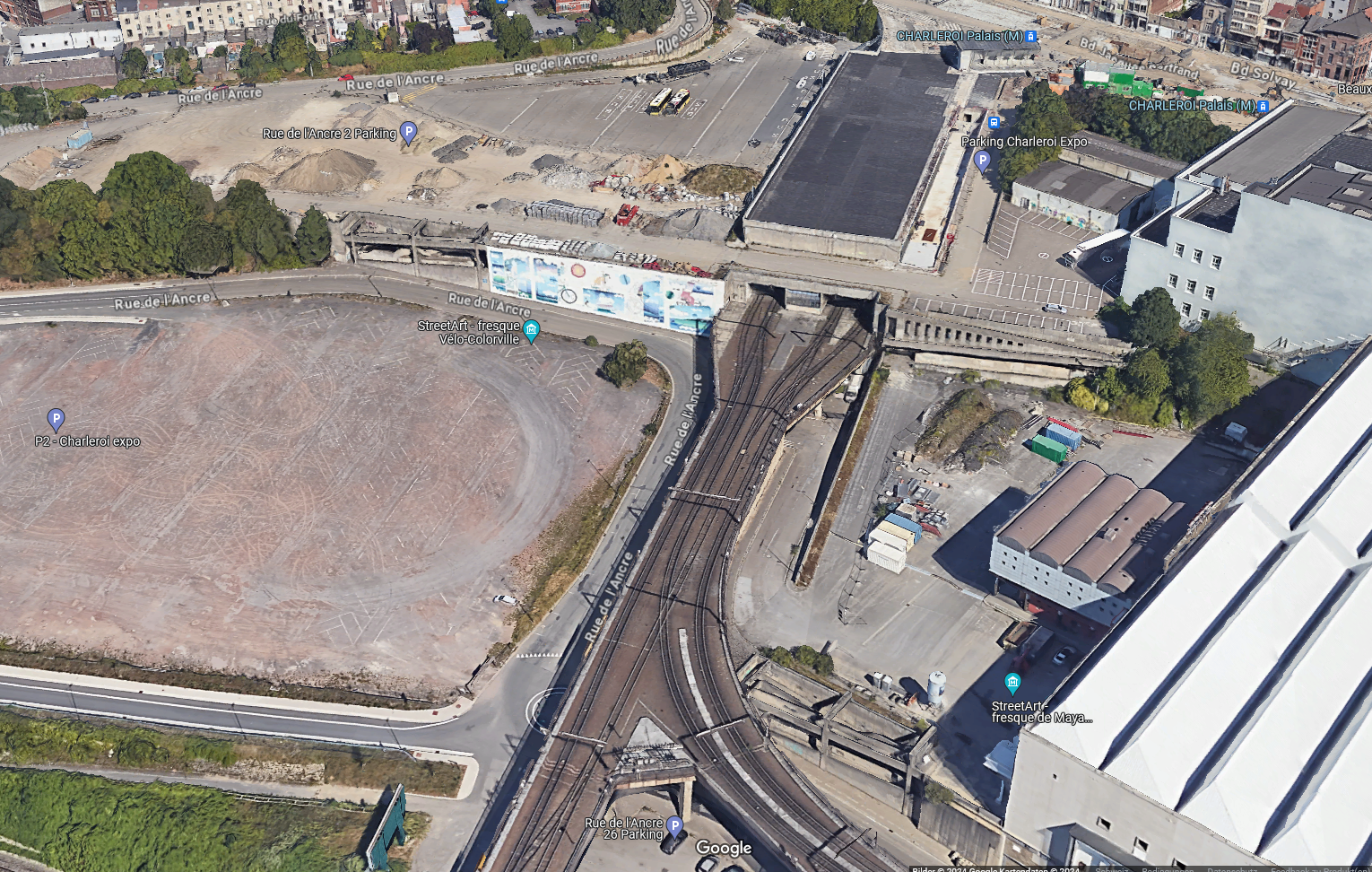
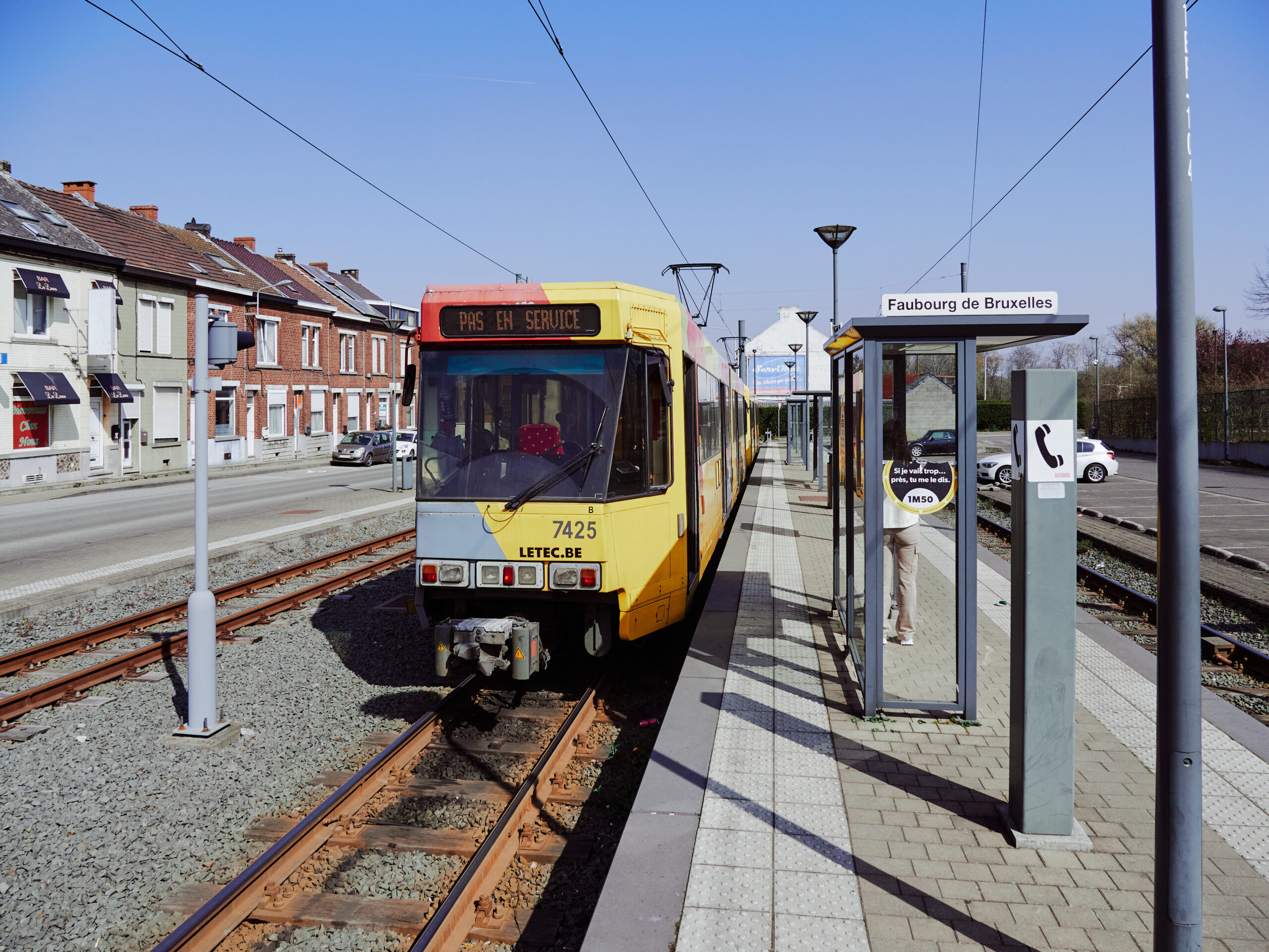
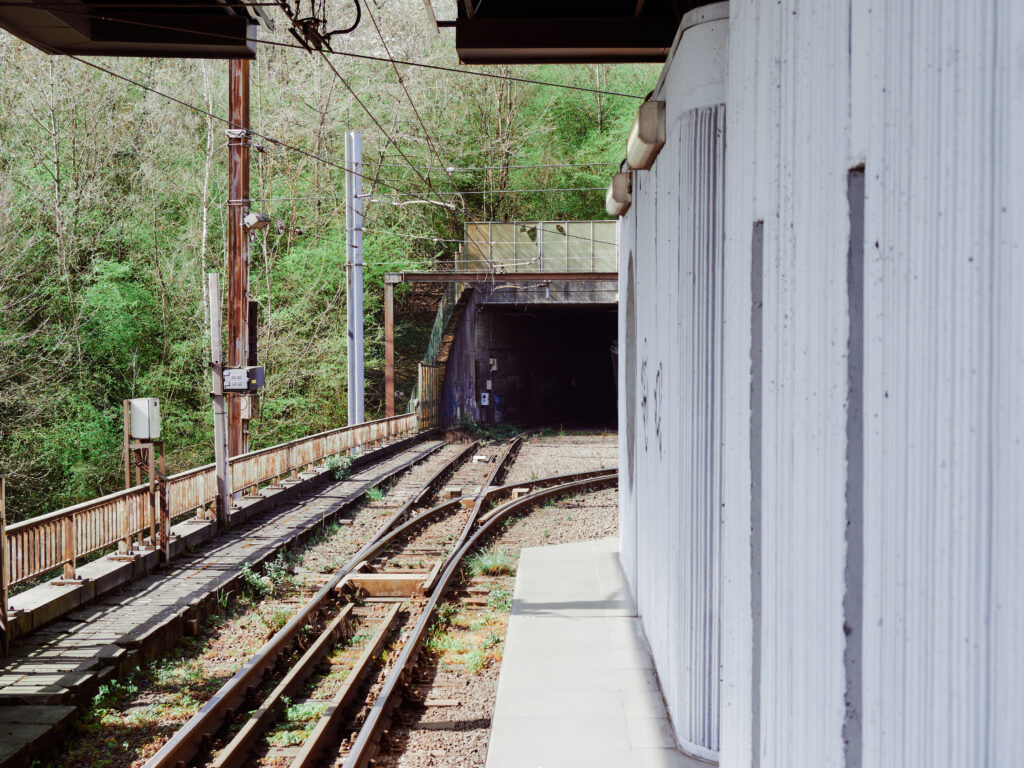
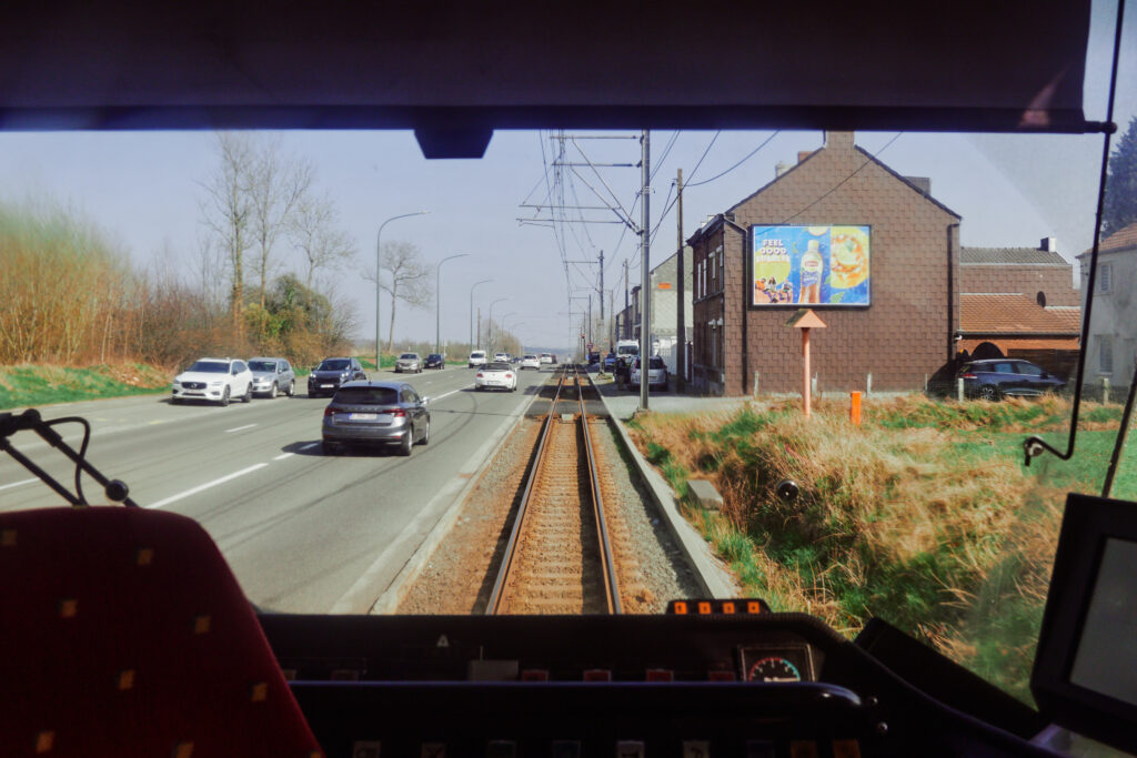
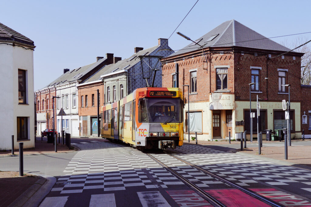
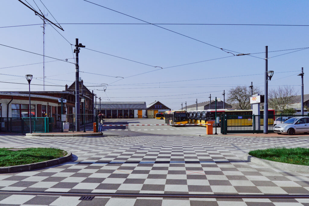
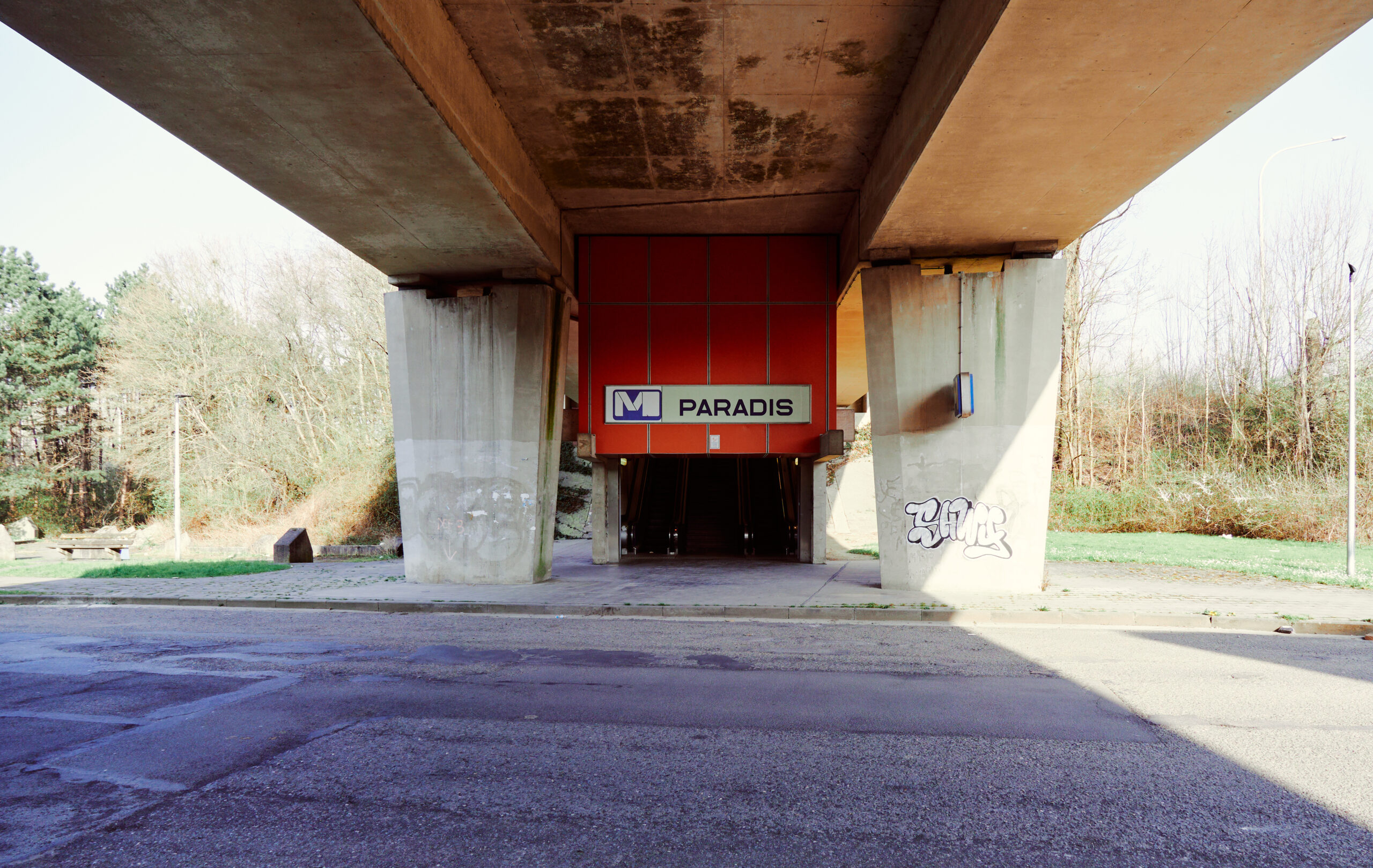
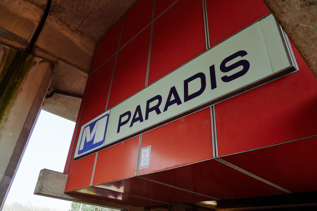
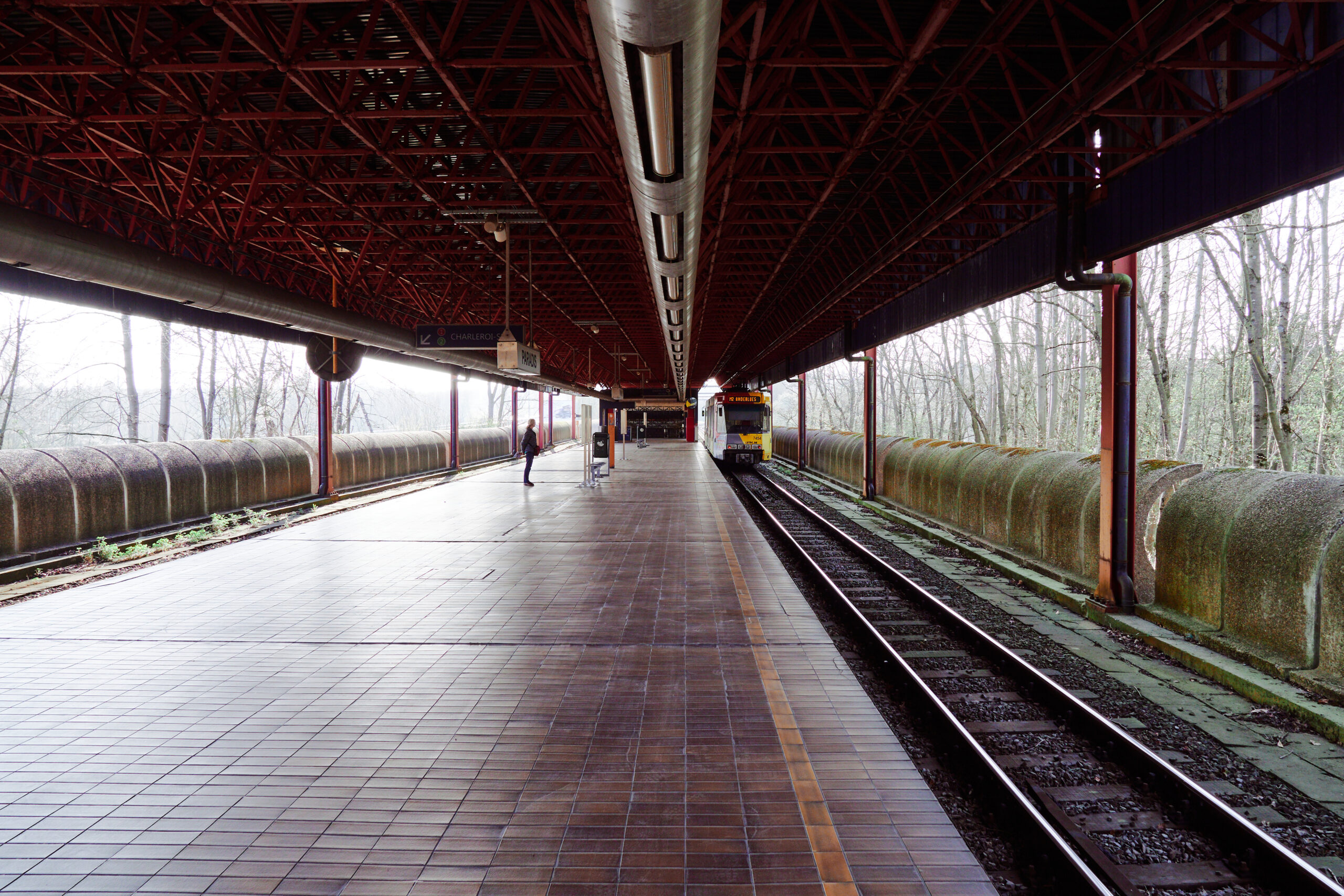
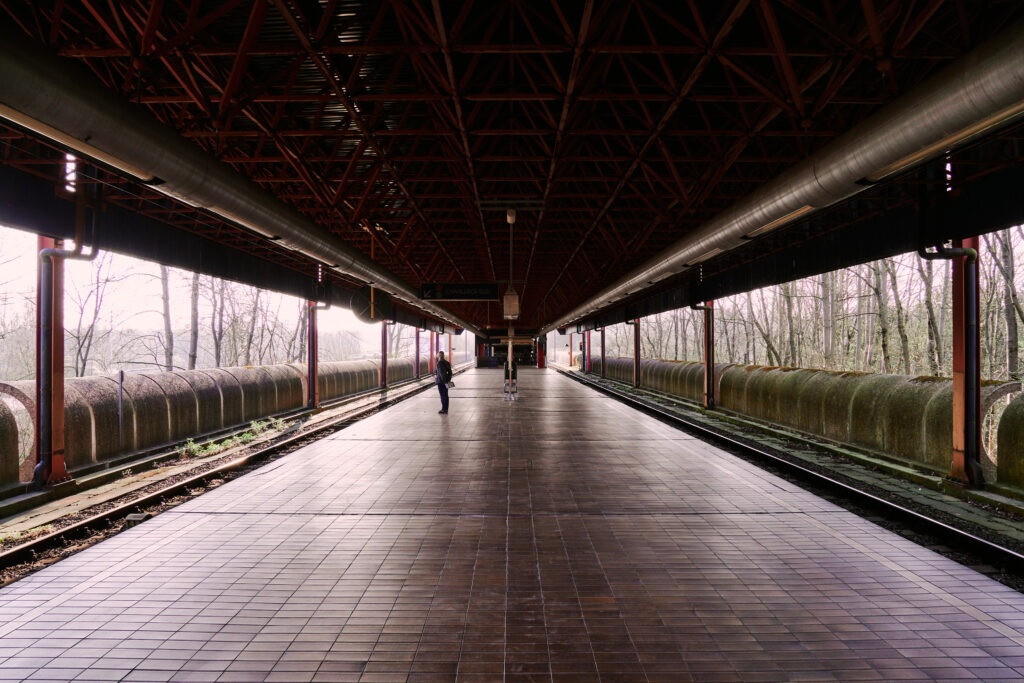
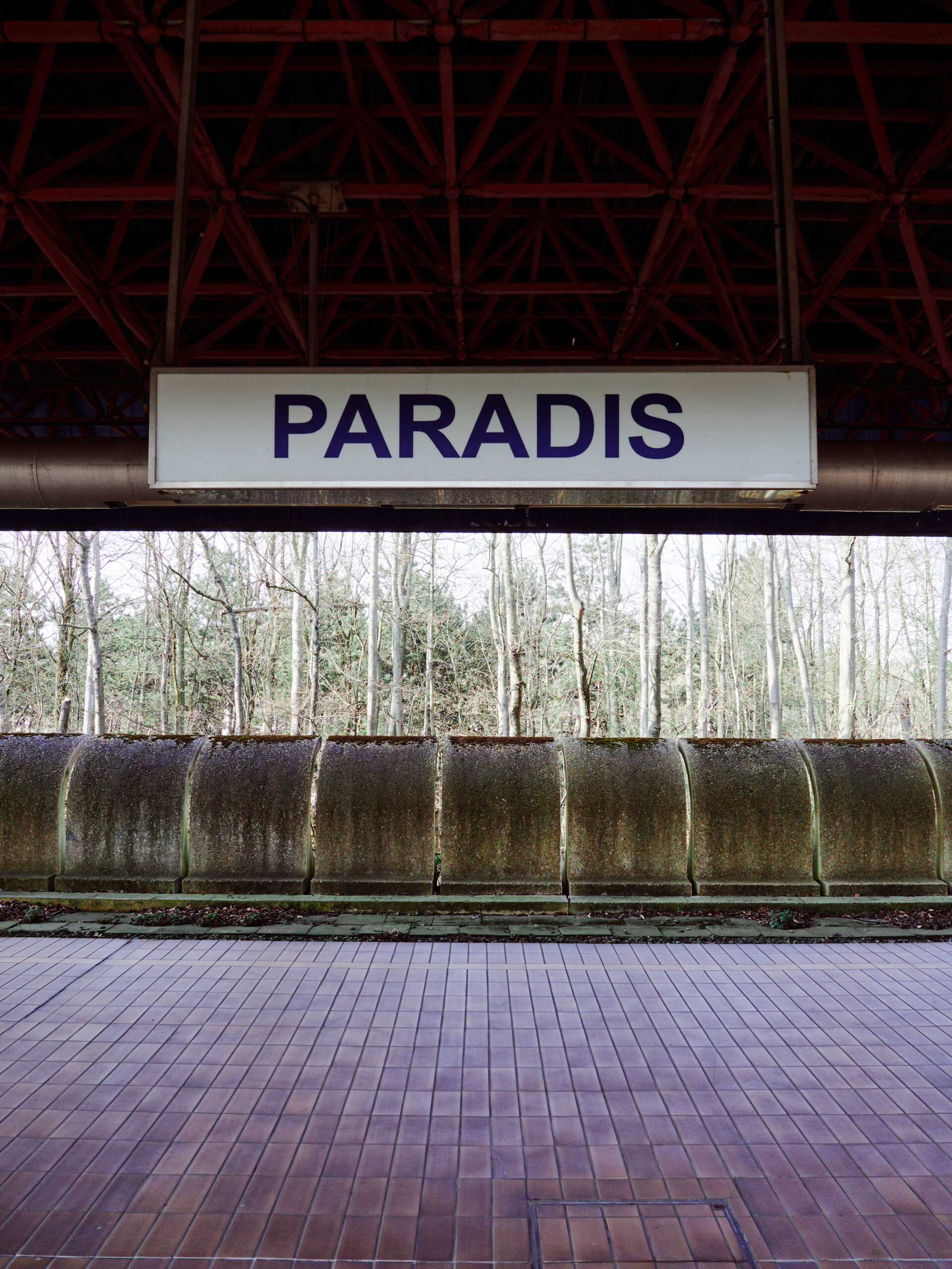
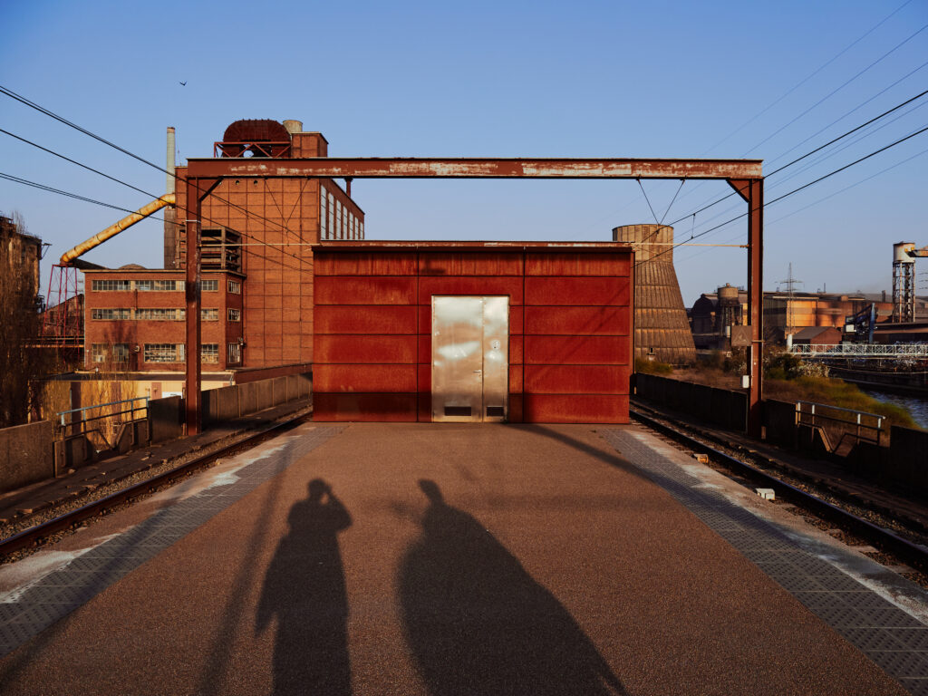
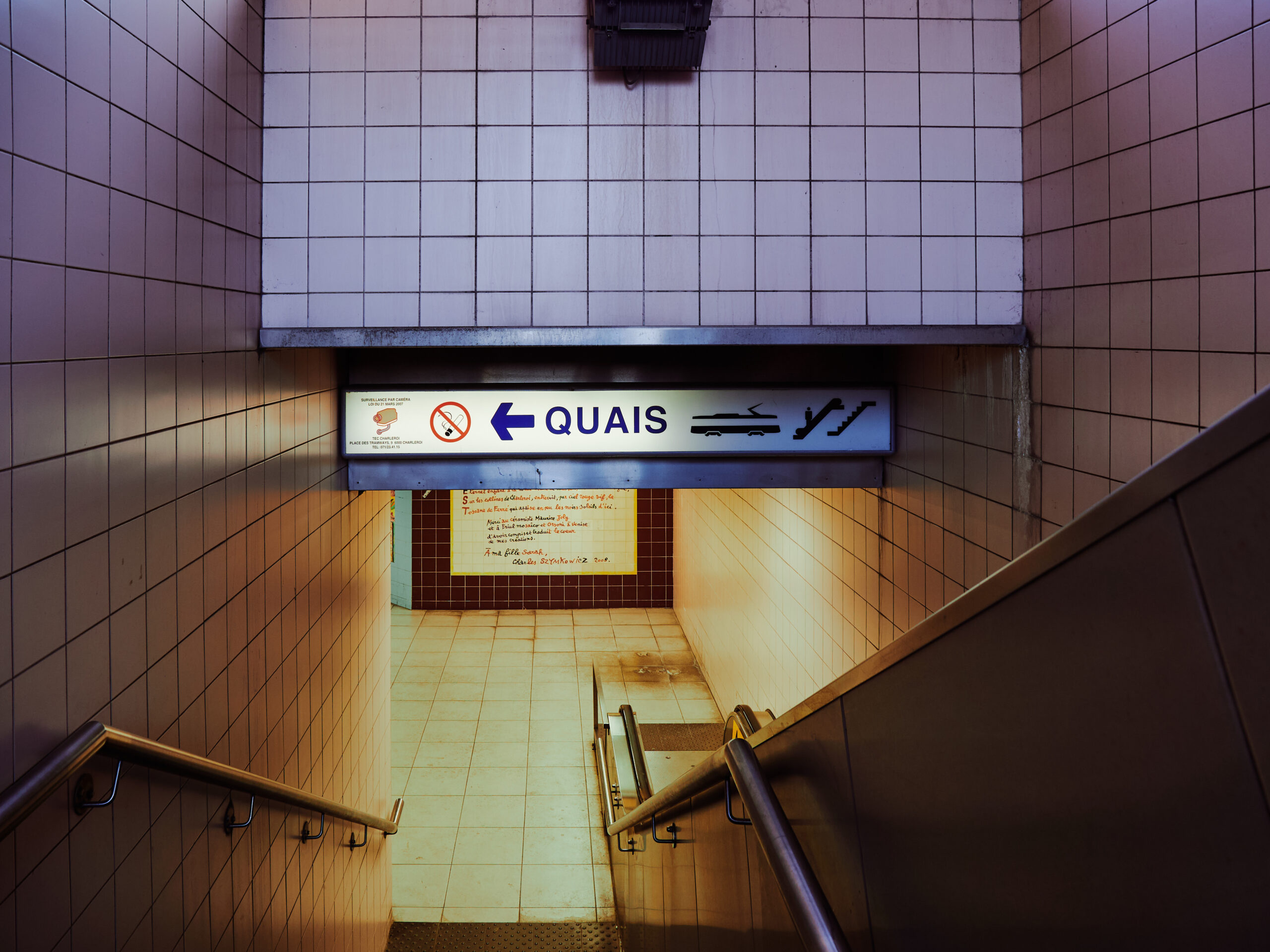
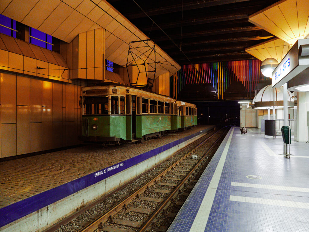
The stop at Charleroi’s main station, Gare de Sud, is closed due to construction works. So we make our way through fences and construction sites to Vilette, the closest station to Gare de Sud. Even in bright sunlight, this doesn’t look very welcoming…
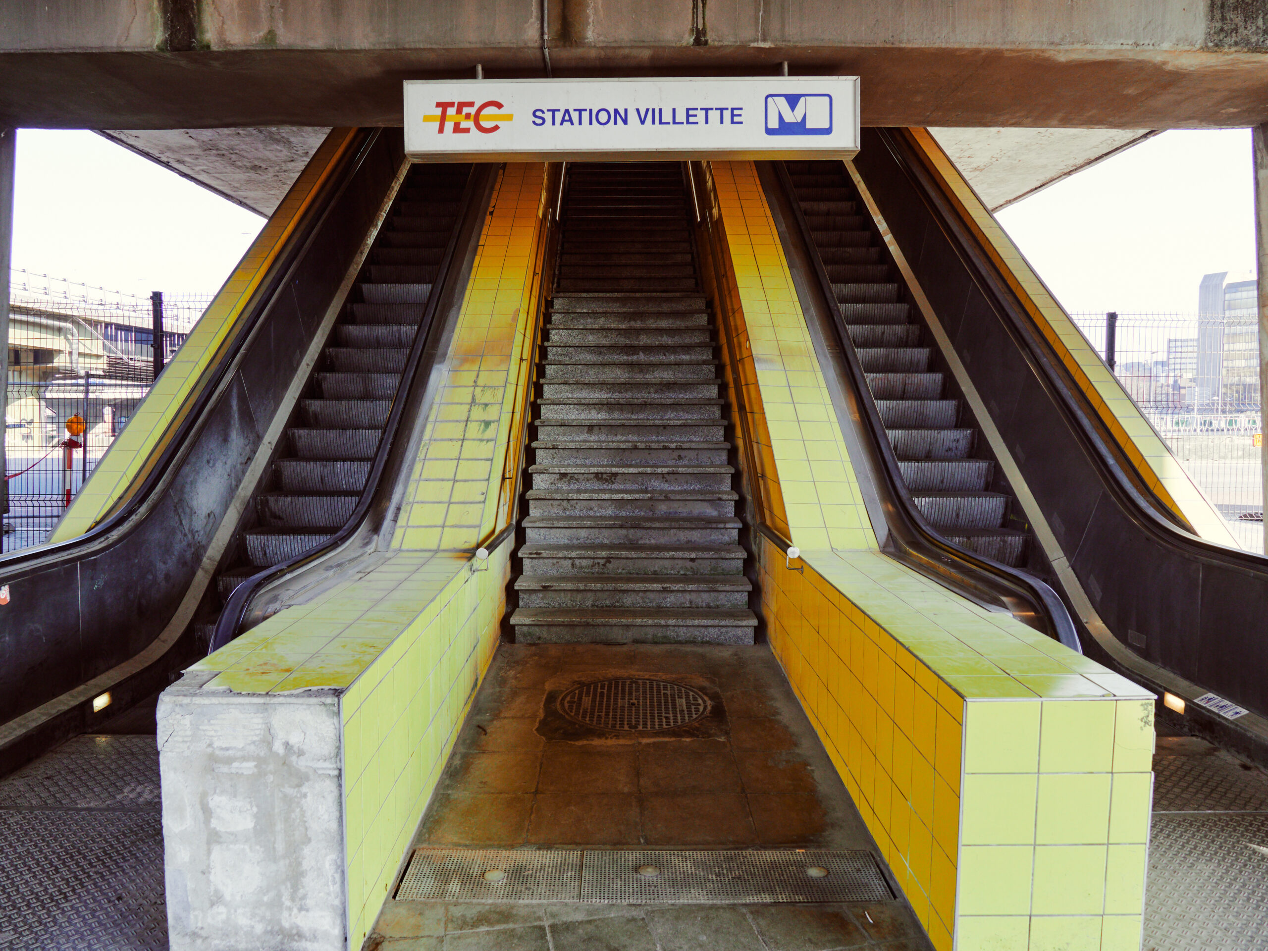
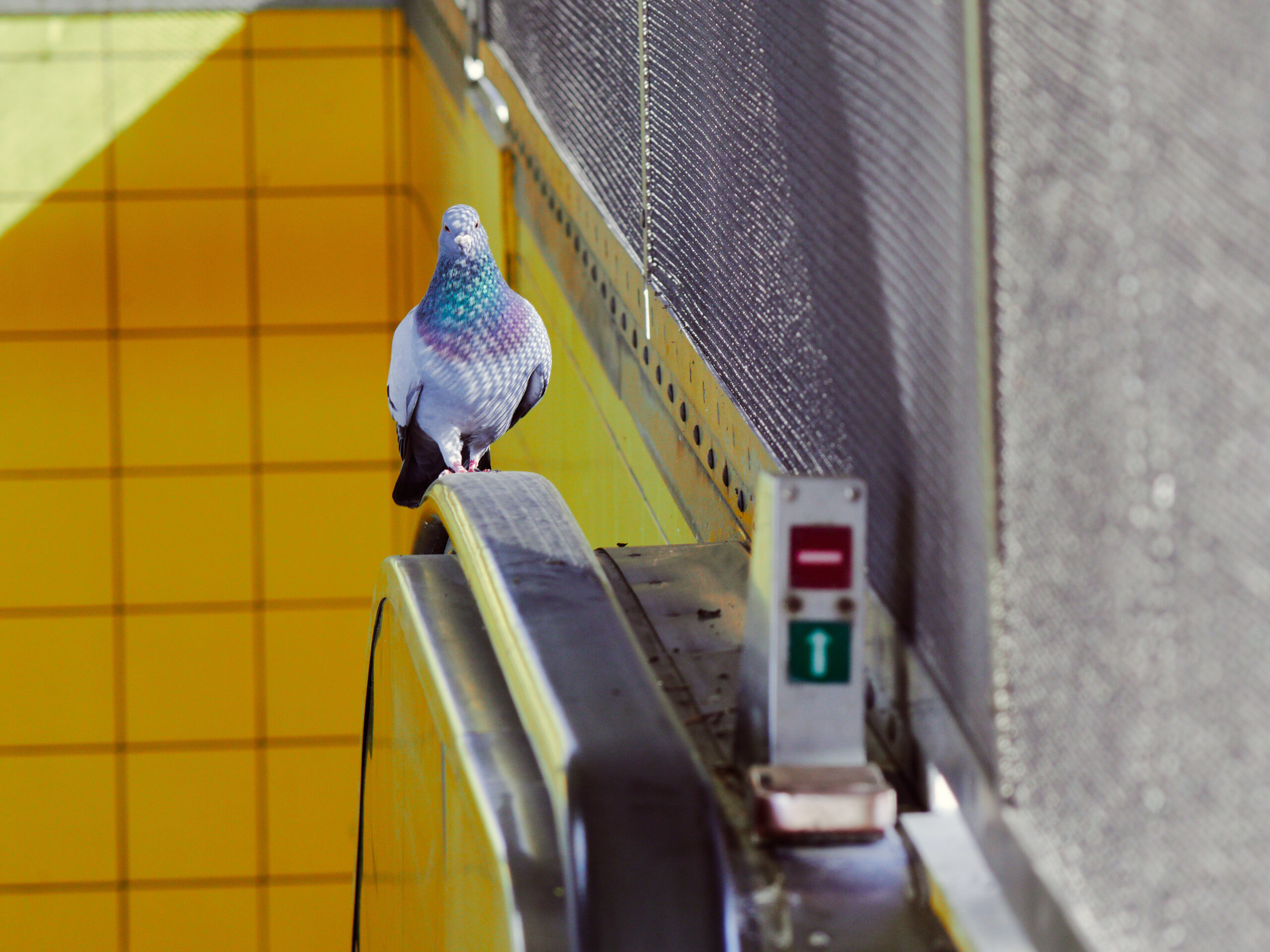
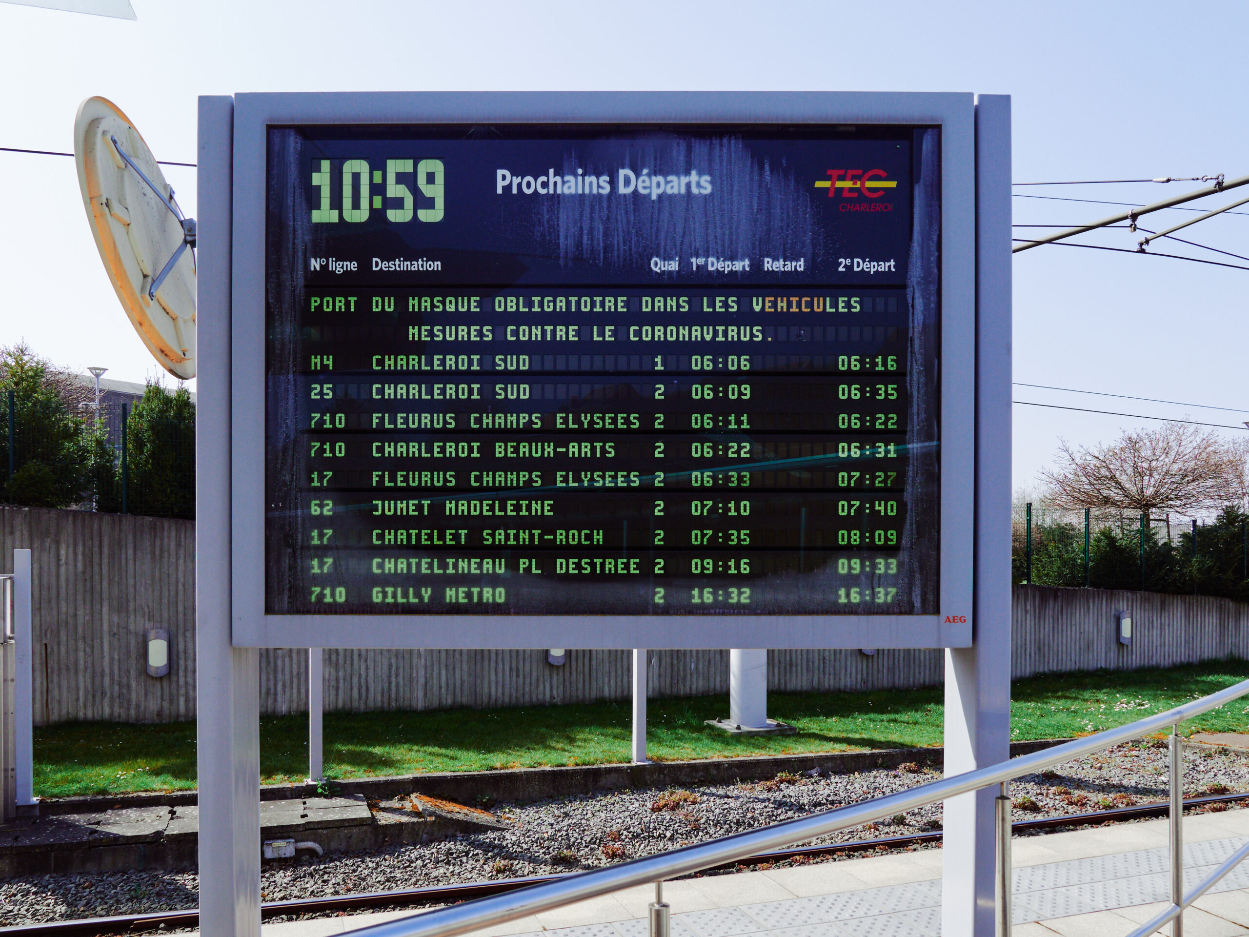
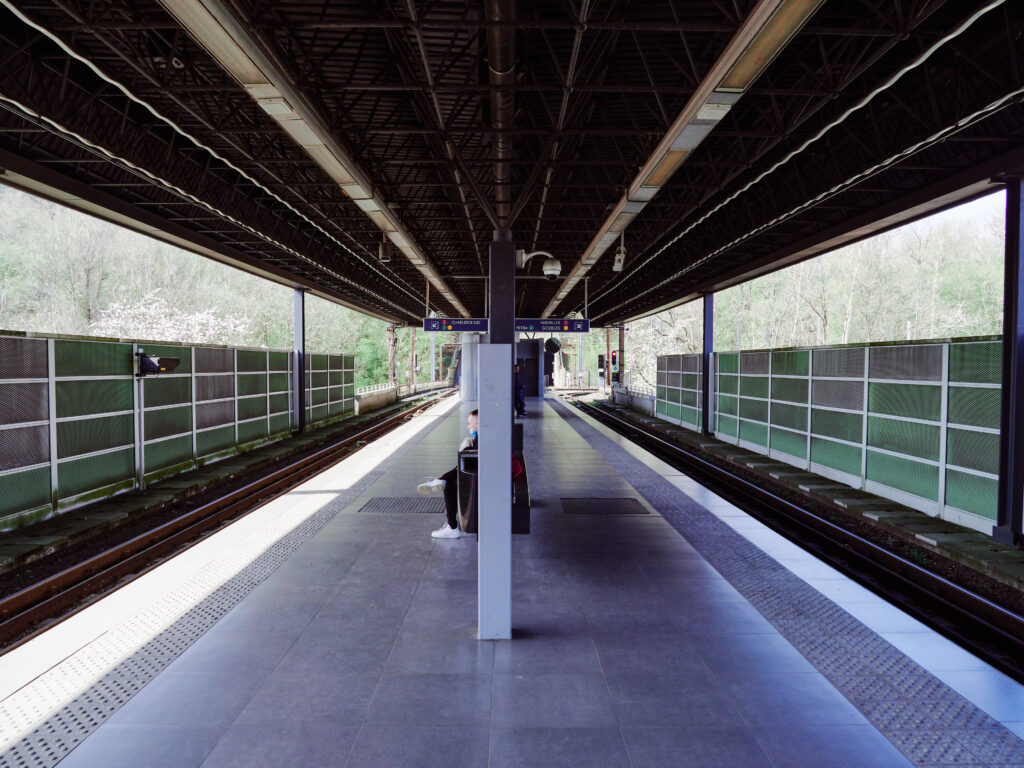
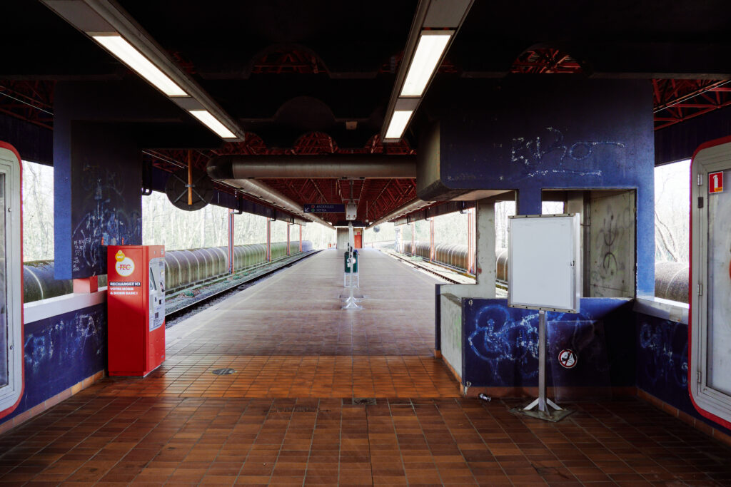
The station is deserted, but the timetable tells us, that M4 runs every 10 minutes. Don’t look for real time departure indicators – there are none of them on the whole network. The view from the platform looks like we’re in a huge industrial zone – but in fact, we’re just outside the historic city centre.
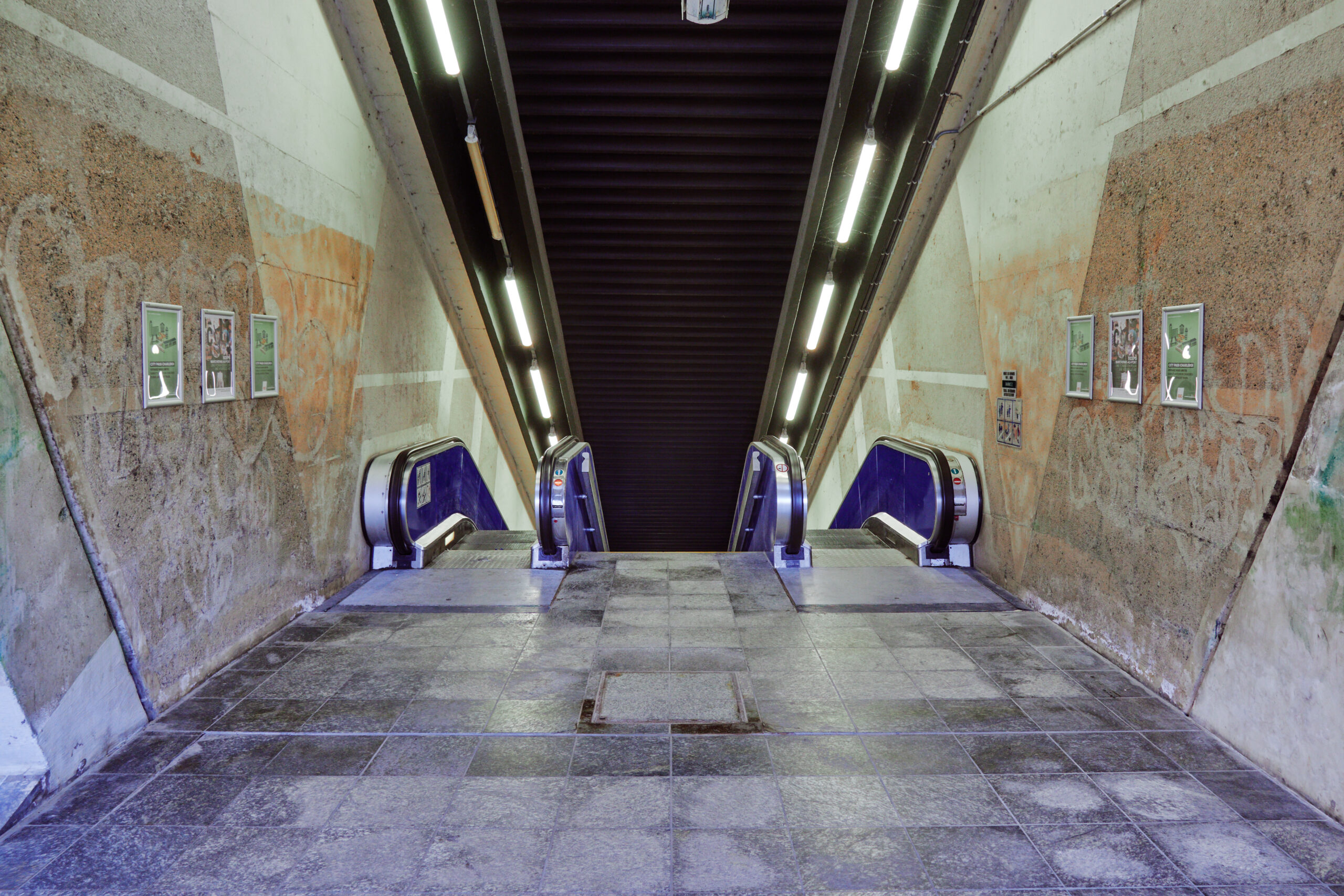
There’s a constant humming from the nearby highway and a bang every time a vehicle crosses the expansion joints. The northern escalators stand still, a pidgeon is the only customer here.
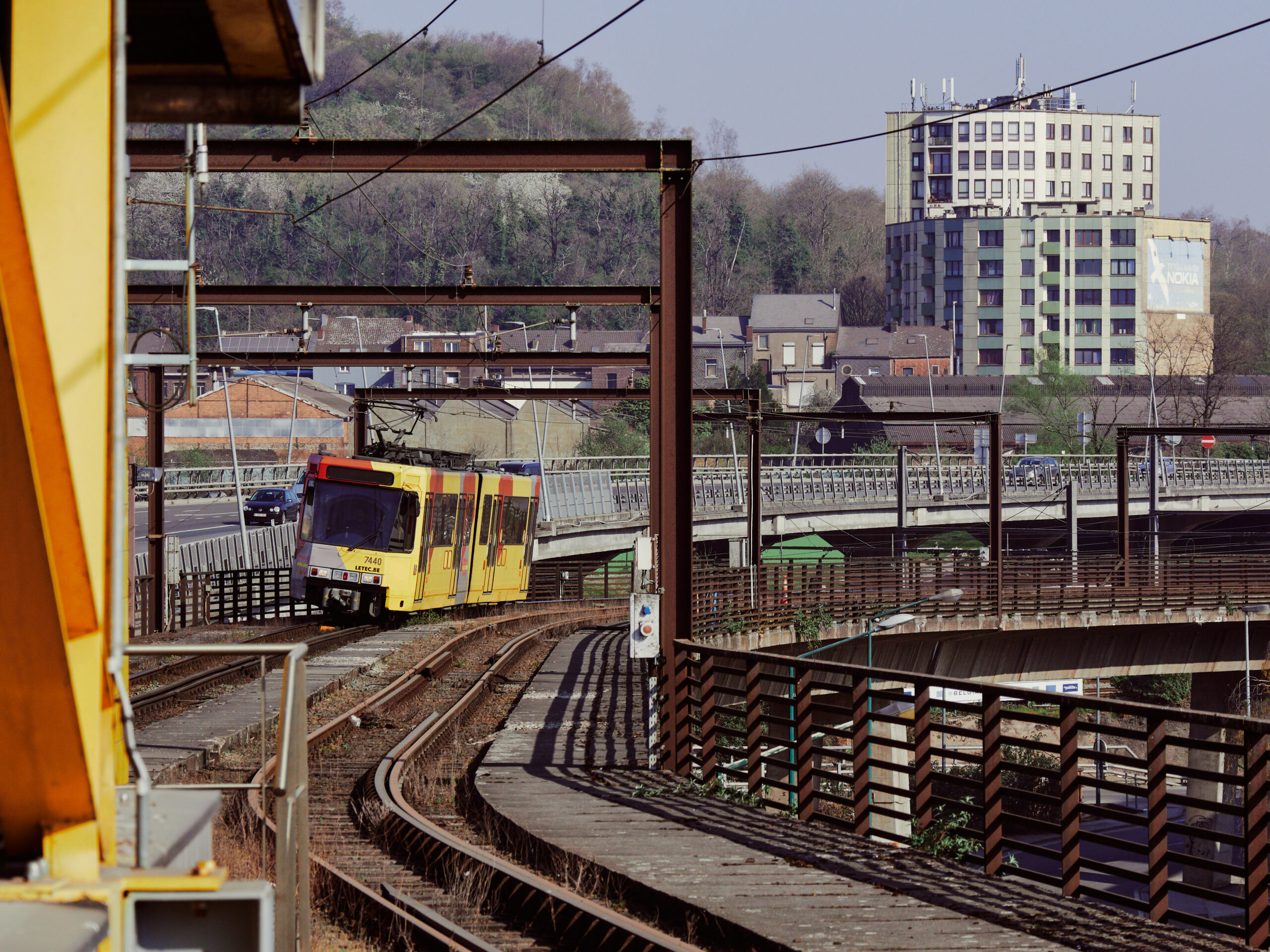
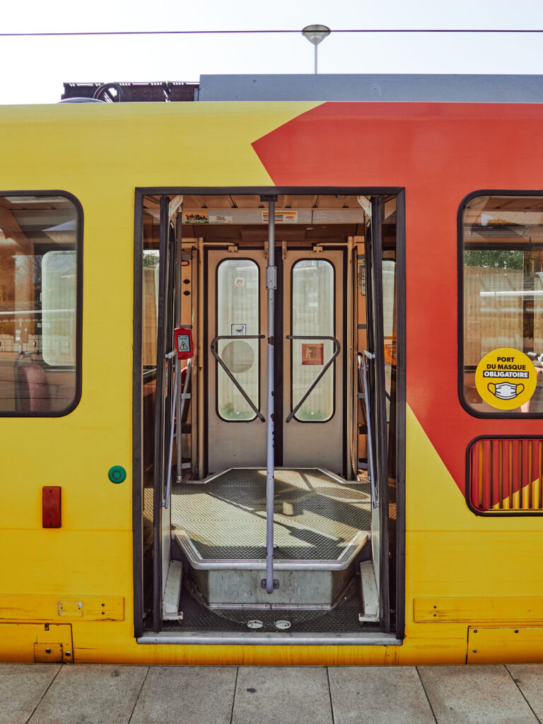
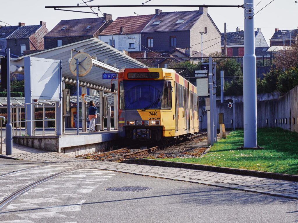
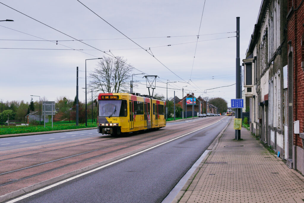
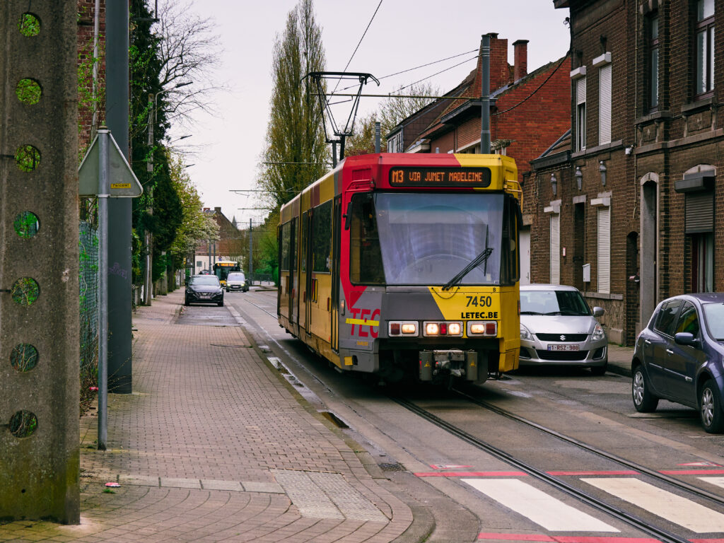
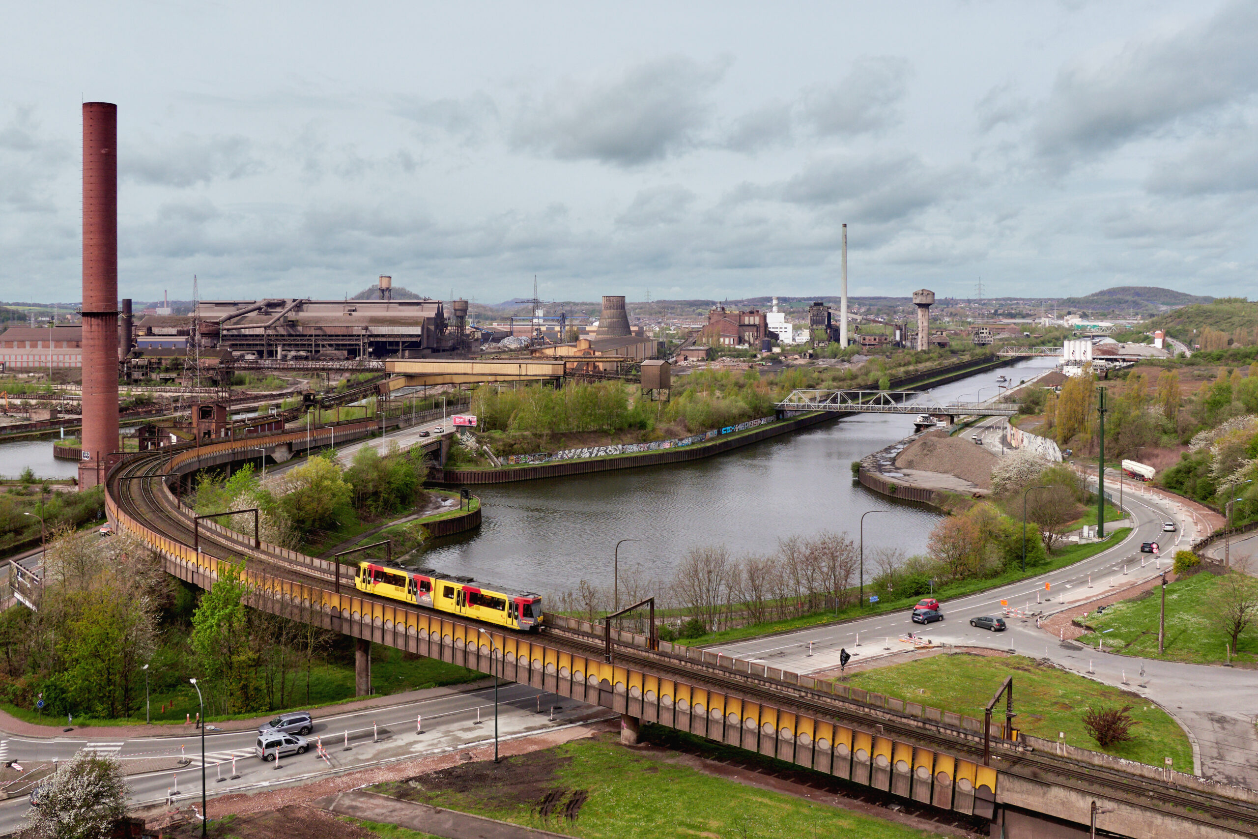
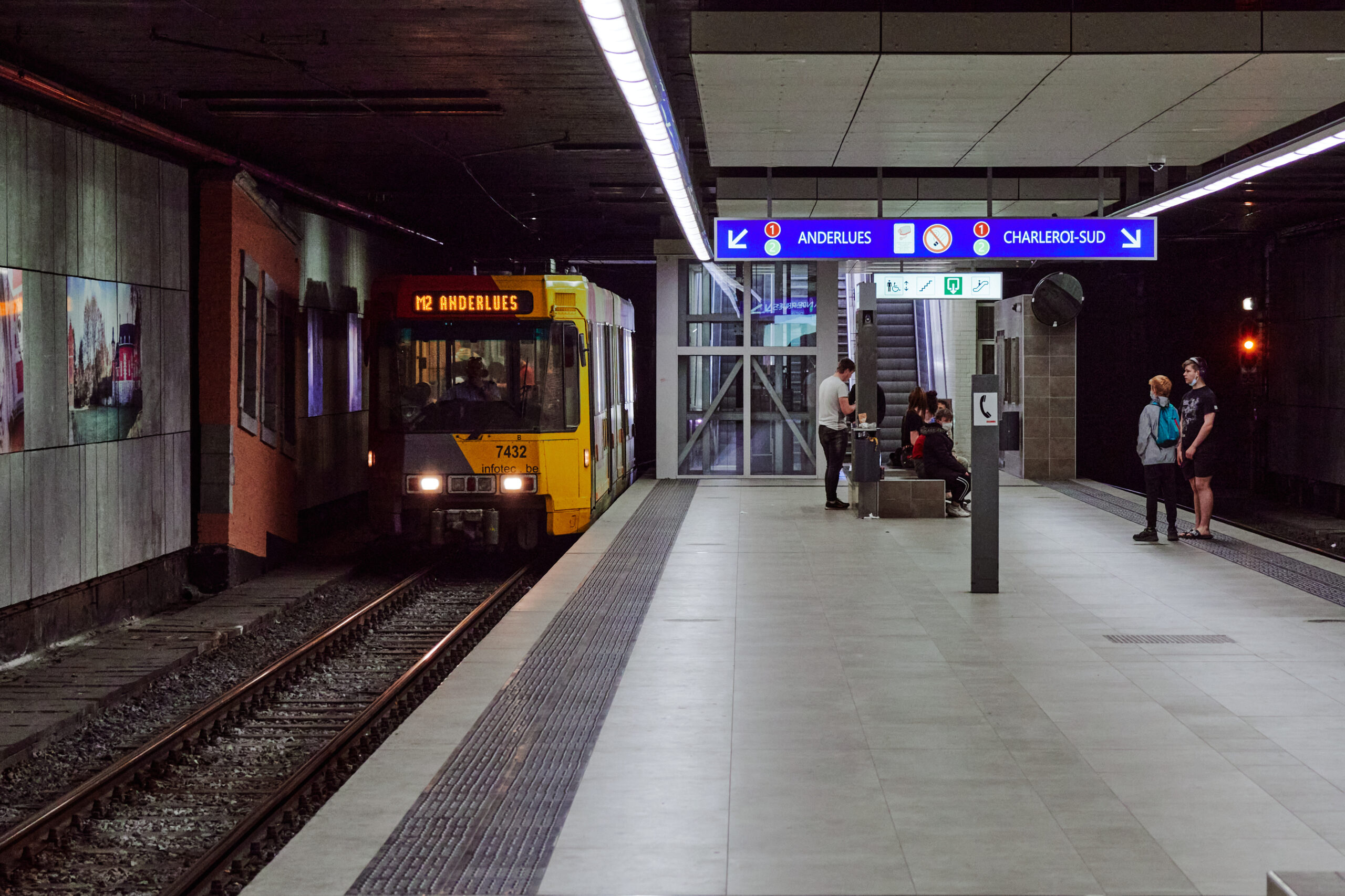
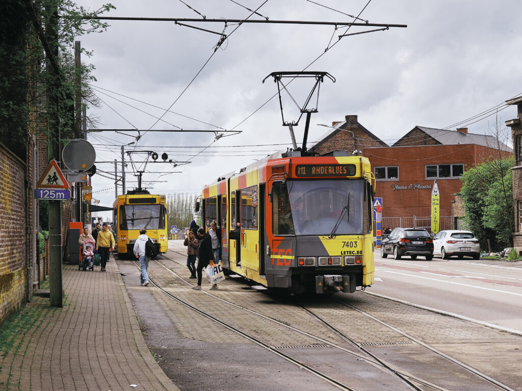
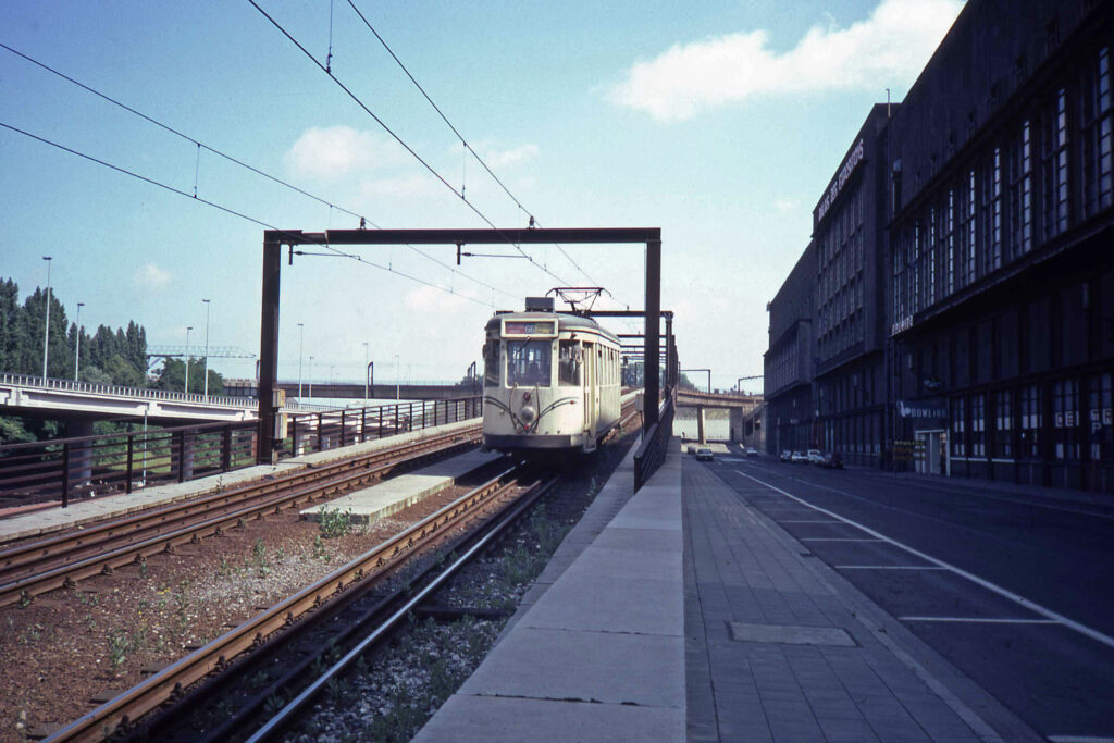
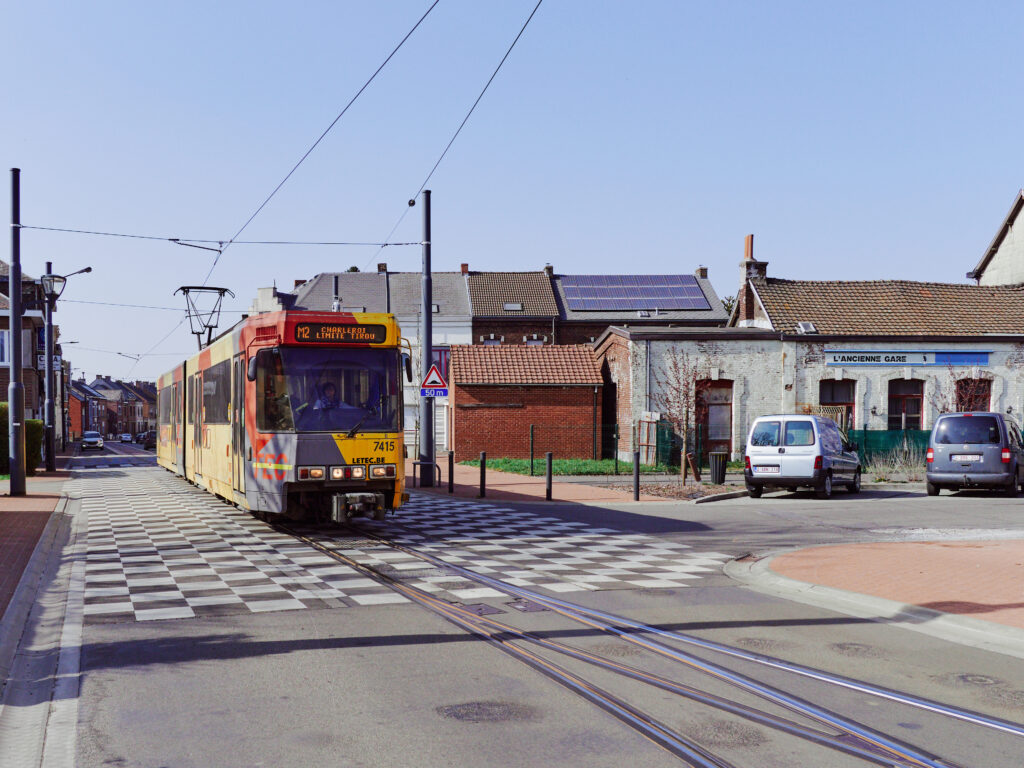
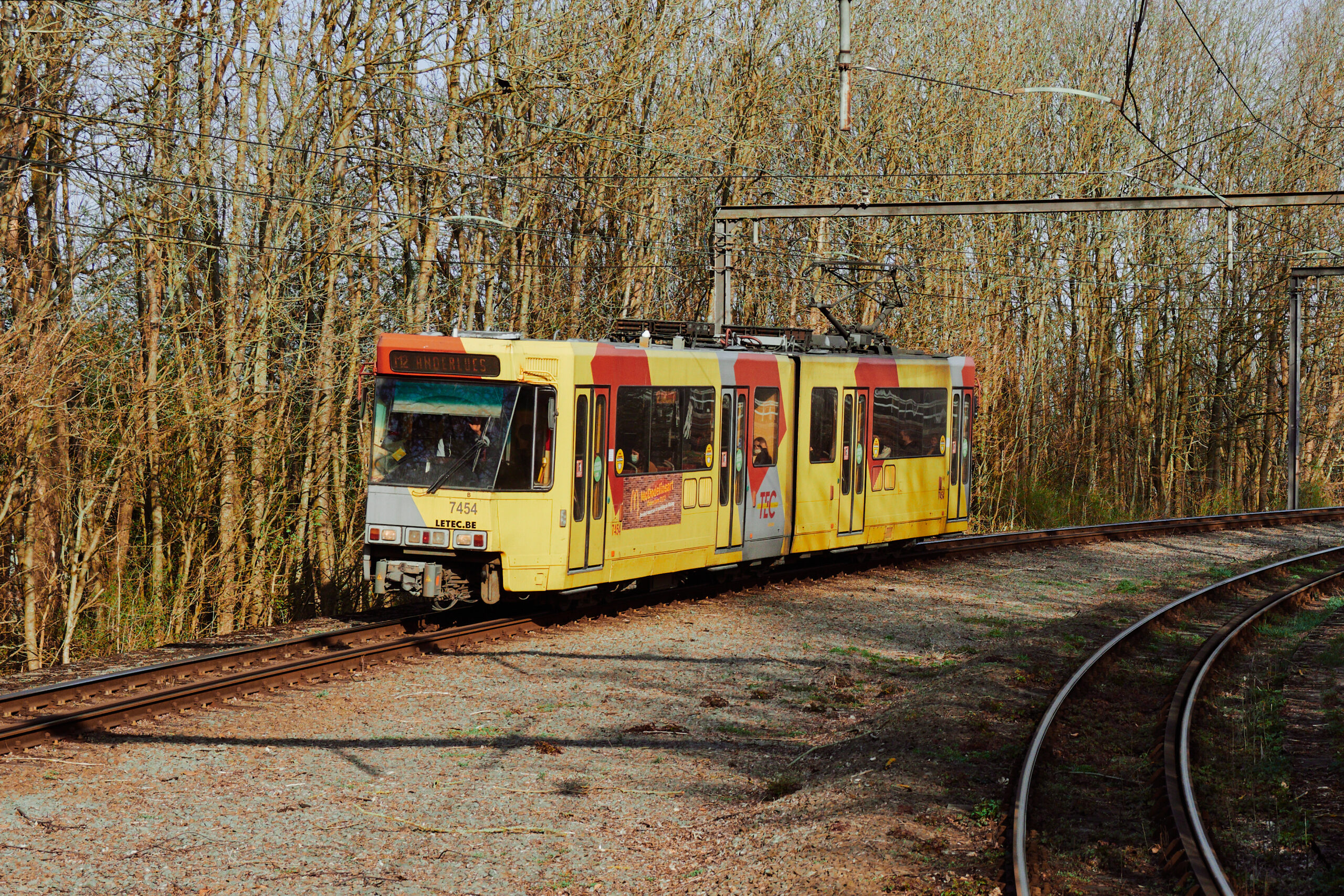
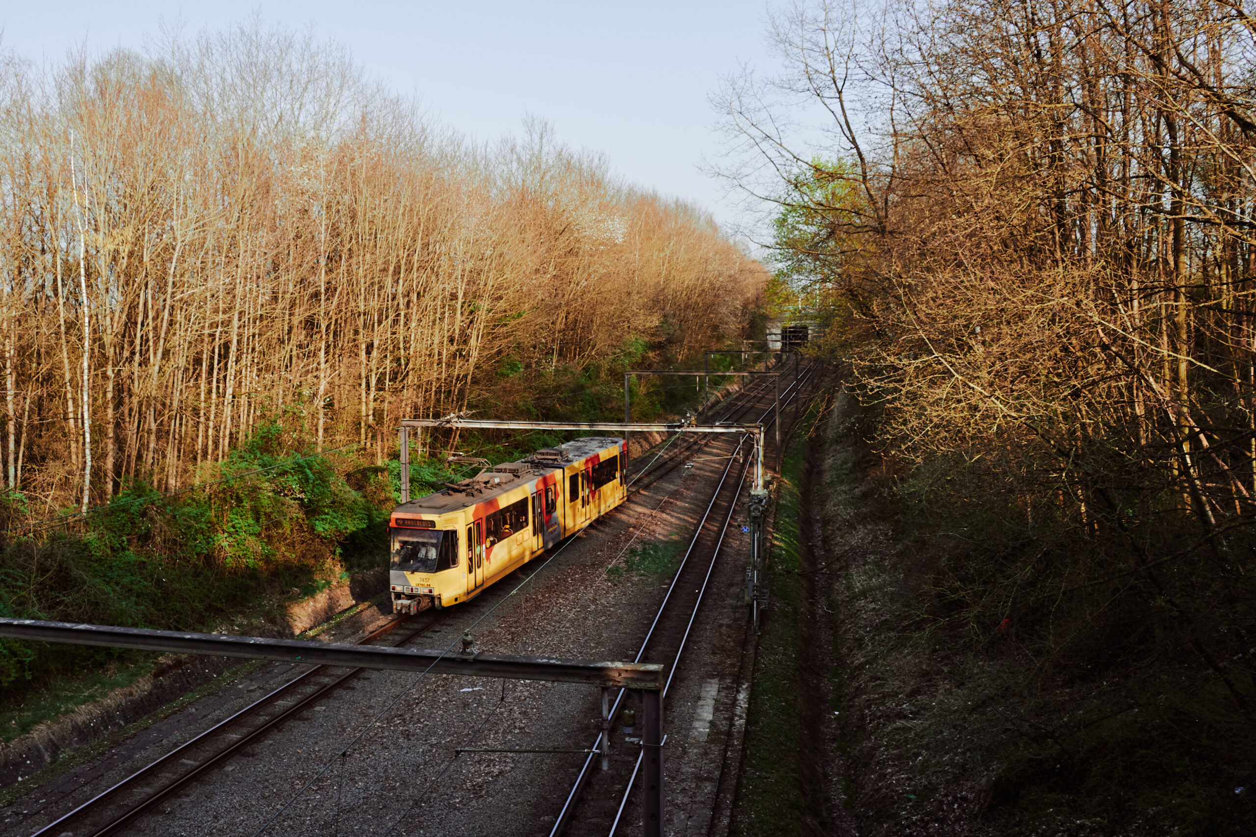
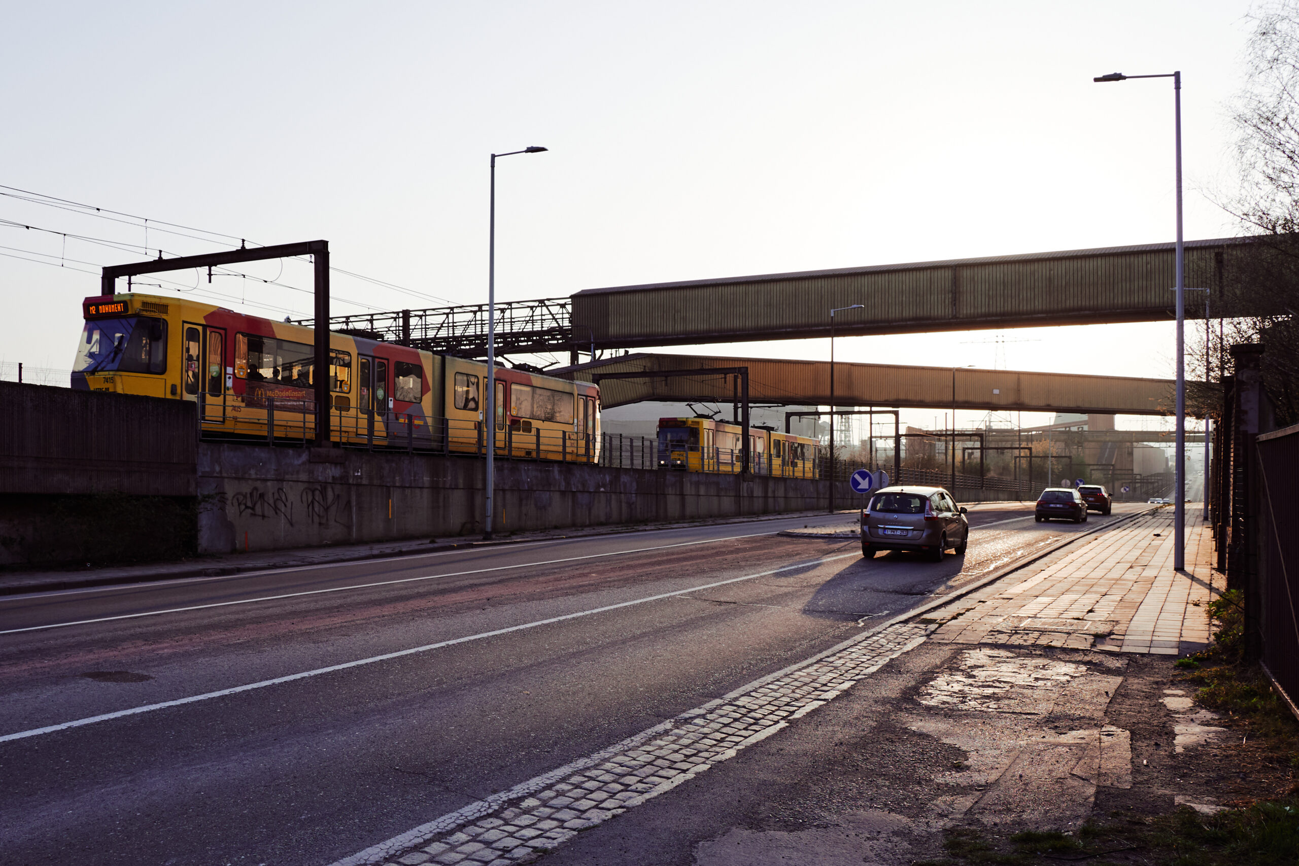
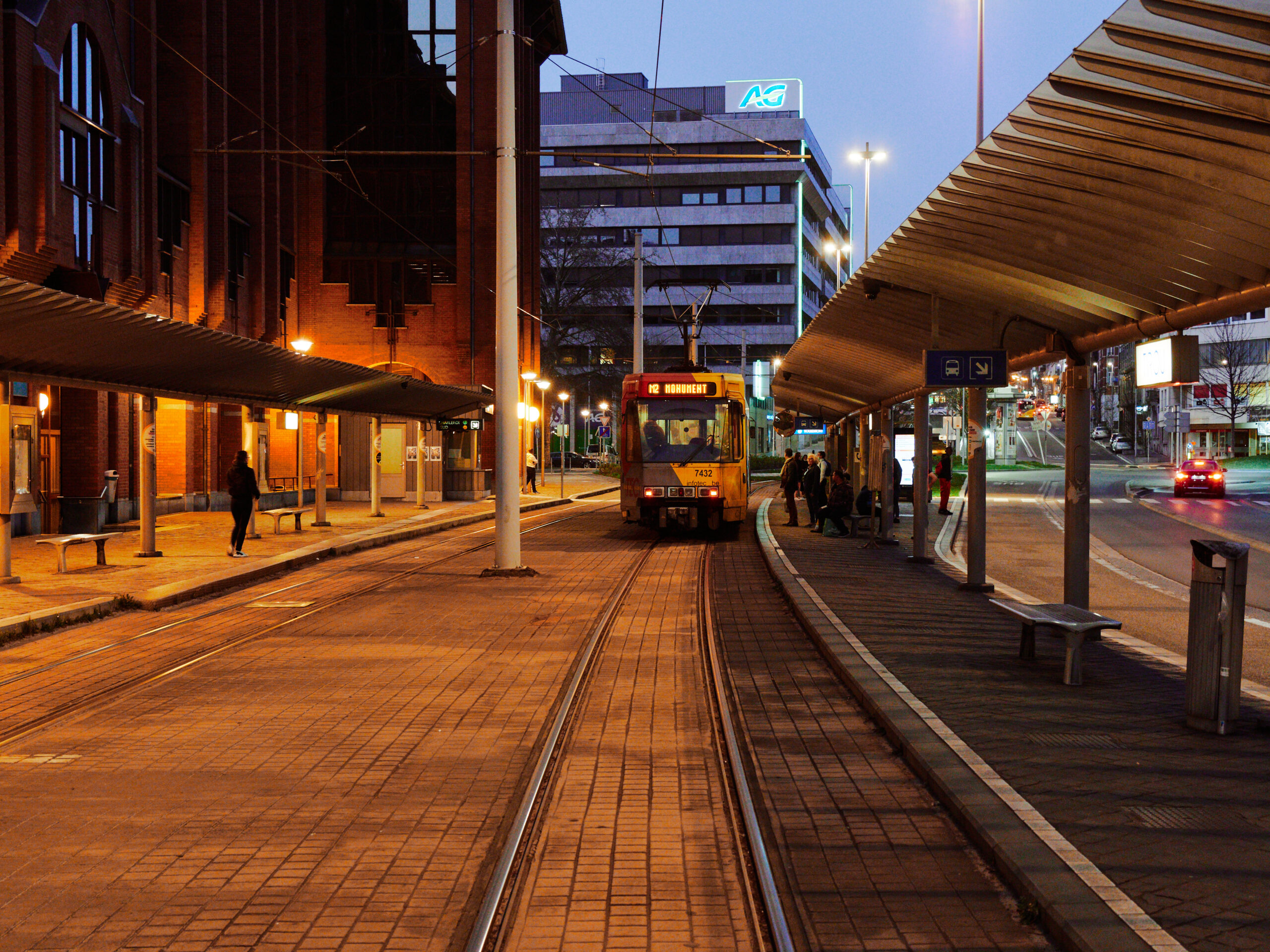
A class 7400 articulated tramcar appears. This is the only class in passenger service here. A typical Prémetro style car, able to run on tram and metro lines. It stops next to the southern entrance, but for alighting only. To board, you have to walk around a randomly placed barrier towards the northern entrance, where the tramcar stops again to pick you up. We hop in and ride to the other end of the M4, Soleilmont.
In the meantime, let’s have a short look at the history: Due to a weird equalisation system in Belgium – the Wafelijzerpolitiek – the City of Charleroi faced a massiv windfall of fundings for a Metro. They planned a vast network with 8 branches. Out of which, only 3 have ever been built. The first part of the ring was opened in 1976, first sections towards Anderlues in 1980. The inauguration of the Gilly and Centenaire branches was planned for 1985. But following a bizzare fight between SNCV and STIC, the suburban and the urban tram operator which both had to share the metro network, these lines were built but not opened, when funding for the project was finally cut.
🗺️ Source: Dirk Hillbrecht, via Wikimedia Commons, CC-BY-SA 3.0
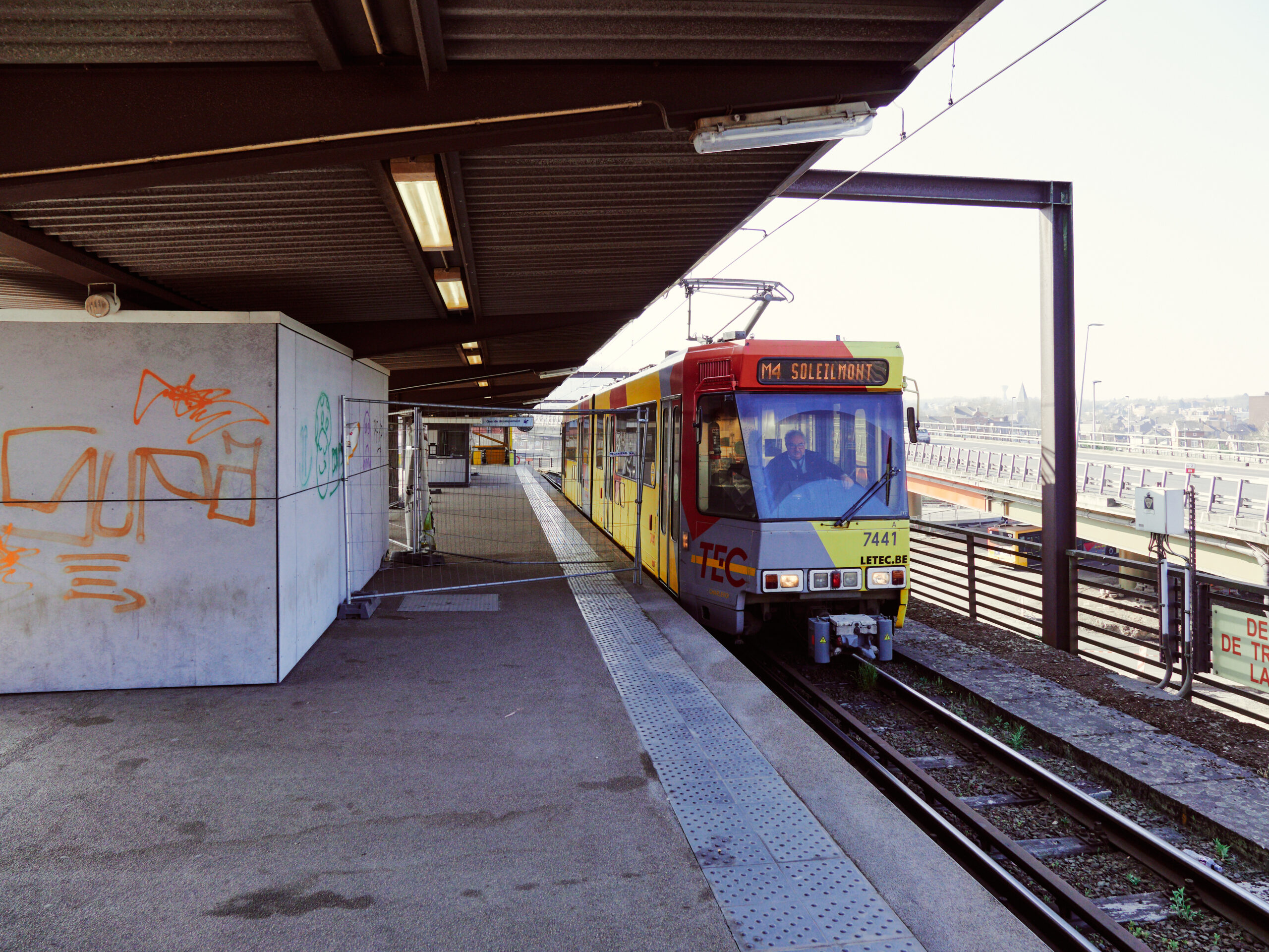
While the Centenaire branch never opened and remained a fully built ghost line until this day, services on the Gilly line finally started in 1992, after SNCV and STIC have been merged to TEC. The line was extended to Soleilmont in 2012, which explains the modern looking and actually well designed end loop here with good connection to bus services.
Update: In 2021, the city of Charleroi secured € 60M funding from an EU fonds to refurbish and finally open the Gilly branch. Construction works are underway, proposed opening date is april 2027.
The terrain here is full of natural and artificial hills. As the Metro runs partially on the surface here, there are some quite harsh inclines of 50 per mill and more.
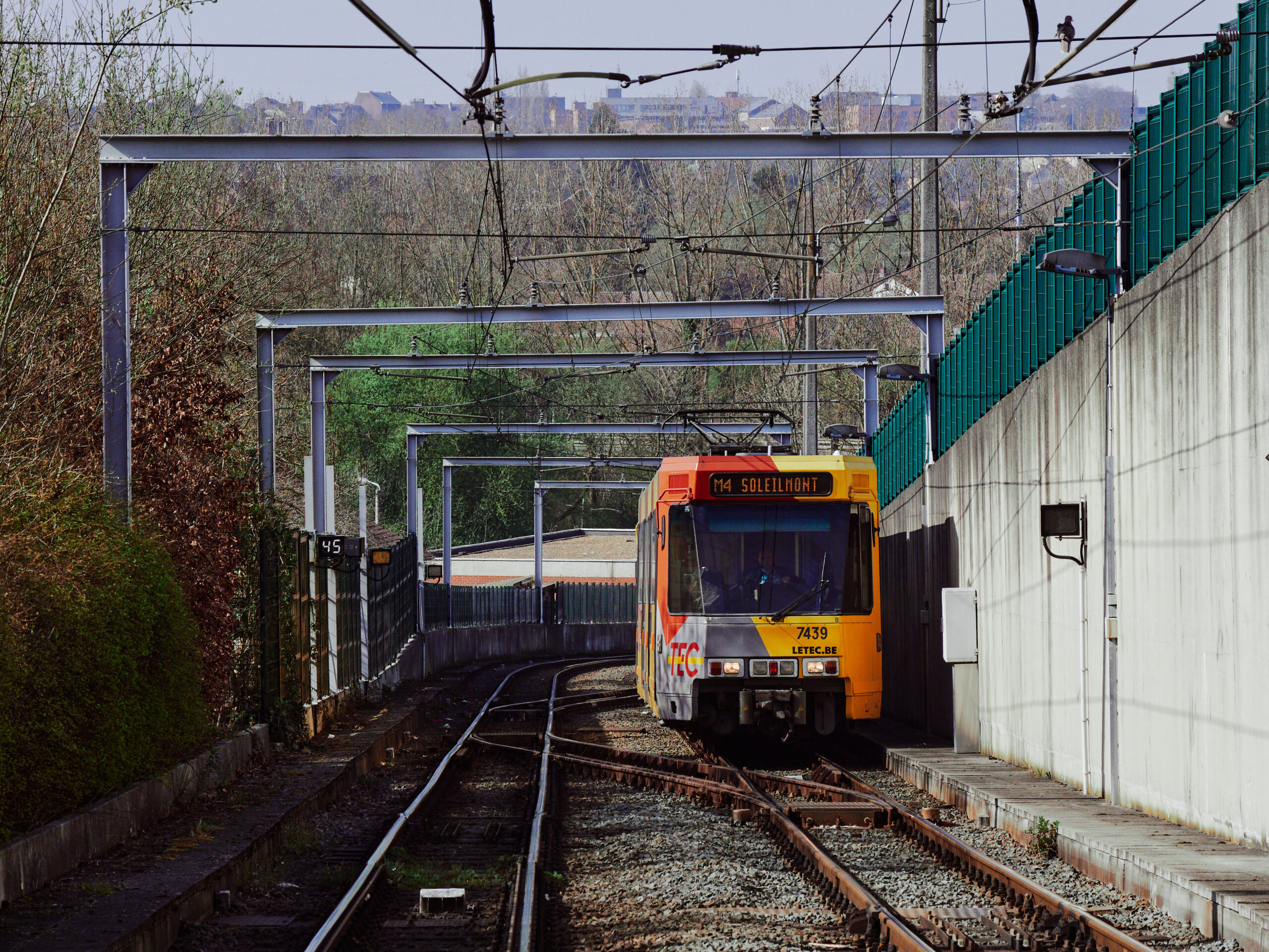
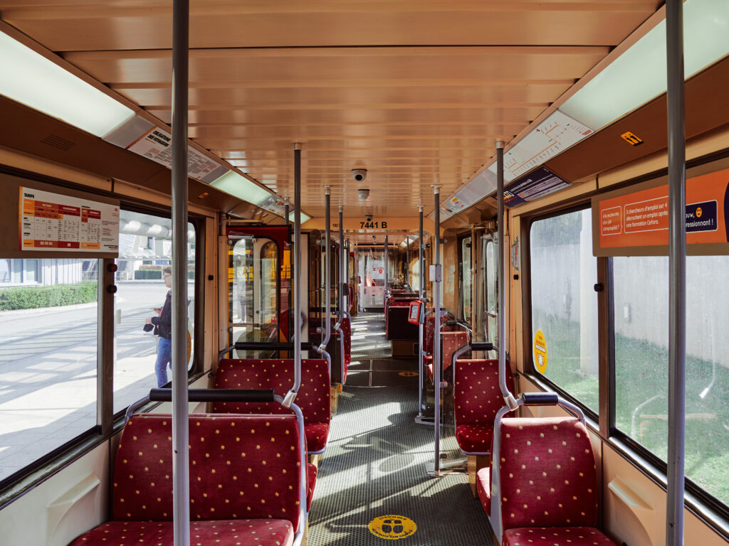
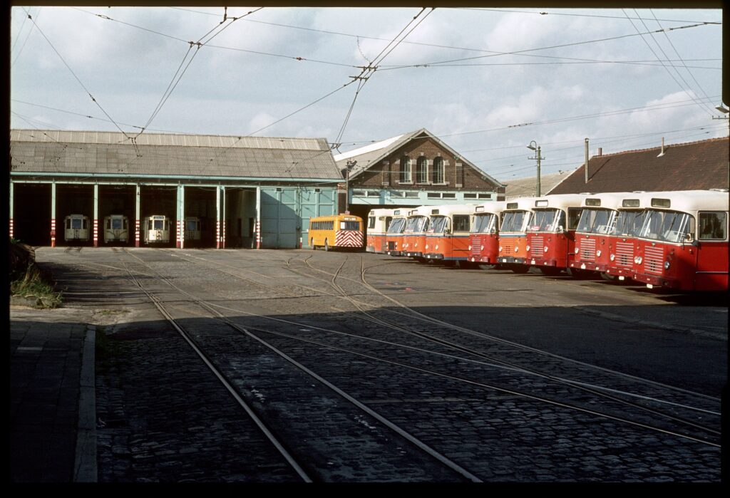
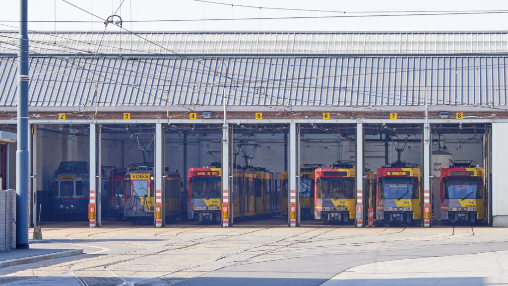
A quick look at the vehicles. The class 7400 are bi-directional units built in Belgium. The 55 cm platform height is unique for pré-métro systems. As TEC cannot afford a new fleet designed specially for Charleroi’s unique infrastructure parameters, they’re stuck with these cars from the early Eighties and plan to refurbish them again.
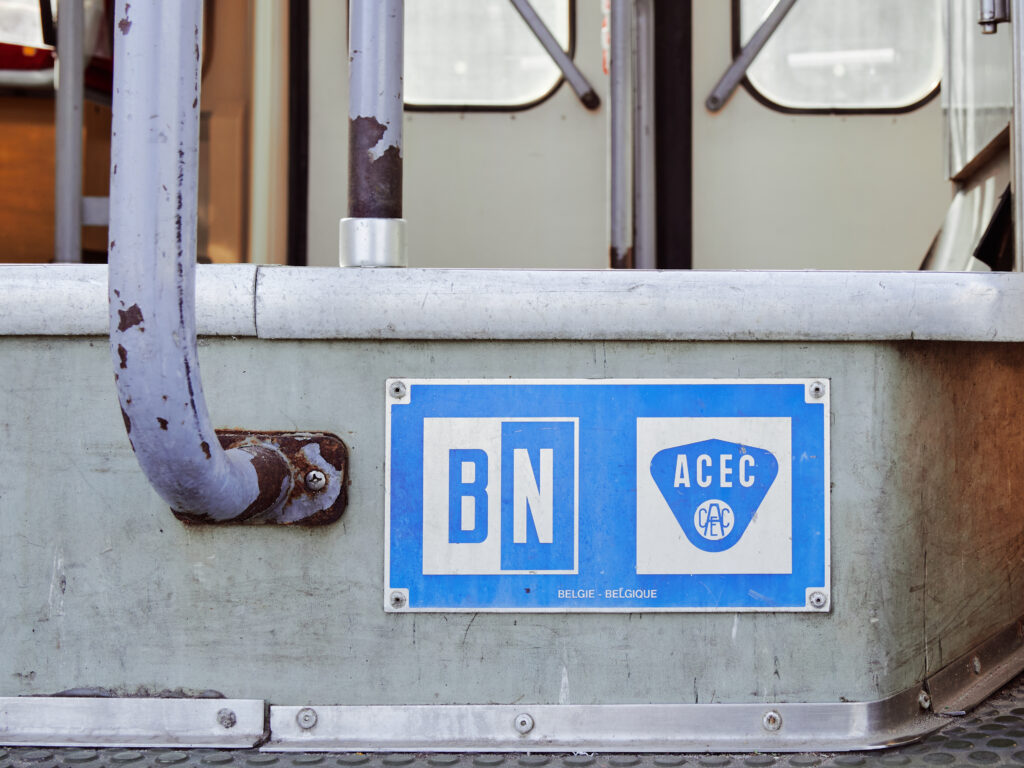
More rolling stock details. The class 7400, together with the similar Kusttram class 6000, were the last rolling stock procurement of SNCV, Belgium’s legendary interurban tramway company with a network of once over 4000km, spreading all over the country. With all other Charleroi lines except for the Metro closed and the Metro never fully built, some of the 55 tram cars were never put in service. A few of them are still rotting away outside a TEC depot.
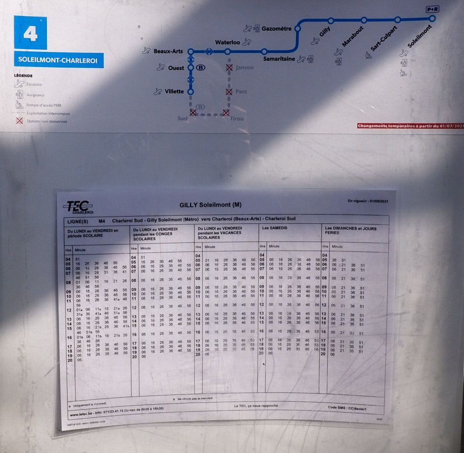
The timetable. Line M4 is the busiest on the network. But the school peak hour at Wednesday noon reminds me more of a rural branch line than a metro. Meanwhile, the beautiful and very Belgian old school departure board is stuck in the past.
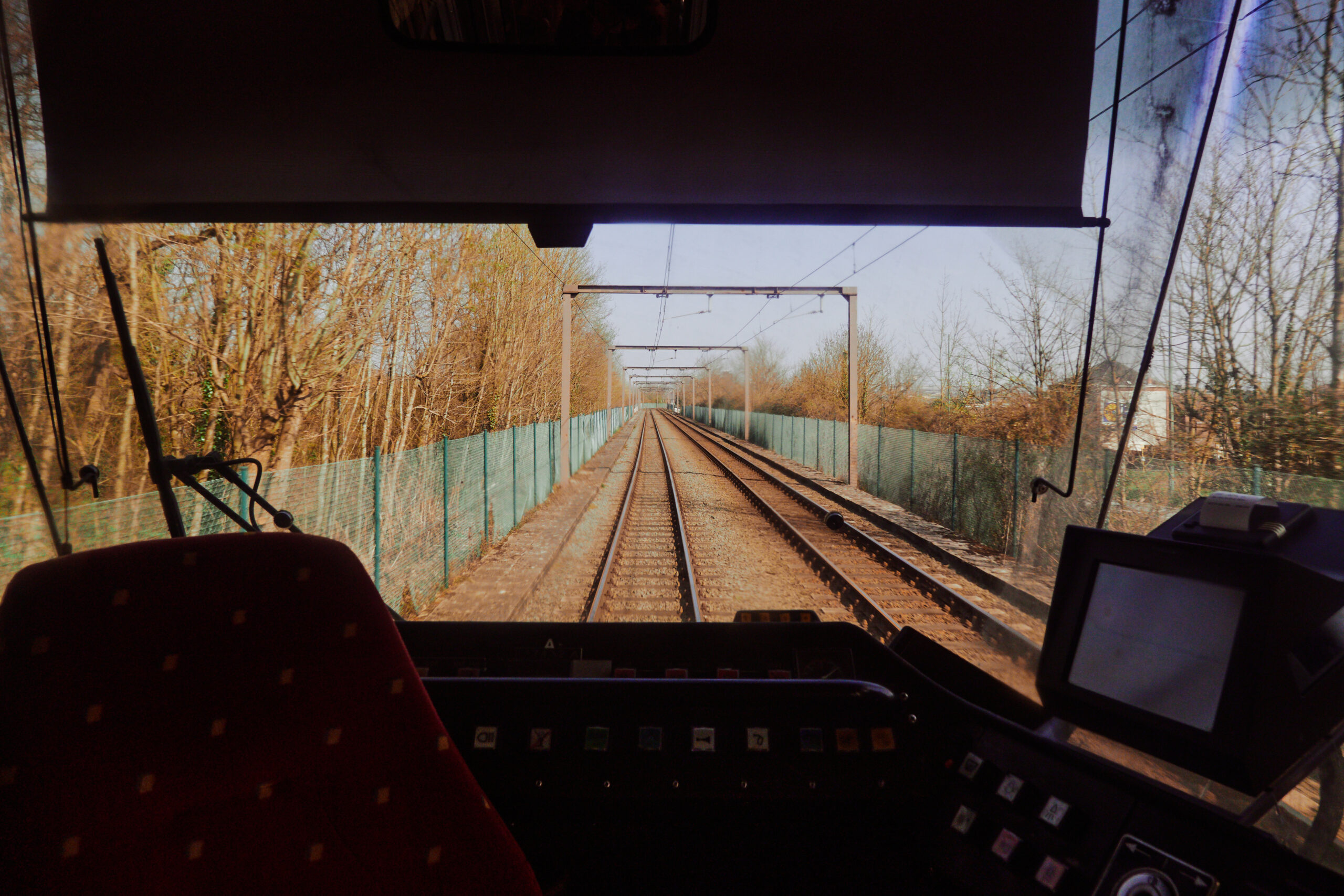
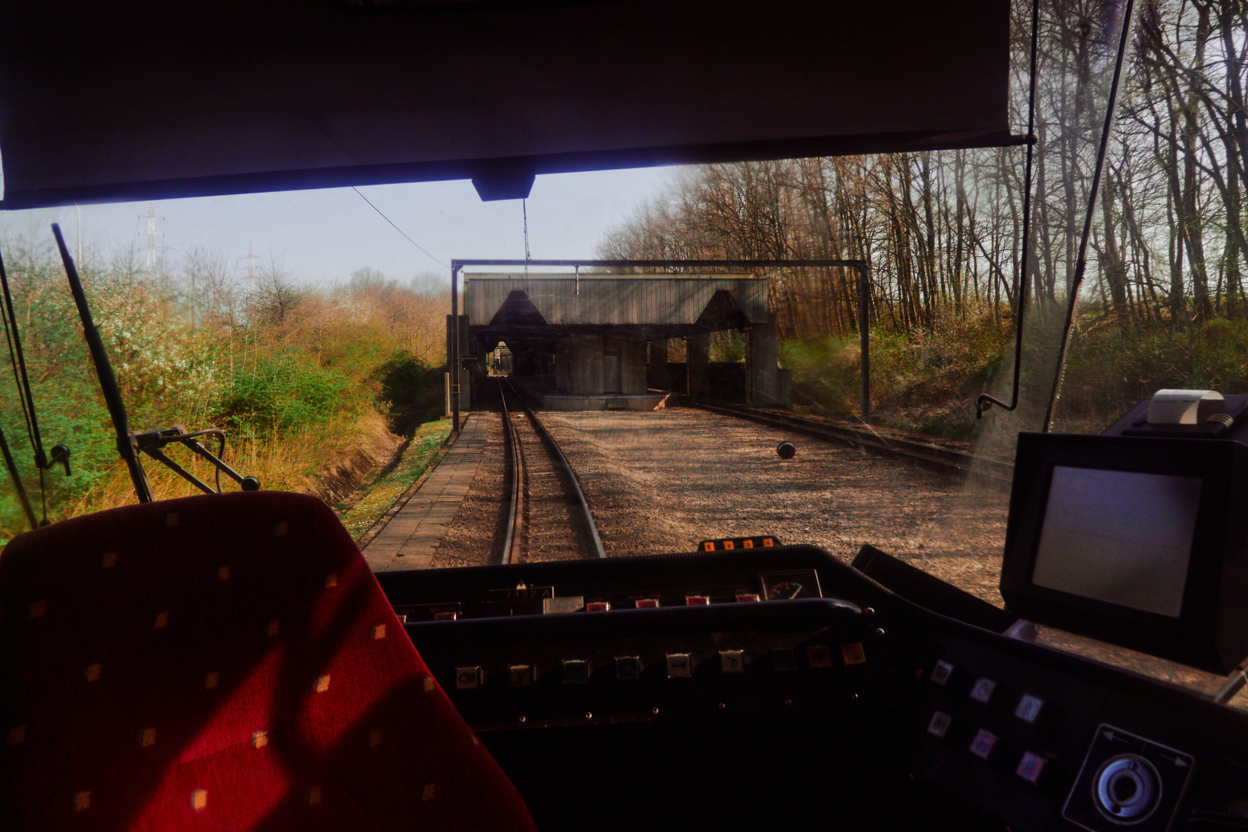
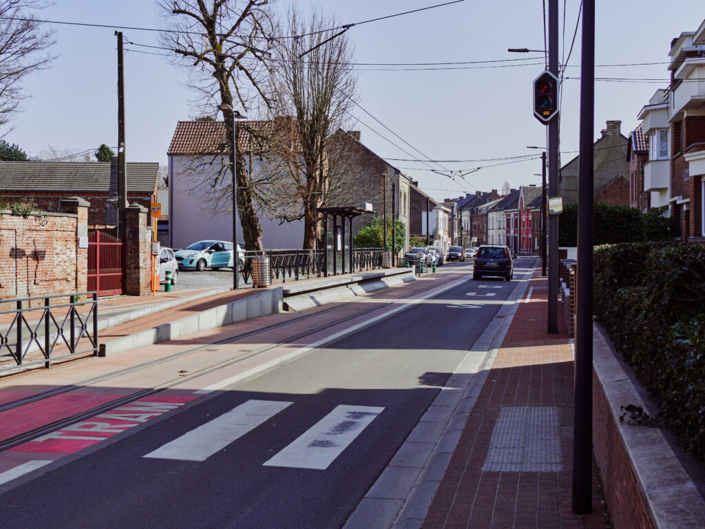
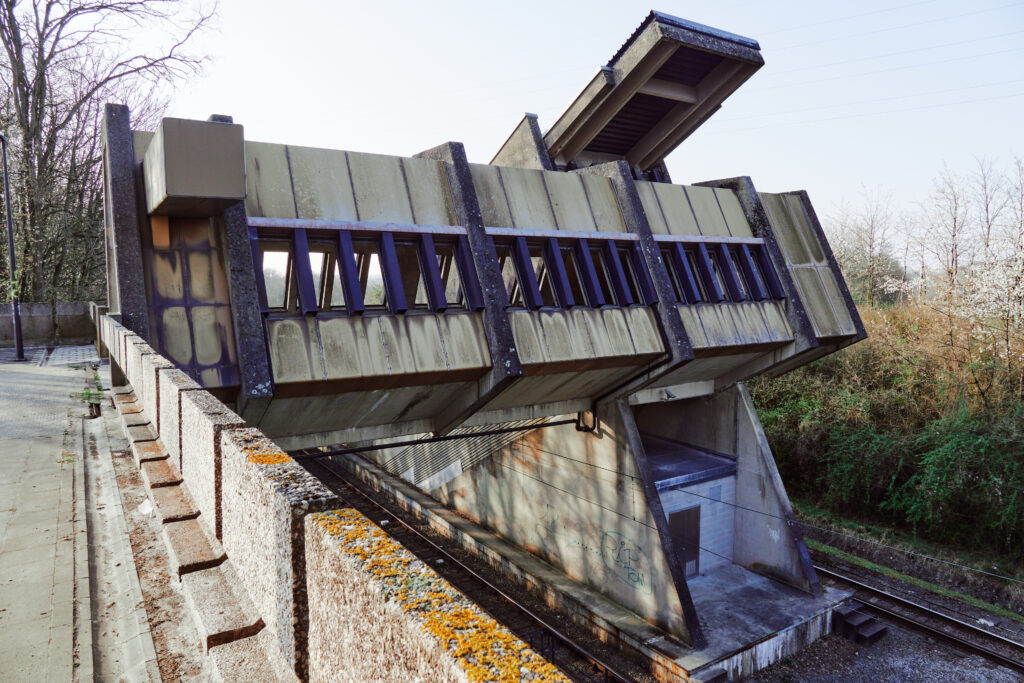
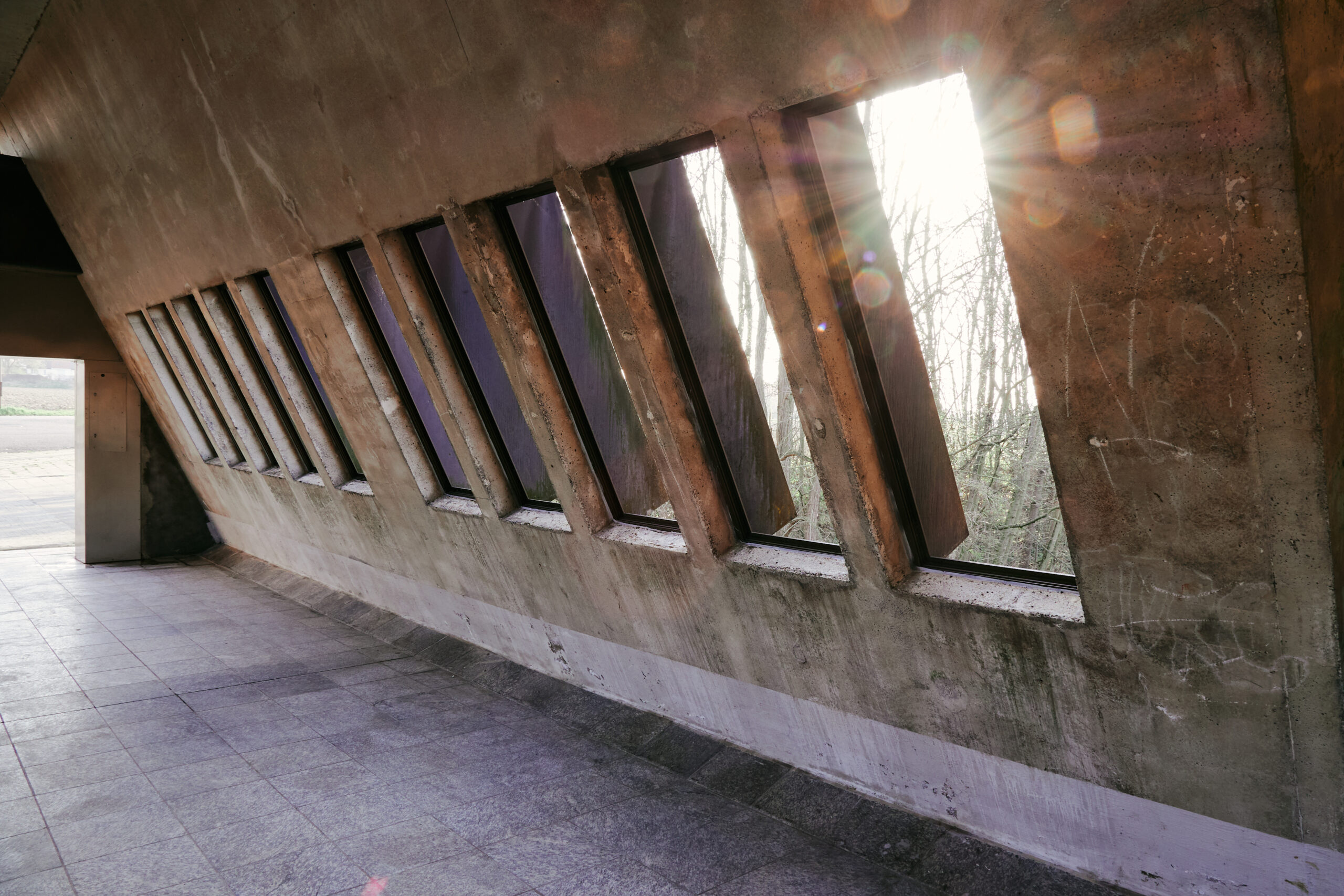
A few stations back towards the centre: The network features an insane amount of bridges and tunnels, making the system probably a way too expensive nightmare to maintain, especially compared to the low passenger numbers.
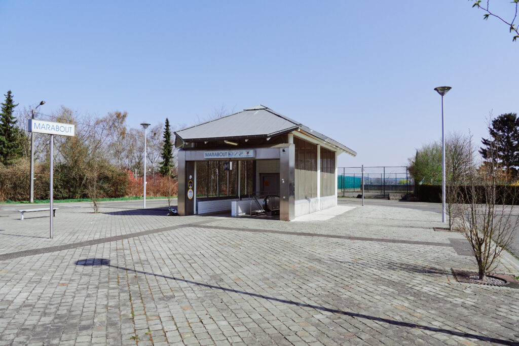
Many stations have been totally unnecessary put underground. There is no obvious reason for me why, for example, Marabout station here couldn’t be on the surface with access from a road bridge above.
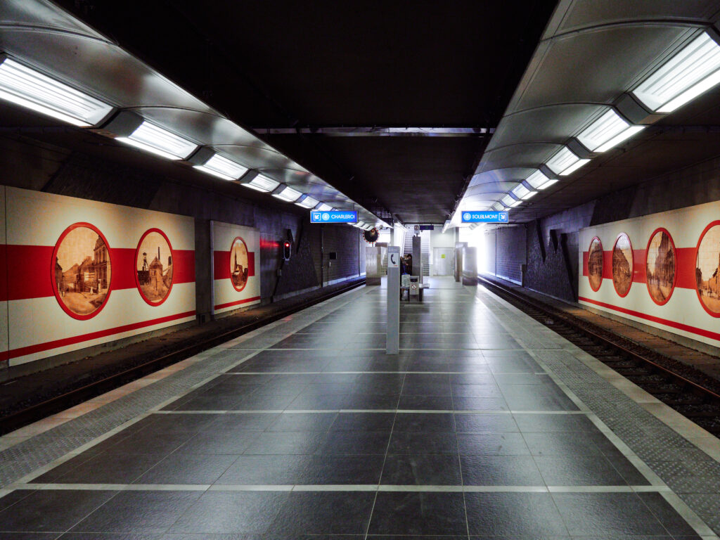
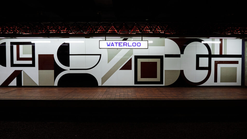
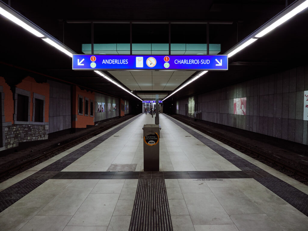
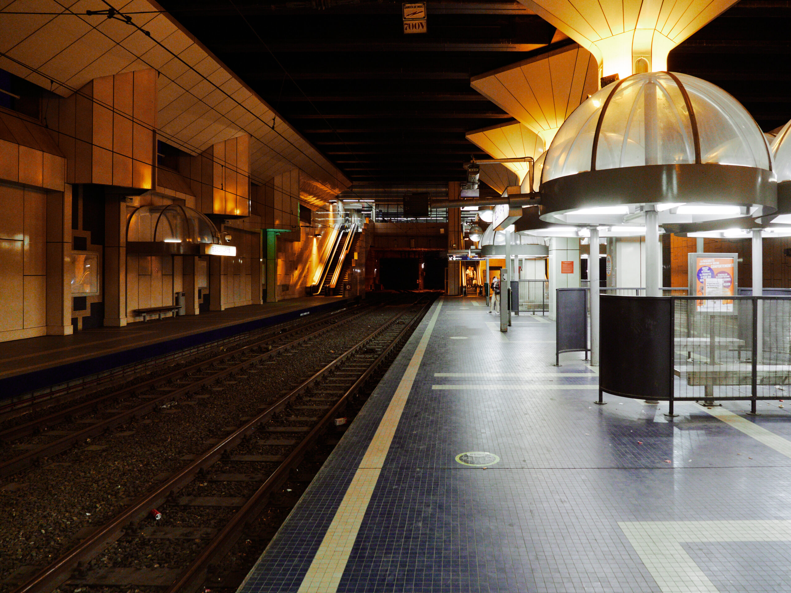
Back at the central loop at Waterloo. I expected the worst after Adrian’s descriptions and indeed he was right. I’ve never seen such a shabby metro station in central Europe before. Dark, a bit dirty, with an almost claustrophobic feeling and with strange people lurking around. Further adding to my unease is the fact, that the exit escalator leads down instead of up, even if we’re already underground.
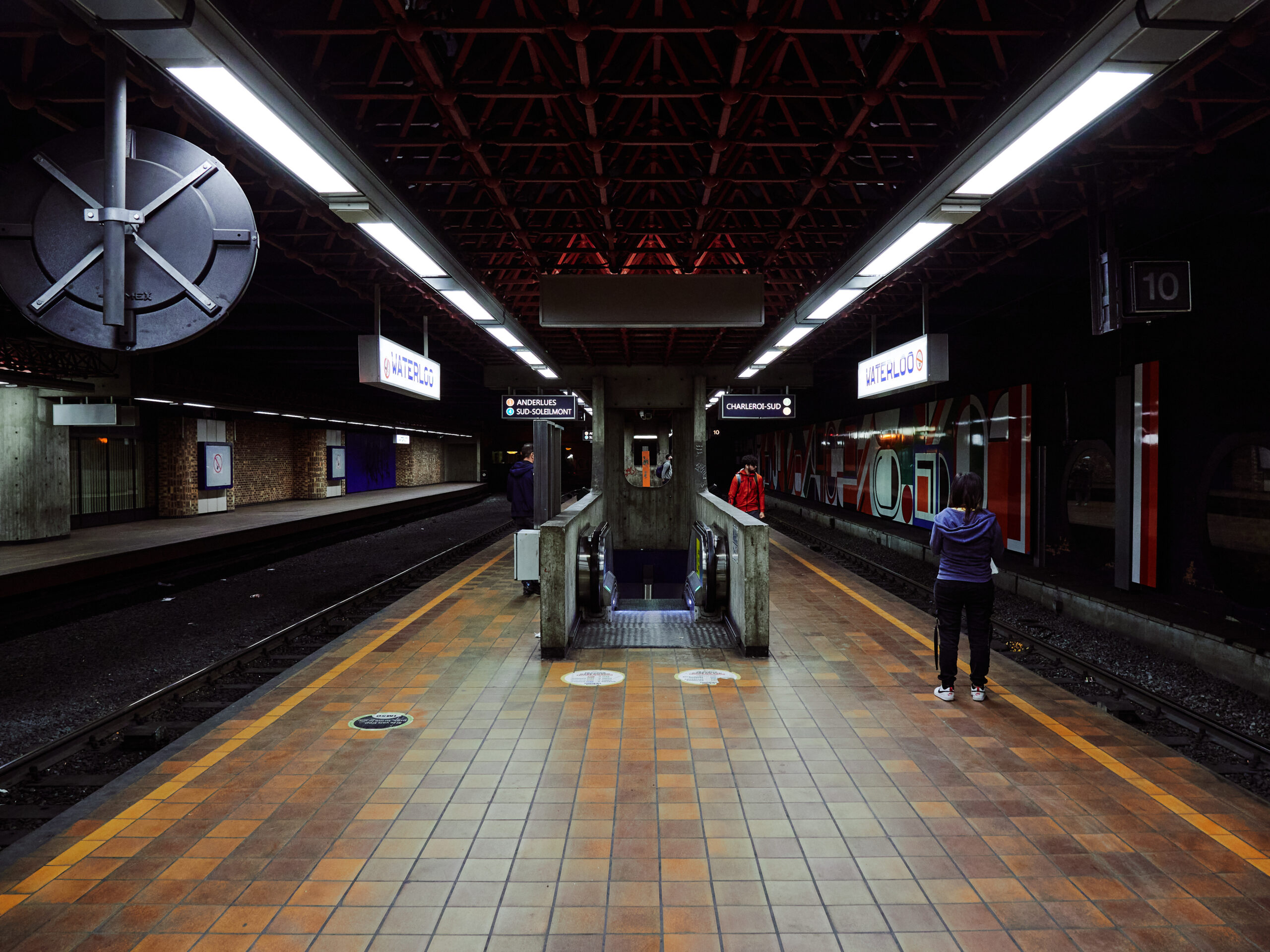
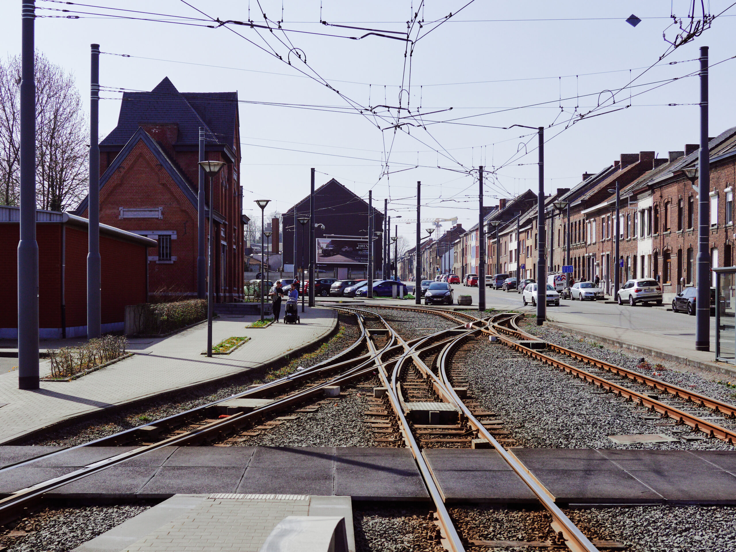
Otherwise, the station is quite interesting. In a fully built network, this would have been an important hub between northern and eastern branches, which is why there is a strange metro „roundabout“ here.
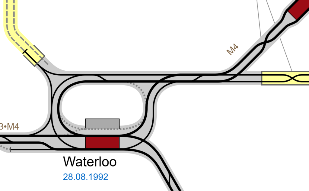
🗺️ Source: Julian Merle-Rémond & Christian Stade (CC-BY-NC-SA), http://gleisplanweb.de
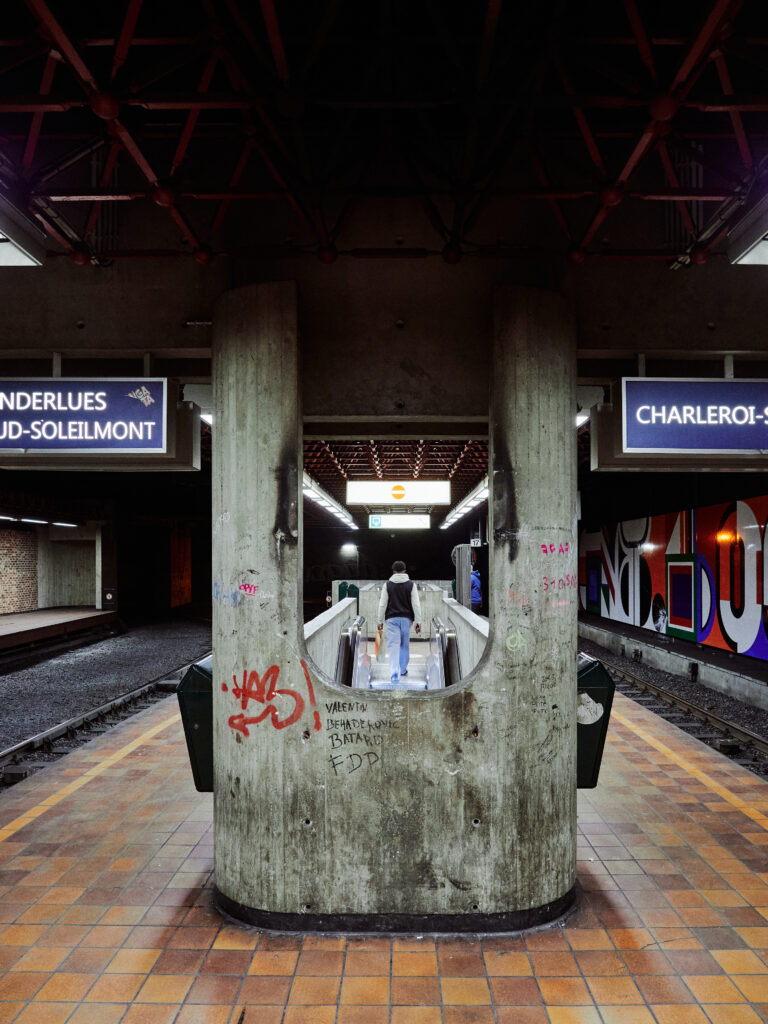
Let’s get out of here! It can only get better… or, can it?
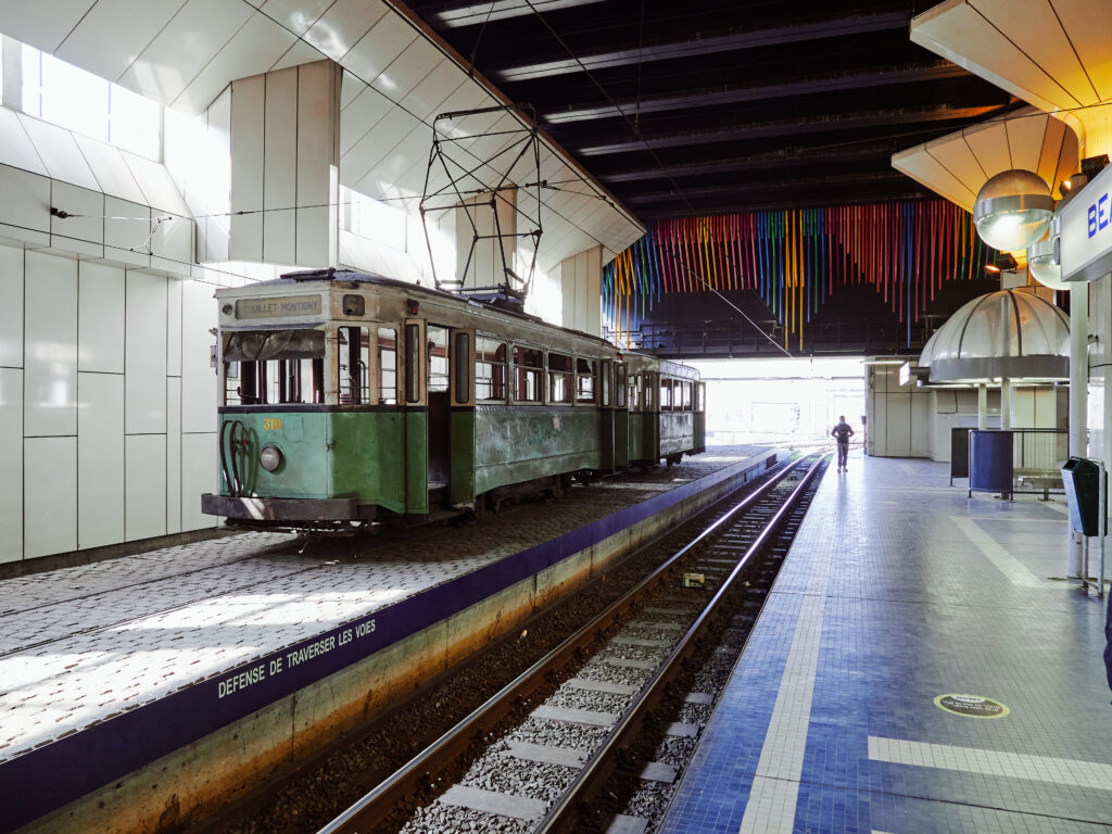
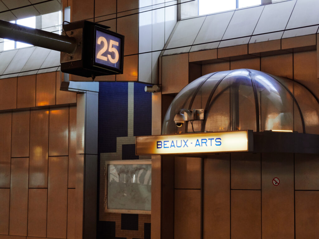
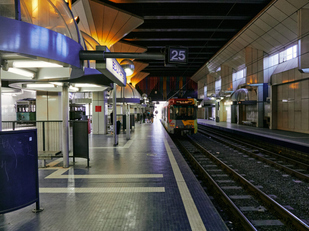
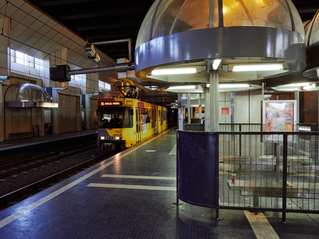
Well… Welcome to Beaux-Arts! The name says it all, doesn’t it? This is the second big station only a bit further west on the loop.
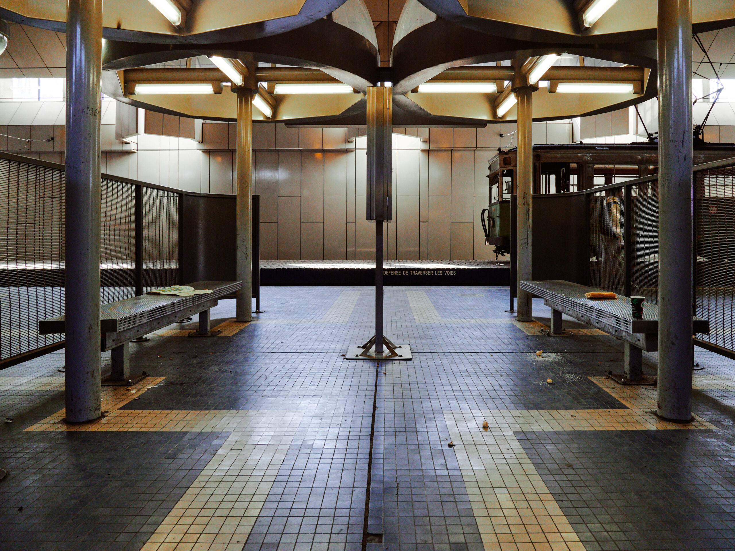
The architecture is, to put it mildly, a bit too much for me here. An old STIC tram consist is rotting on a separate track. But at least it’s much brighter and less claustrophobic than Waterloo.
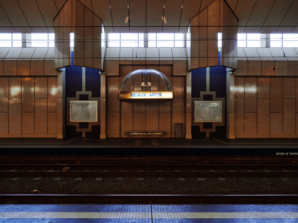
Update: The station has been renamed „Palais“ in the meantime.
An interesting track layout as well: There is an underground loop which is used by some services from the main station via Villette to Anderlues. And this station is – again – unnecessarily underground! There’s just a parking lot above at the surface…
🗺️ Source: Julian Merle-Rémond & Christian Stade (CC-BY-NC-SA), http://gleisplanweb.de
Speaking of which: The gleisplanweb.de-Track map is fascinating to dive in and reveals a lot of details about the never built or never opened sections.
gleisplanweb.eu
«Stadtbahn Charleroi» auf gleisplanweb.eu
Detaillierte Gleispläne von Strassen- und Stadtbahnnetzen
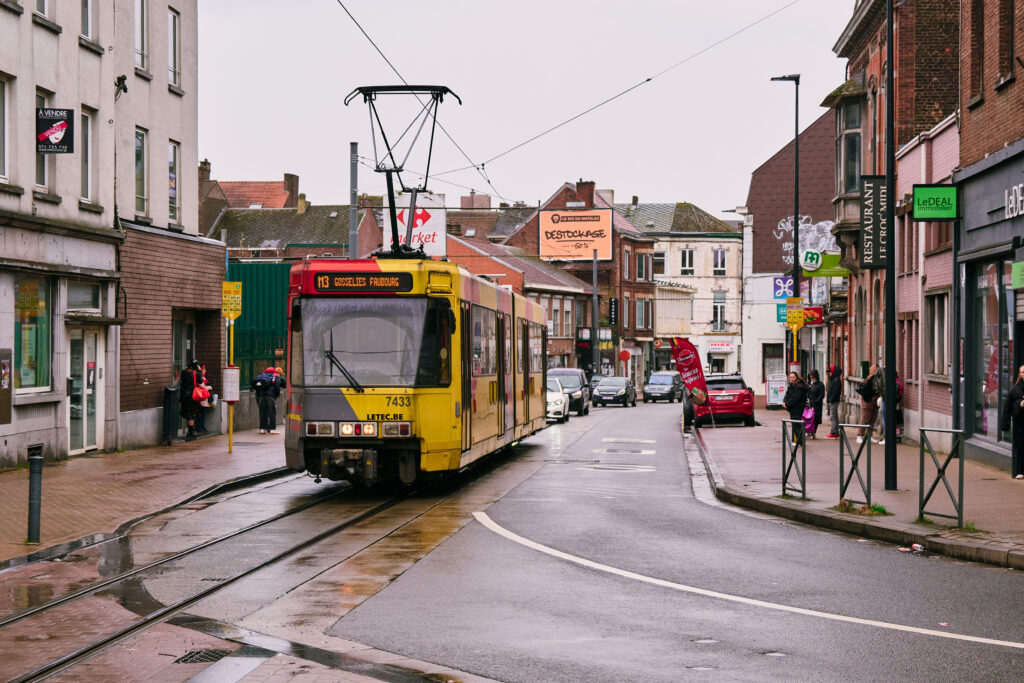
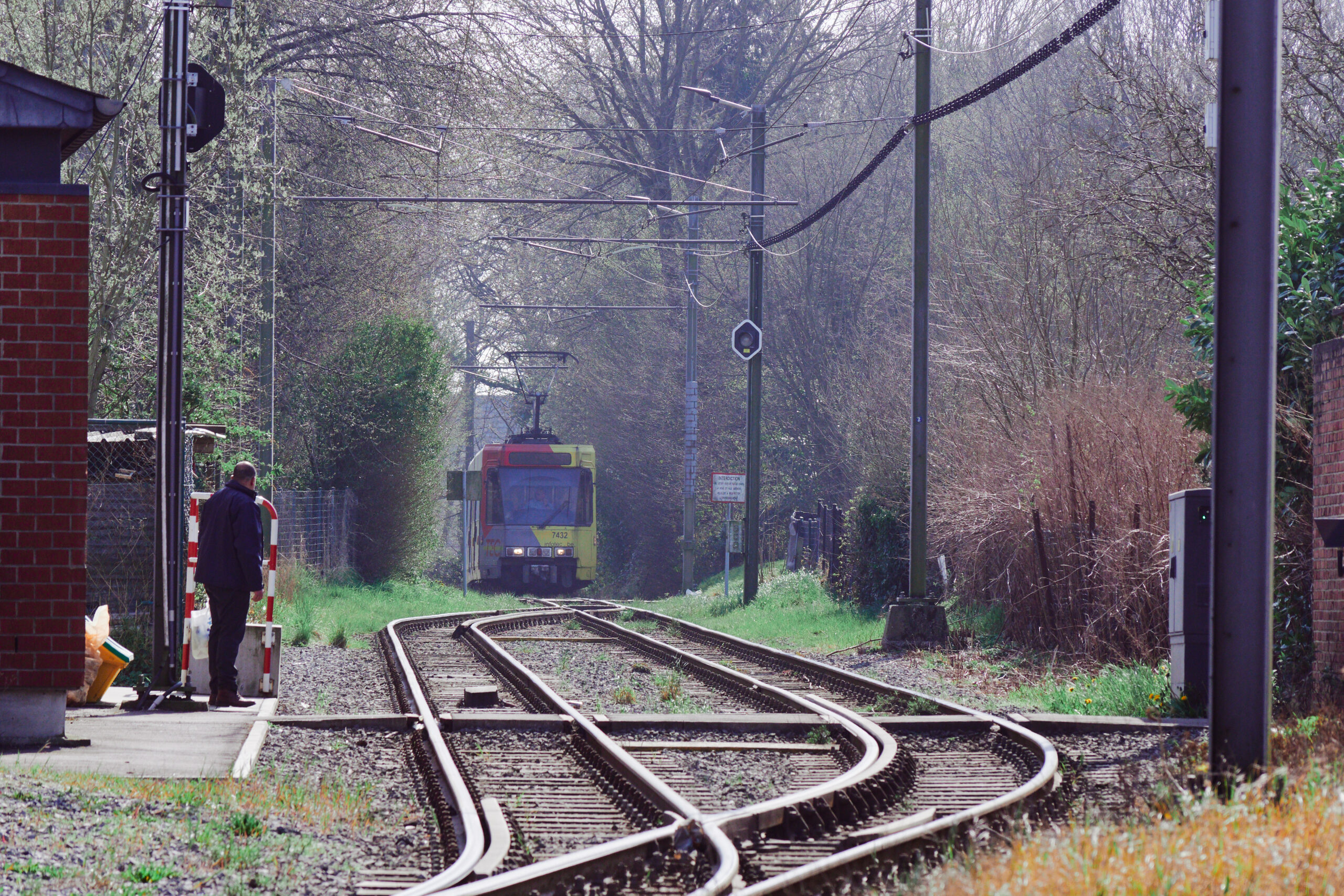
Next up: The new old branch to the North. Although: A guy on the platform claimed, that line M3 would not run today. We couldn’t believe this as we checked at home, but there was no was to confirm this without a phone, as there was no real time information at the station. So we just waited and after a while, an M3 service arrived.
This branch is an actual tram line which opened 2013. Well opened for passengers; the line itself had been there for nearly a century. It’s an old SNCV vicinal tram line which was closed for passengers but kept in operational condition, as it was the only acces to the Jumet depot, an old tramway depot, was repurposed for the metro. That’s an insane 4 km of track maintained for 30 years just for depot access! 🤯 Finally, in 2013, it re-opened commercially and even was extended to Gosselies.
Original plans of course included a proper metro branch with its own right of way. The 2013 solution is much more modest: Mostly street-running (but at least mostly separated from car traffic) and a bit of repurposed old freight railway line. On the northern end in Gosselies, there is a huge 4.5 km loop with the two tracks up to 400m apart. Unfortunately, we haven’t had the time to further explore this branch. So only photos from the Faubourg-de-Bruxelles terminus, where the trams reverse.
Update: A few years later, I finally managed to get photos from the Gosselies branch. As it’s quite an interesting one, I throw these four pictures from 2024.
It’s noon and we’re back in the centre at Piget. M3 and M4 done, now changing for M1/M2 to Anderlues. As this will be by far the best part of the network, I’ll do a break here. Stay tuned for part 2!
Part 2 of #BétonBelge was, like some metro lines, partially built, but never opened to the public. First, I had no time. Then I had other threads upcoming. And then, Musk bought Twitter and everything went downhill. The platform, where I was preparing my threads on was sold and shut down. I lost access to all my prepeard threads – including part two of the Charleroi métro. But it still bugged me to have unfinished business here. Especially because the Anderlues branch was by far the most absurd in the Charleroi network. That’s why I took the „evacuation“ of the first part from Twitter to my own website as an opportunity to finally rewrite the second part. So here we go, let’s visit one of Europes most impressive monuments for failed planning. #BétonBelge, part II.
Dominic Stucki
@dominicstucki
Industrial wasteland, an infrastructure orgy and the last tiny bit of what once was a 4000 km long interurban tram network. Welcome to the Anderlues branch of the Charleroi métro.
This is #BétonBelge, part II.
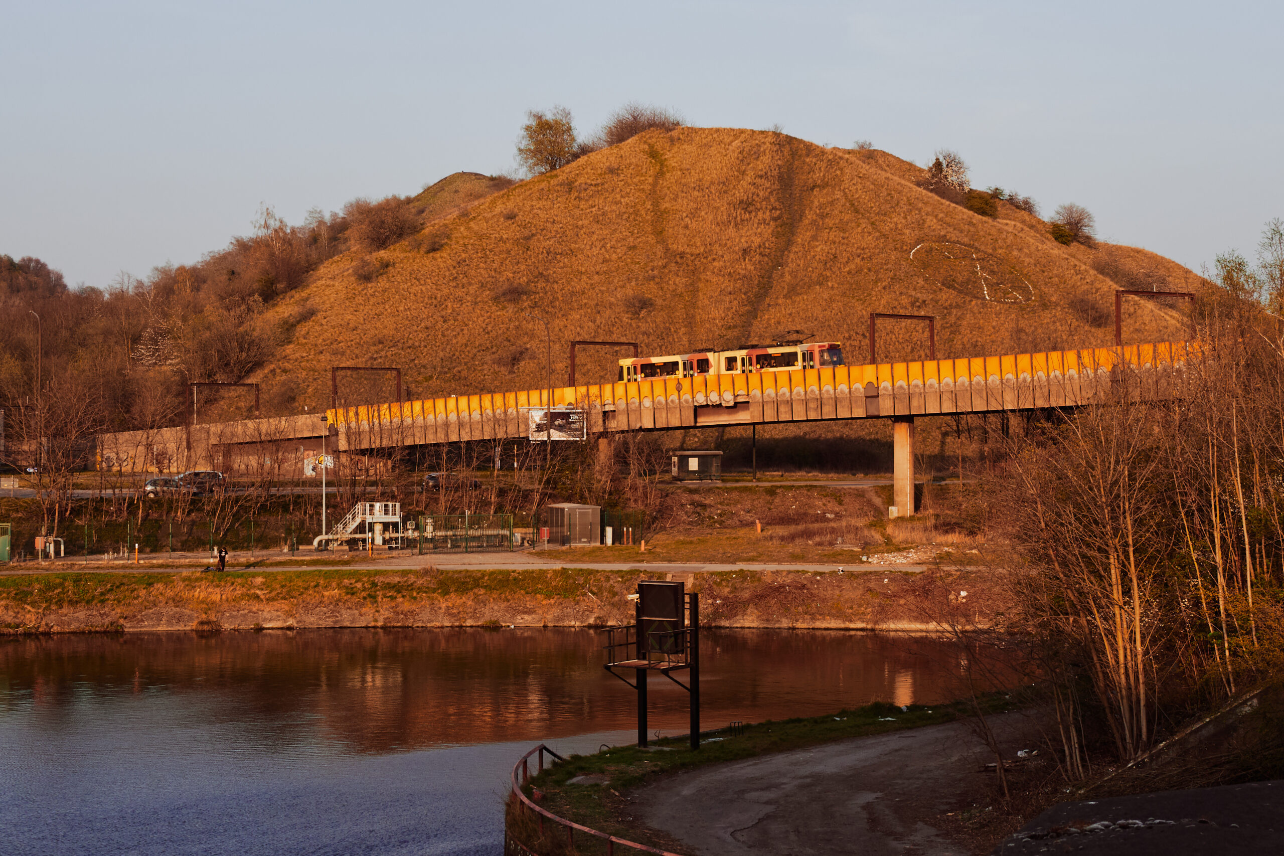
Just outside Piget, the tracks dive into another tunnel. The „mountain“ it traverses is, however, of human origin. It’s one of dozends of mining dumps around Charleroi, witnesses of the coal mining era. „Teril“ is what they call them here. In the tunnel, invisible in the dark, is a pre-built junction for the never realised Courcelles branch.
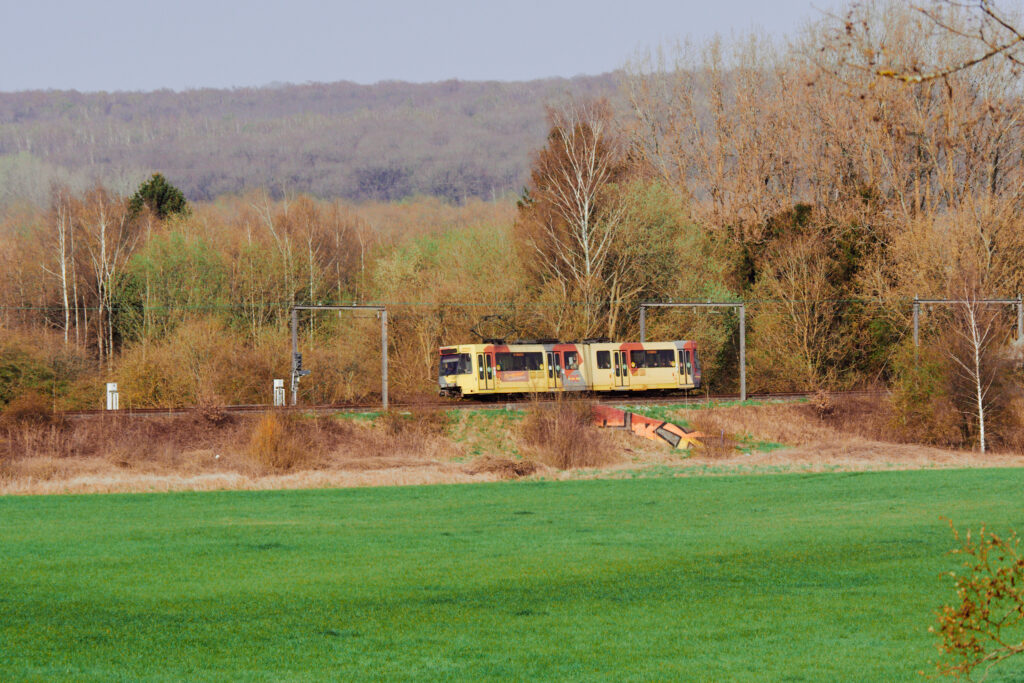
After Damprémy, a modernised underground stop, the line resurfaces. And you find yourself in these surroundings. This is a picture from a later trip, but too impressive not to show here.
We will come back here later, but first we alighted at De Cartier (another modernised unterground station) and went for a little walk along river Sambre which can’t hide its industrial past here. Just next to the SNCB bridge is another shell for a never completed stop, of which I stupidely forgot to take a picture. This would have been the transfer point to Marchienne-au-Pont SNCB station just at the other side of the river.
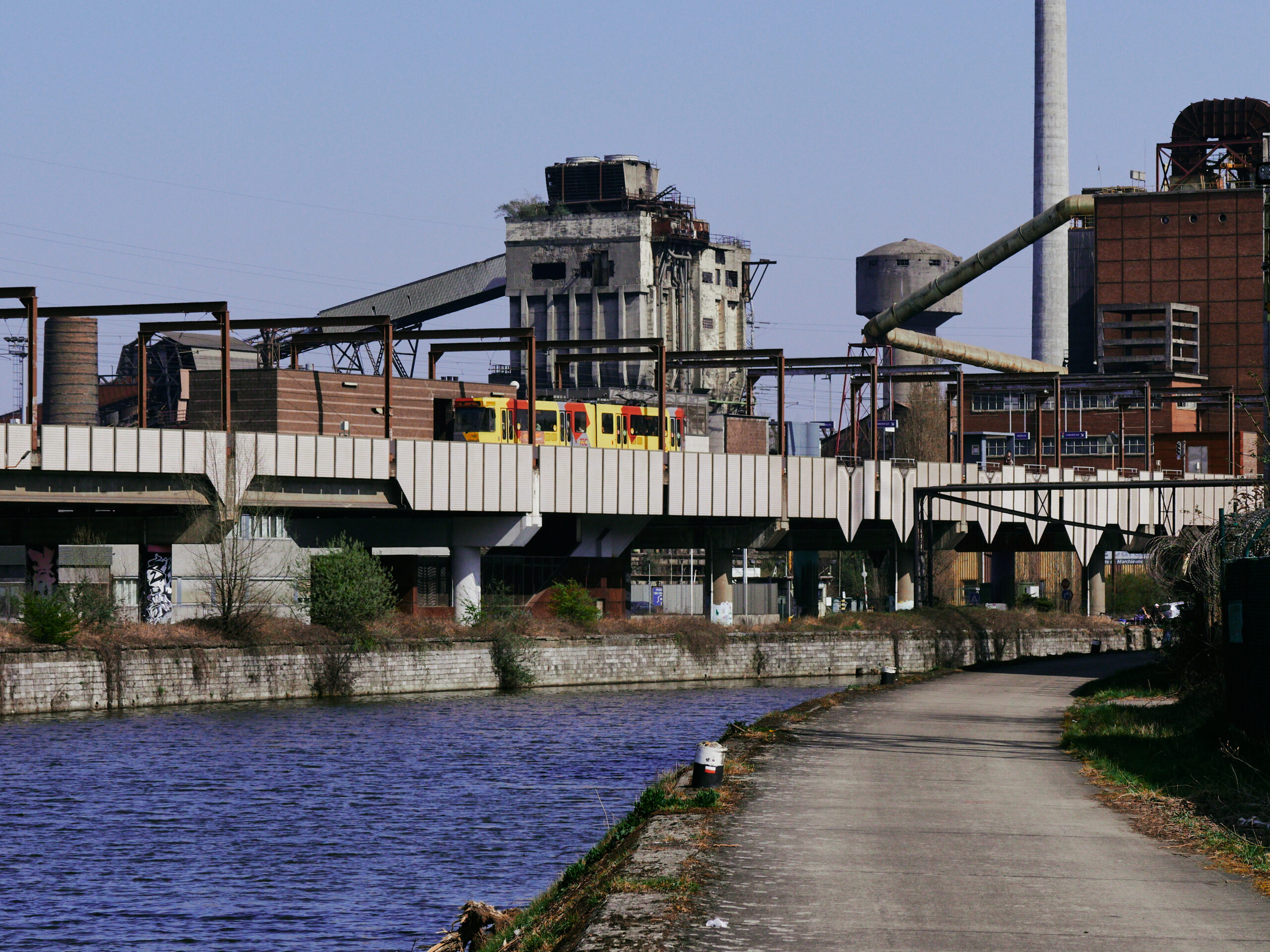
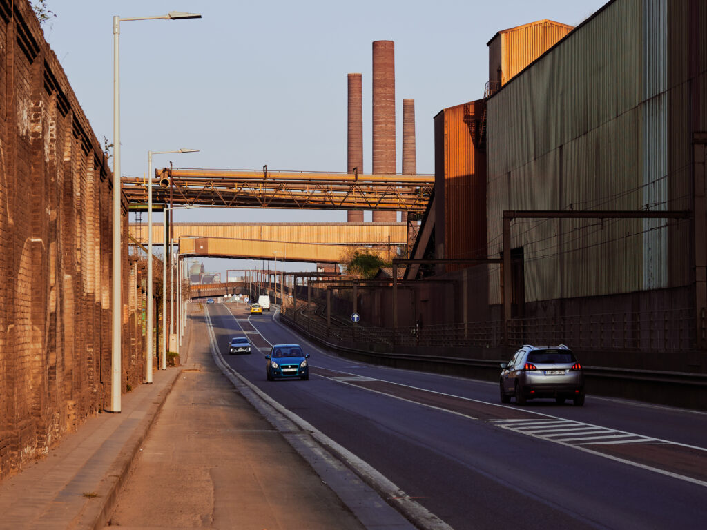
From the southern bank of river Sambre, we have a good view on Providence station and the adjacent viaducts. This area here is, where the heart of Charleroi’s steel industry once was: The Forges de la Providence. The gas power station is still in use, whereas the coking plant behind Providence station was shut down in the early 2000s.
Next to Le Cartier station is a lovely Château with a small park, which served us as Pic-Nic location, suspicioulsy eyed by locals. Very clearly, tourists are a rare sight in Charleroi’s poor suburbs. A short visit to the next boulangerie and then we hopped on the next metro train towards Anderlues.
Tunnel, viaduct, tunnel, viaduct. The line nearly only consists of civil engineering structures. The line is aligned fast here, we made good progress, even if we stopped at quite a few rather abandoned looking stations in the middle of nowhere. We’ll get back to these in a minute.
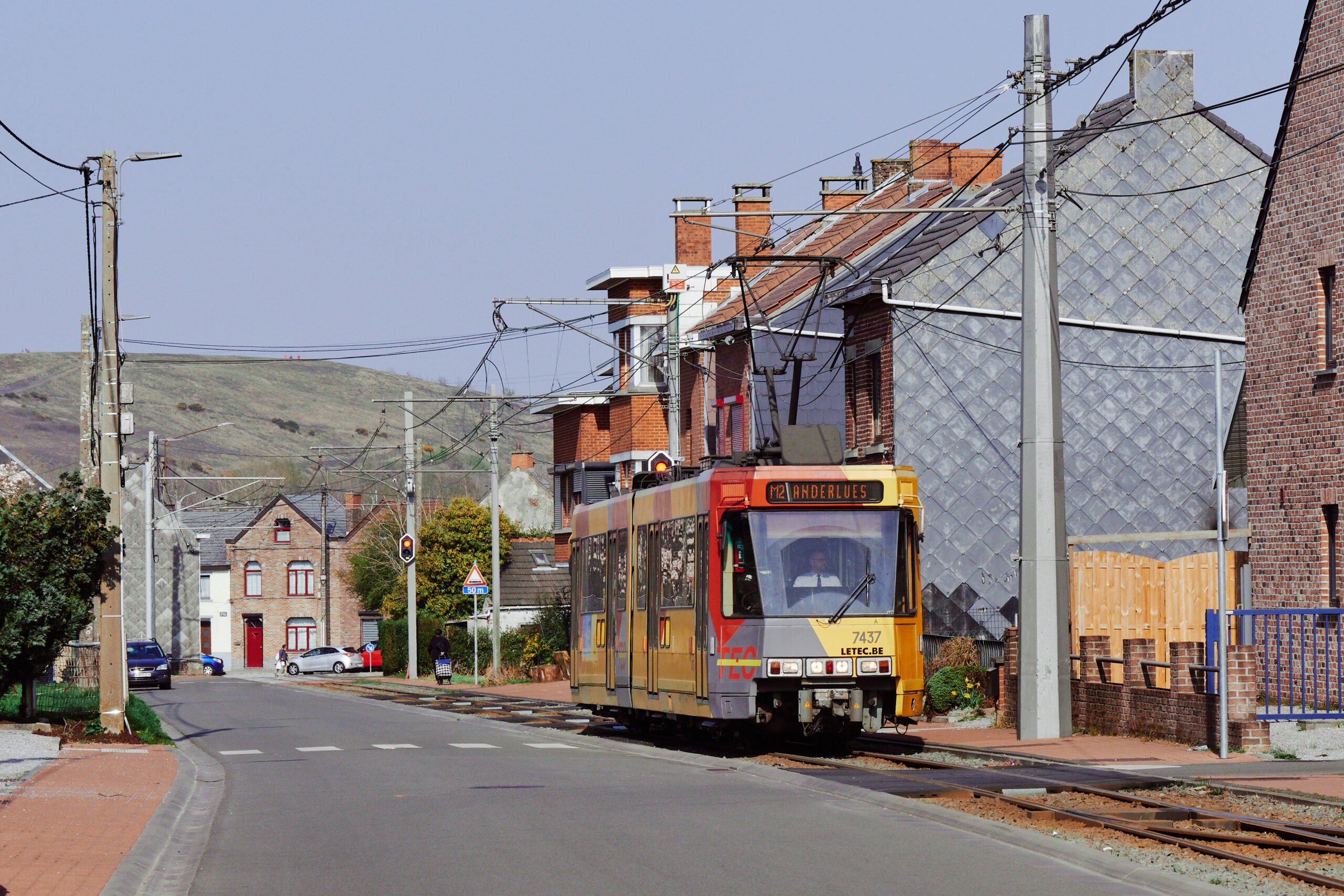
But then, after Pétria, a station in the backgardens of a suburban living area, the line described two sharp curves. And suddenly we were on a roadside single track line. Dear reader: Welcome to the last bit of what was once a 4000 km interurban tram network covering all of Belgium! This here is more or less the last unmodernised remnant of SNCV – absolutely wild!
Over run down tracks, and over some proper street running sections through Anderlues, we reached the Terminus at Anderlues Monument.
Update: This picture is from a later visit, as I was too slow to manage getting a photo of the metro car, once we alighted at Anderlues Monument.
I’ll try to explain this weird change from metro to tram in a bit. But first, we had to investigate where our metro train went to. Instead of waiting at the terminus here, it continued westwards on a track, which is not used in commercial service anymore. Past a supermarket parking lot, through another passing loop to a buffer stop in a little backgarden forest. I have absolutely no clue why this useless part of track was kept, but apparently it’s somehow really important to run until the very end of the line.
But seriously: What is happening here?! Well: Charleroi once was the center of a dense SNCV sub network with a lot of interurban tram lines. Even if many of them shut down after the war, these old, roadside or street running lines were an obstacle for the fast growing road traffic. To get the remaining lines away from the road as fast as possible, the metro was never intended as a closed system. Instead, the SNCV lines coming from further out would also use the metro infrastructure to reach Charleroi’s city centre.
📷 Source: «Smiley.toerist» via Wikipedia Commons, CC BY-SA 3.0
The new class 7400 (originally 6100) metro fleet was built to light rail standards, so that it was tailored to new metro lines as well as the old SNCV interurban tram lines. In the early years, they still reached Binche and La Louvière on the SNCV line 90, as shown in the picture below. With the ongoing decomissioning of the interurban network in the 80s and 90s, the metro beacme more and more of an isolated system. In 1993, the last remaining SNCV interurban line between Charleroi and La Louvière was closed. All that remained was metro line 89 as far as Anderlues.
📷Source: «Smiley.toerist» via Wikipedia Commons, CC BY-SA 3.0
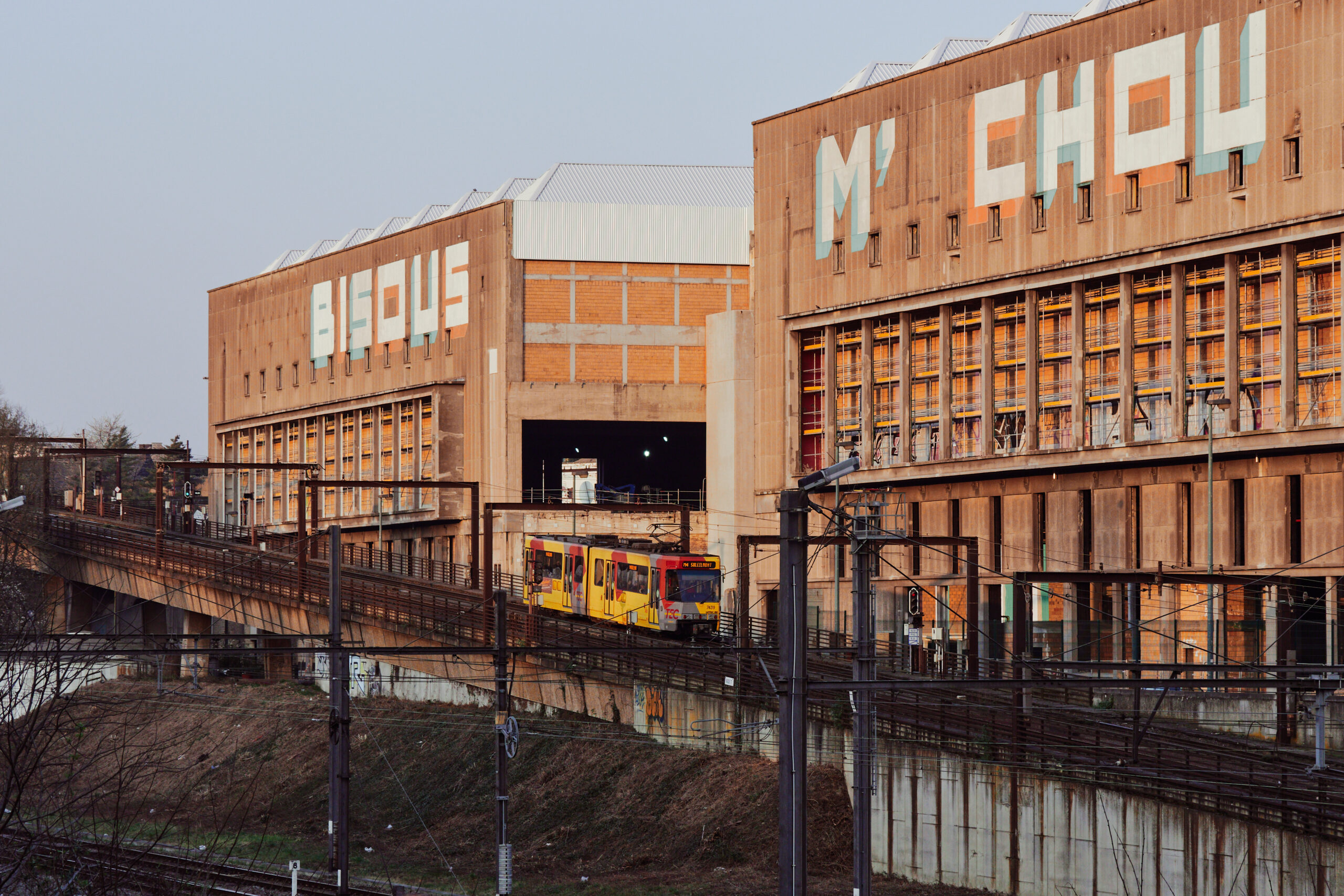
But then, why was the part from Pétria, end point of the metro infrastructure, to Anderlues kept, you may ask? As the metro gradually evolved from SNCV’s interurban network, a proper metro depot was never built. Instead and until today, the metro uses the former SNCV tram and bus depots, one of which is located in Jumet and the other in Anderlues. Apparently, there was also some kind of rivalry between the two and as they bought way to many class 7400 trains they needed space to store them. In the end, the Anderlues depot and the line from Pétria to Anderlues were preserved.
📷 Source: Michel Huhardeaux, via Wikimedia Commons, CC BY-SA 2.0
.jpg)
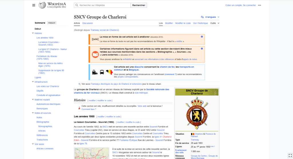
If you want to know more about the history of Charleroi’s SNCV-Network and the conversion to the metro, I highly recommend diving into the Wikipedia articles. This one here might be a good starting point.
fr.wikipedia.org
«SNCV Groupe de Charleroi» auf wikipedia.org
Le groupe de Charleroi est un ancien réseau de tramway exploité par la Société nationale des chemins de fer vicinaux (SNCV). Le réseau était construit à voie métrique.
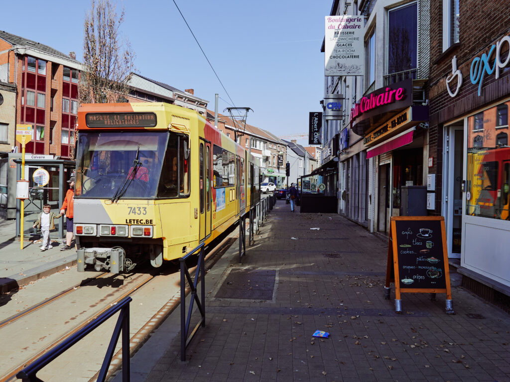
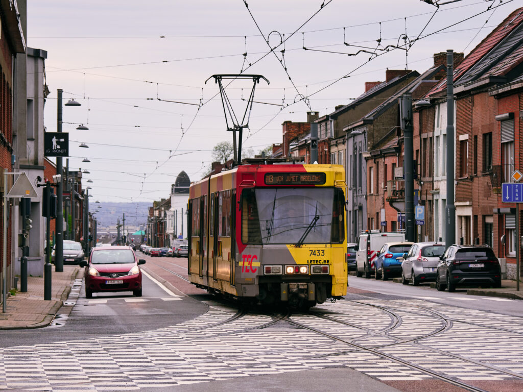
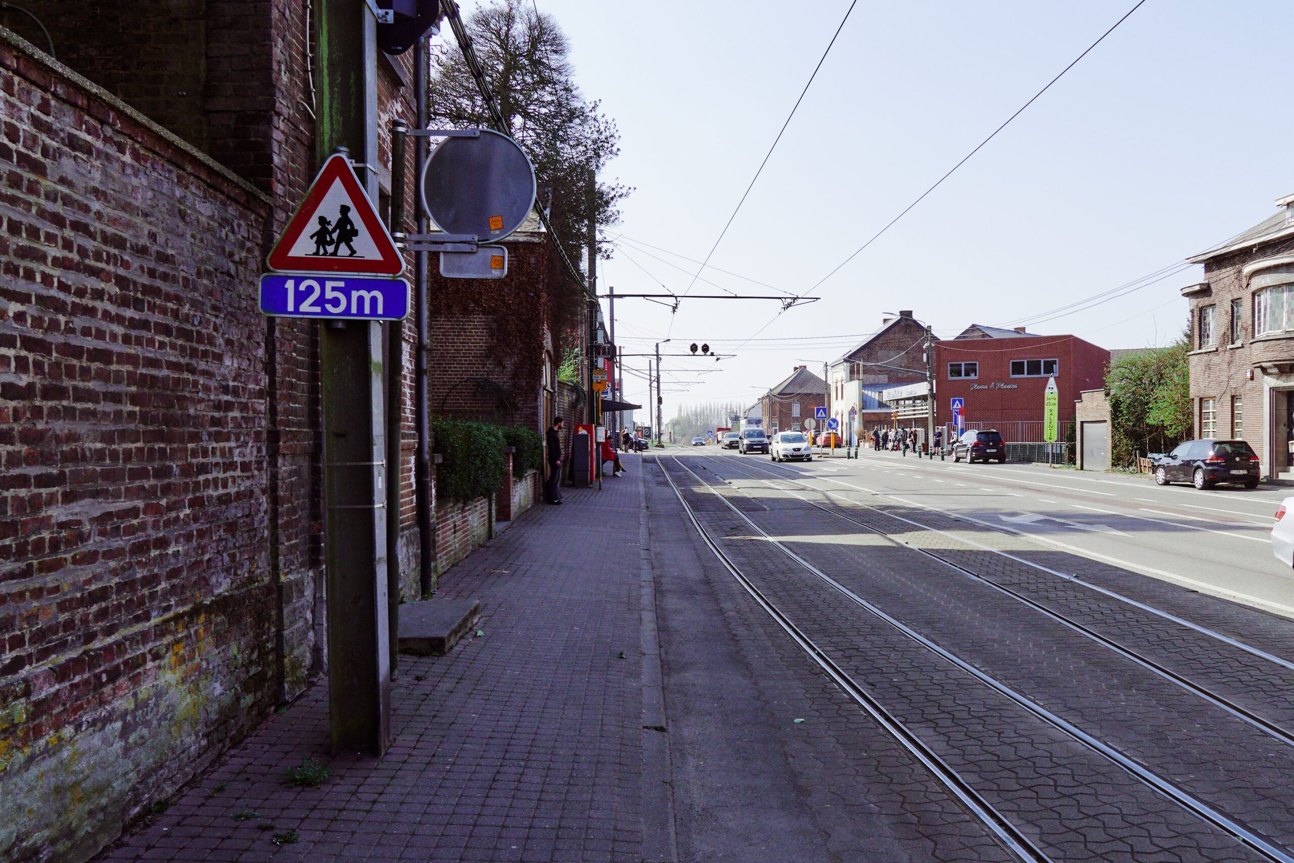
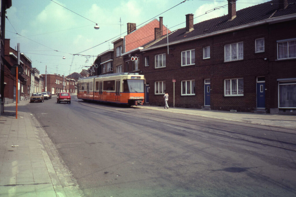
And with that, back to our little exploring tour. In the meantime, we walked back towards the town centre. After a few minutes wait, the tram which brought us here returned to Charleroi, crossing the town on a modernised, but still true SNCV-style street running section.
55cm platforms in the middle of the road. Given the integration of SNCV lines, the decision for high platforms on the metro probably wasn’t very wise. Oh, and do the surroundings look familiar? Yes, of course this is a former railway line crossing here. Don’t forget that Belgium once had Europe’s most dense railway network!
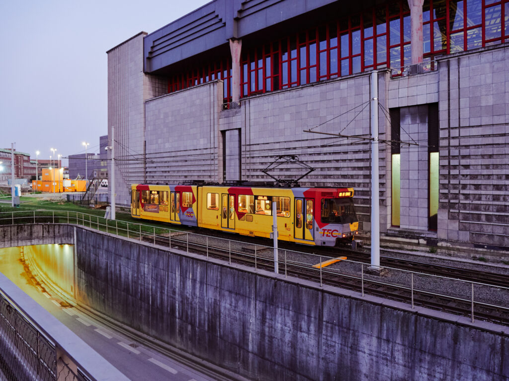
Next to Jonction stop, once a transfer station for the line to Thuin, we find the Anderlues depot. The infrastructure has been heavily modernised here. And if you look closely in the depot, you’ll discover a few old type SM former SNCV tramcars as service vehicles.
What, however, fascinated me most was the stretch of line from the depot towards Charleroi. Running through typical belgian sprawl, I’m pretty sure that this is how most SNCV lines would look today, if any of them had survived.
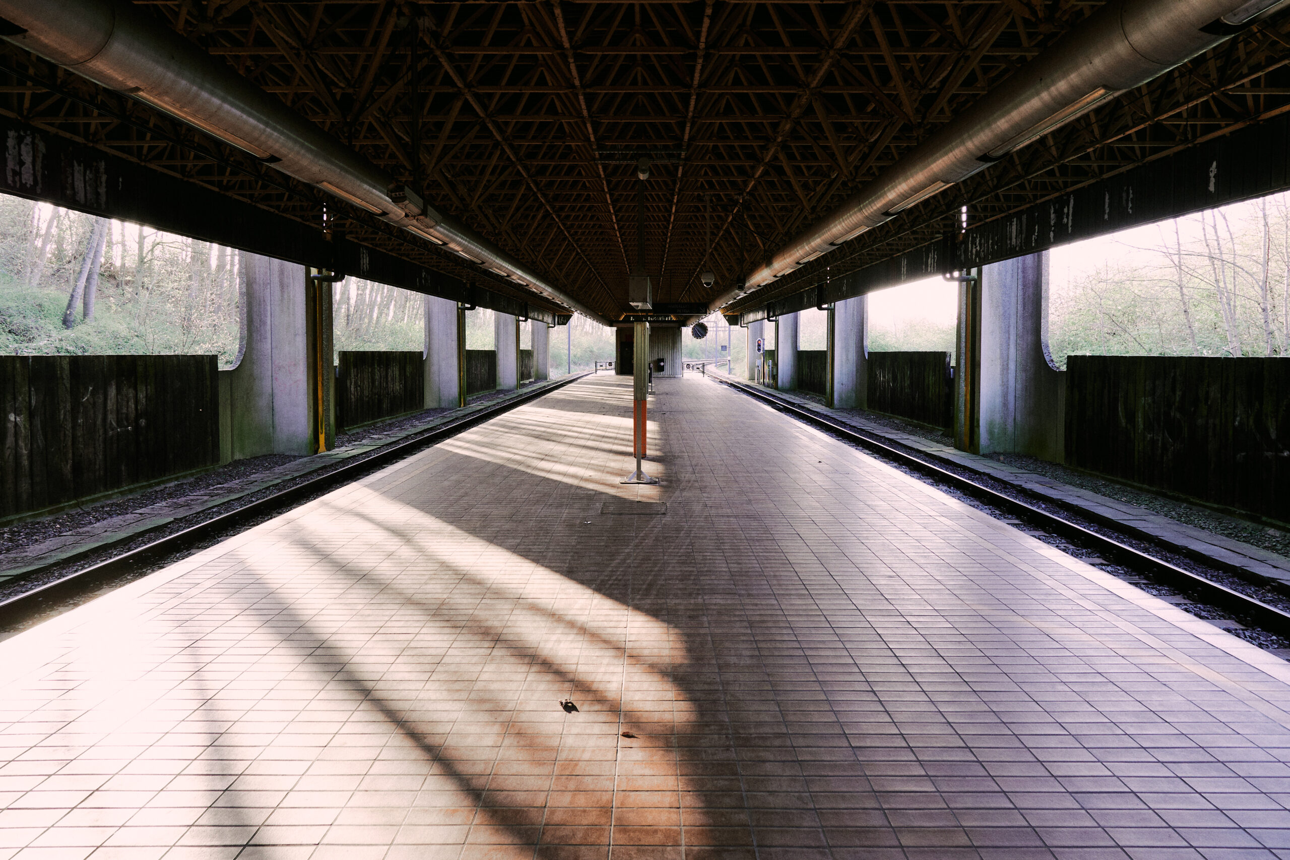
It was nice here on this sunny early spring afternoon. I could have easily stayed for a few more hours. But this quirky metro only runs until sunset, we had to speed up the pace as we wanted to see more. Back on a train at Route de Thuin, a station which looks a bit like your ordinary Swiss narrow gauge railway stop.
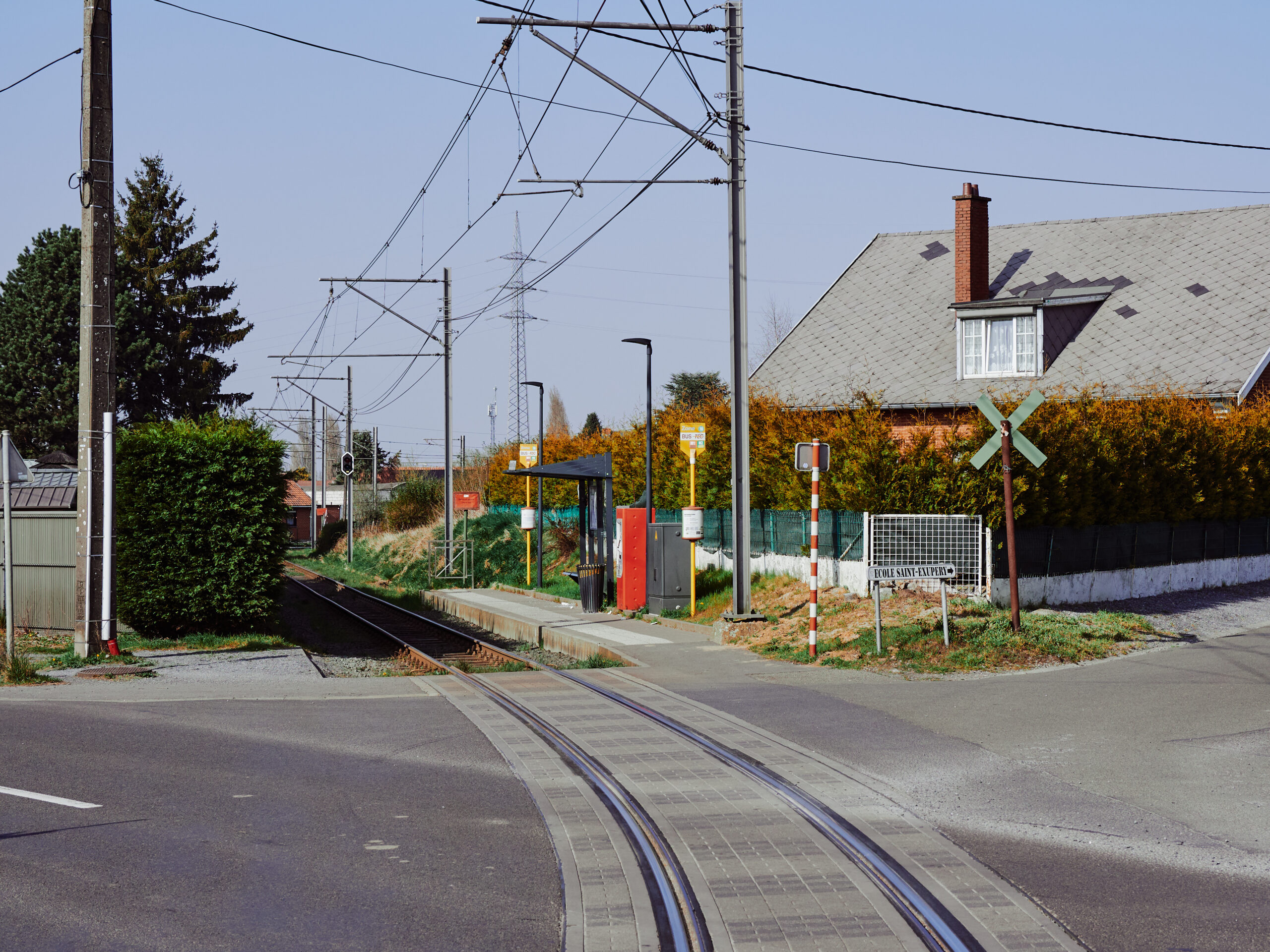
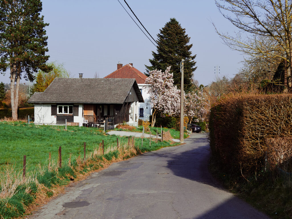
Back to the «metro» part of the line, where we hopped out at Fontaine and went for a little walk through the Belgian „countryside“. The metro looks nearly like a standard Infrabel standard gauge line here – except that there is only a tiny tram every 30 minutes instead of a real train.
After our experiences in the city centre, I was genuinely surprised how nice it is out here. A quiet area, blooming trees, nice houses, small roads, birds were singing – it was like in a little…
…oh…!
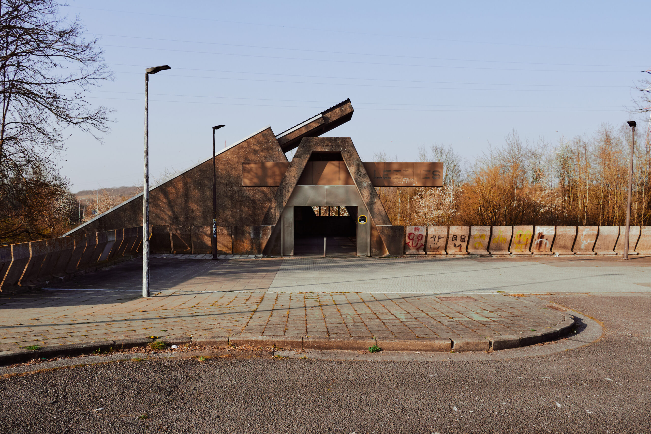
Woah, wait, wait, wait: WHAT?! What is this? And who on earth thought I would be a good idea to let Wes Anderson design a metro station? I mean, it must have been him, right? Right?
I have to admit that I was slightly underwhelmed by this interpretation of a paradise. If I should have donated more last time I visited a church? It’s downright absurd that this station has been planned and built with a ticket office! I wonder whether it has ever been operational…
Just like to prove us that this is still an operational metro station, one of the rare trains was due. One passenger got off, none got on.
The next train to Charleroi was only in about 30 minutes. Nevertheless, a passenger appeared way too early. If the lady wanted to spend some extra time in paradise?
I had to leave, needed some time to process all the absurdity I just saw.
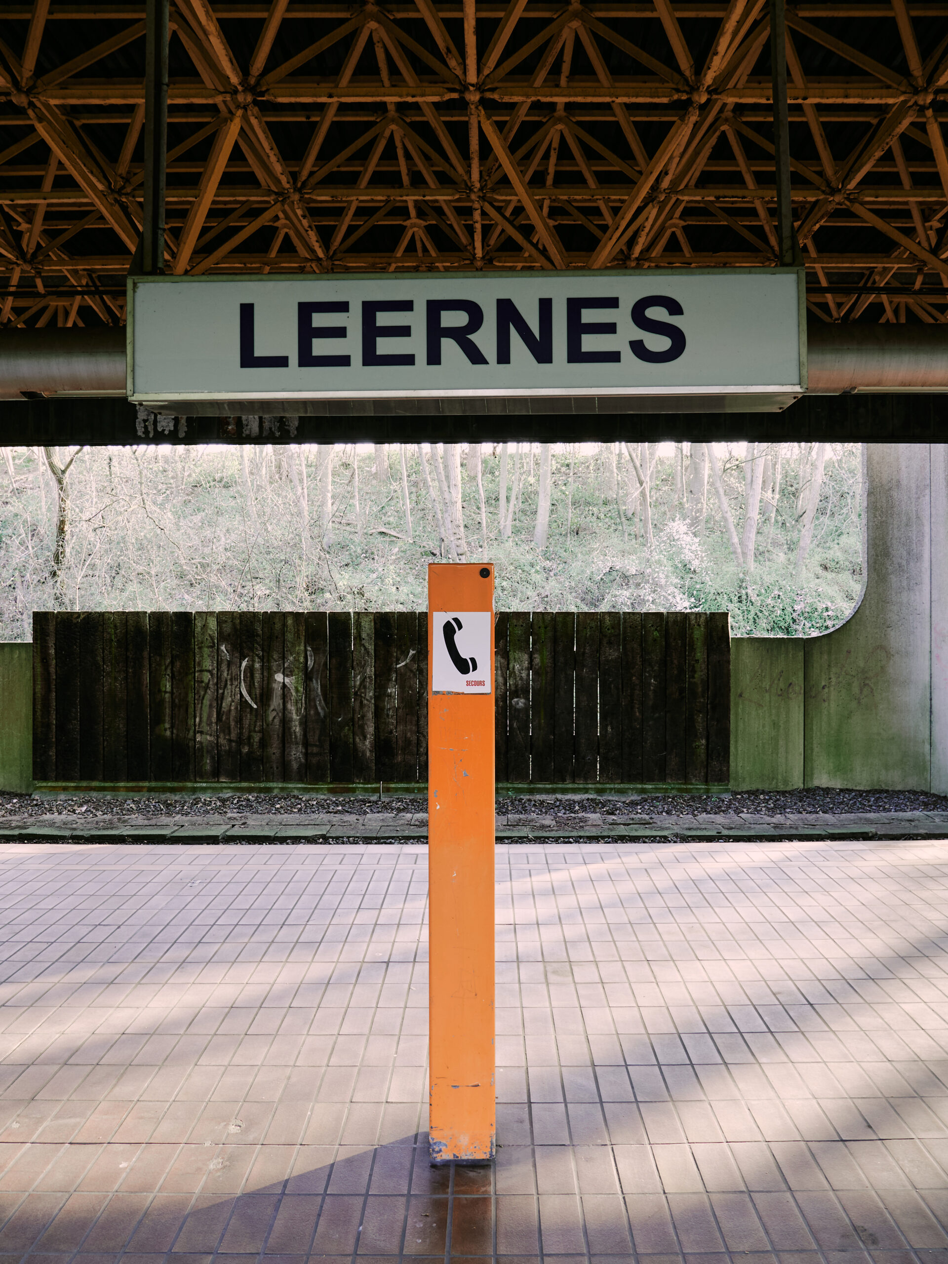
So. Back to our lovely walk across the fields in the Belgian countryside, which was just about to wake up from winter hibernation. The birds sang, the first bushes started to bloom and we were safe from that fever dream of a metro that… Wait, what is this? Here in the middle of the fields? Is this a metro logo?!
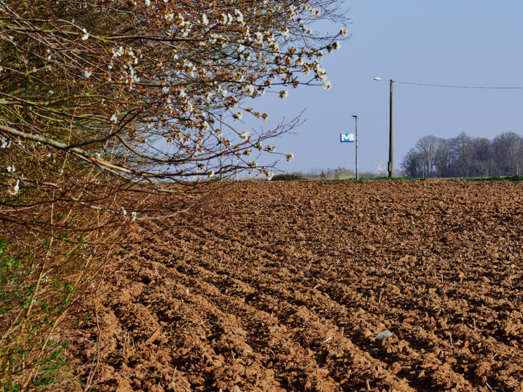
Oh, yes, of course it is! Seriously, I just don’t know what to tell you about this. I… I have no words.
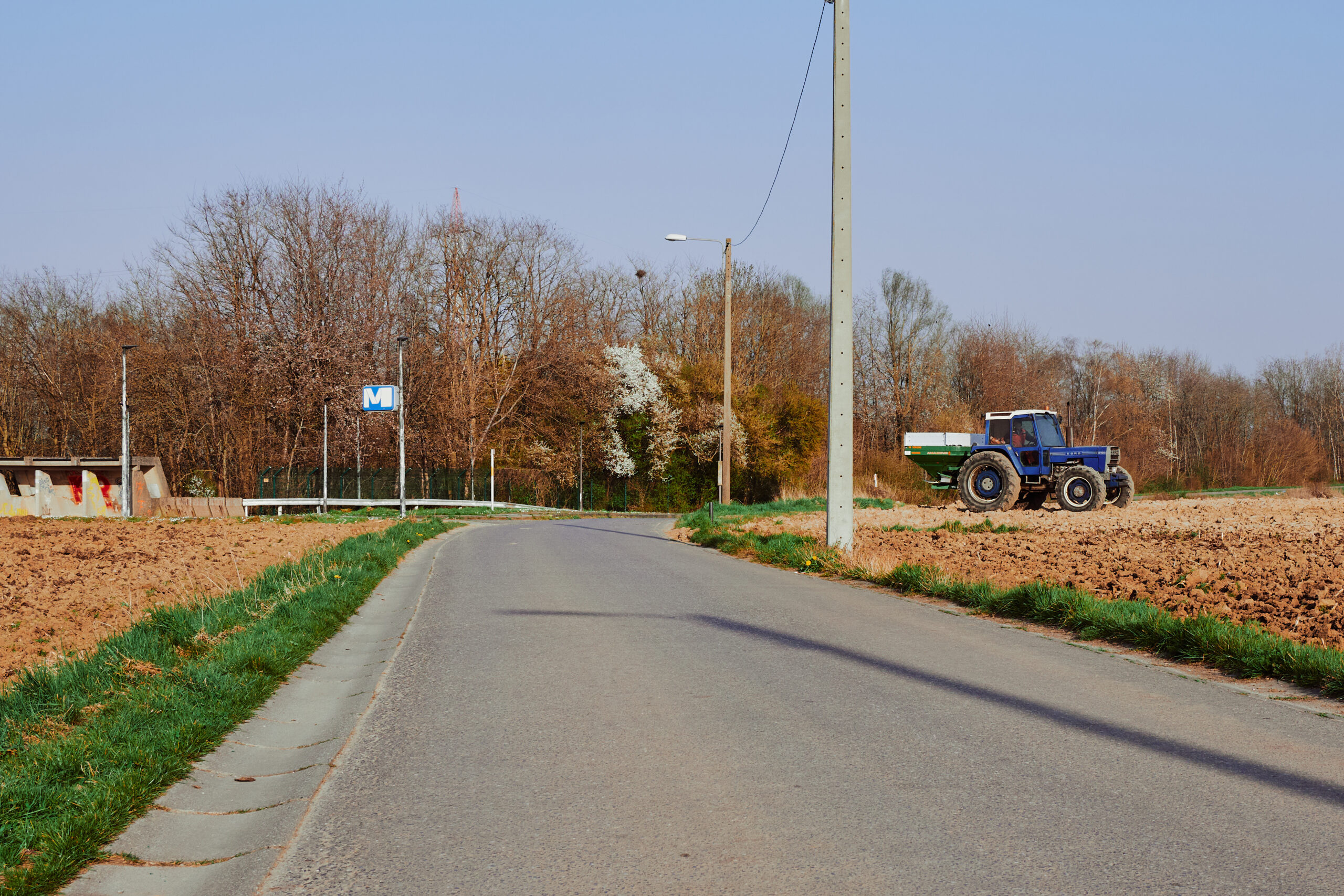
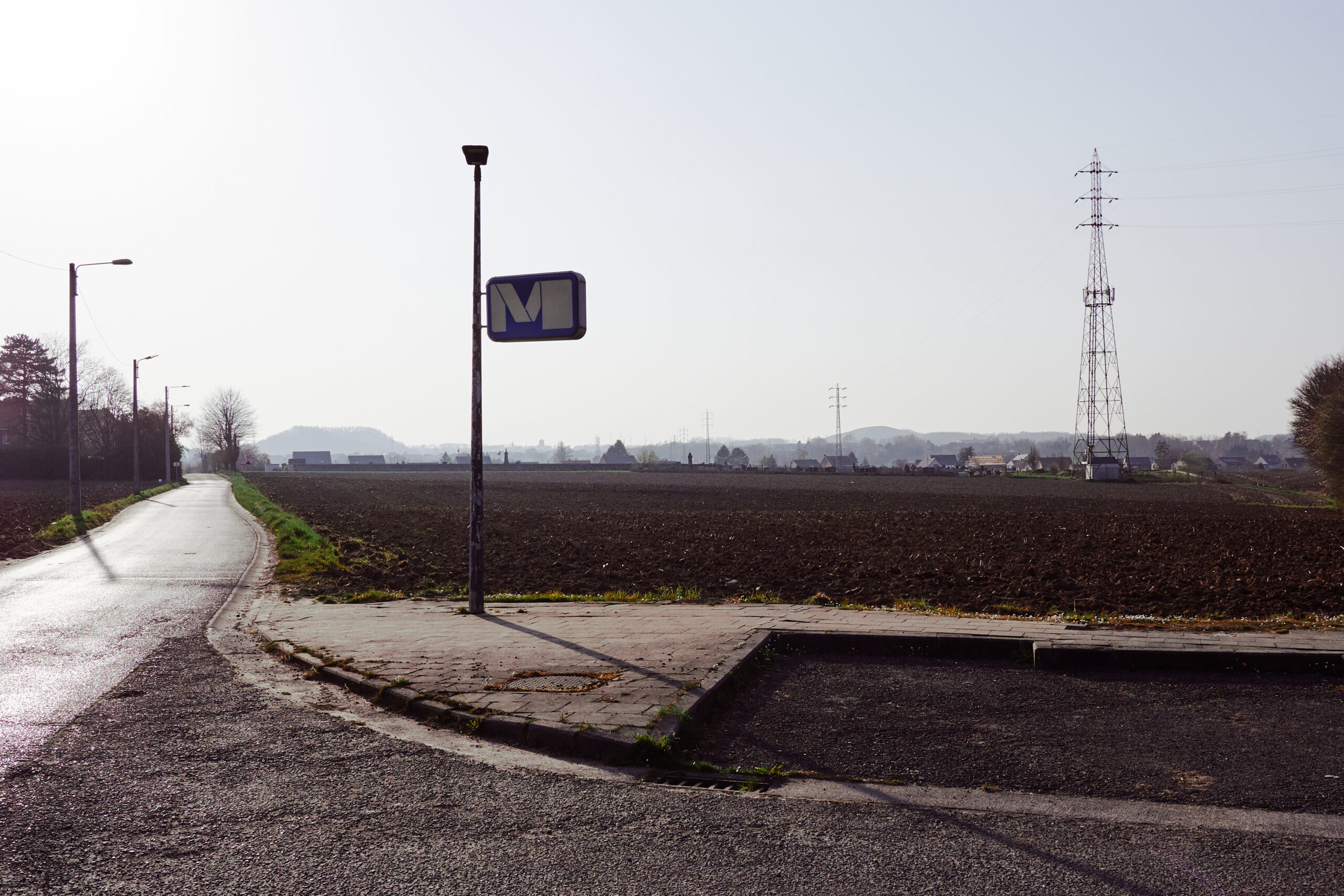
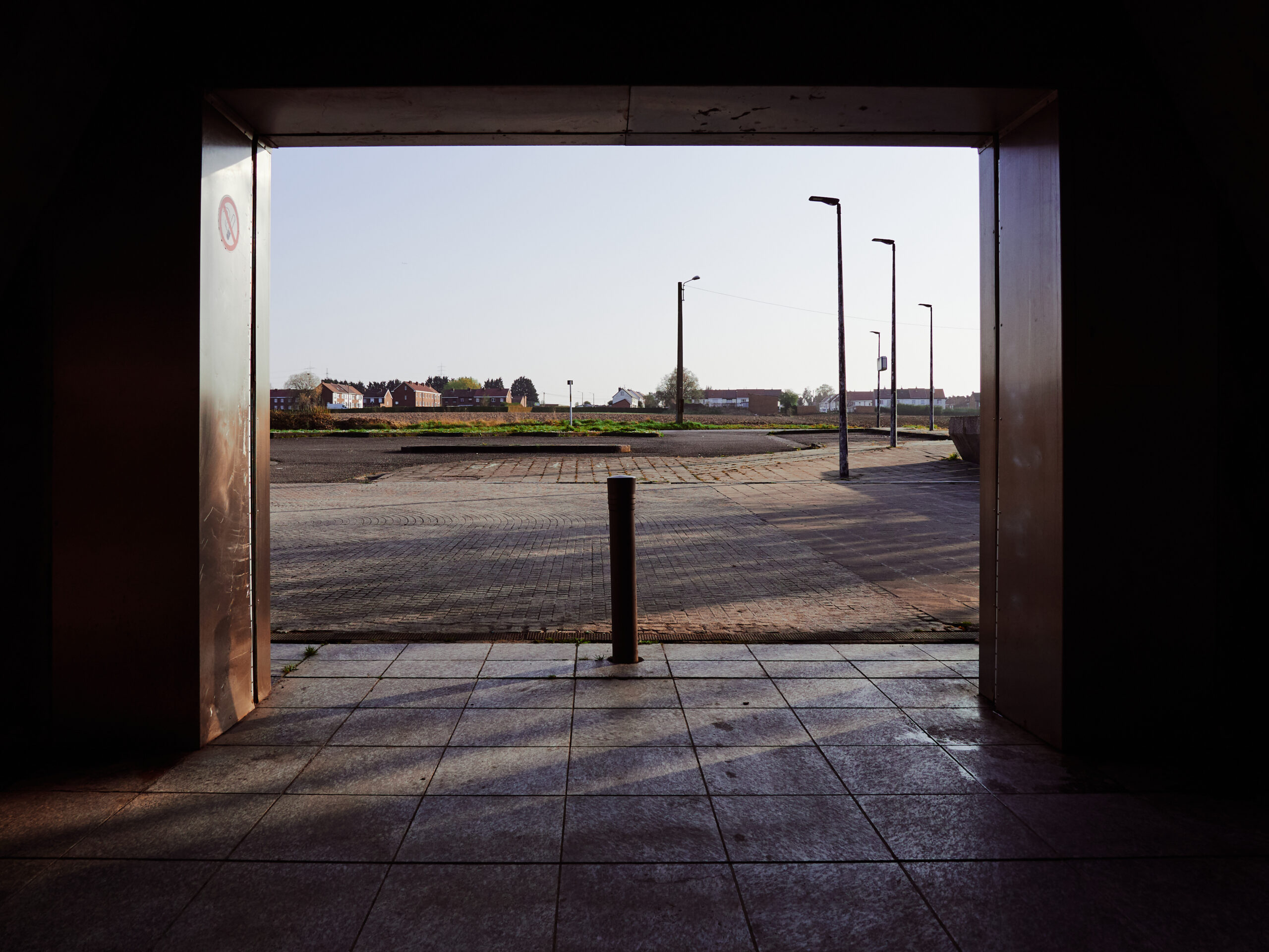
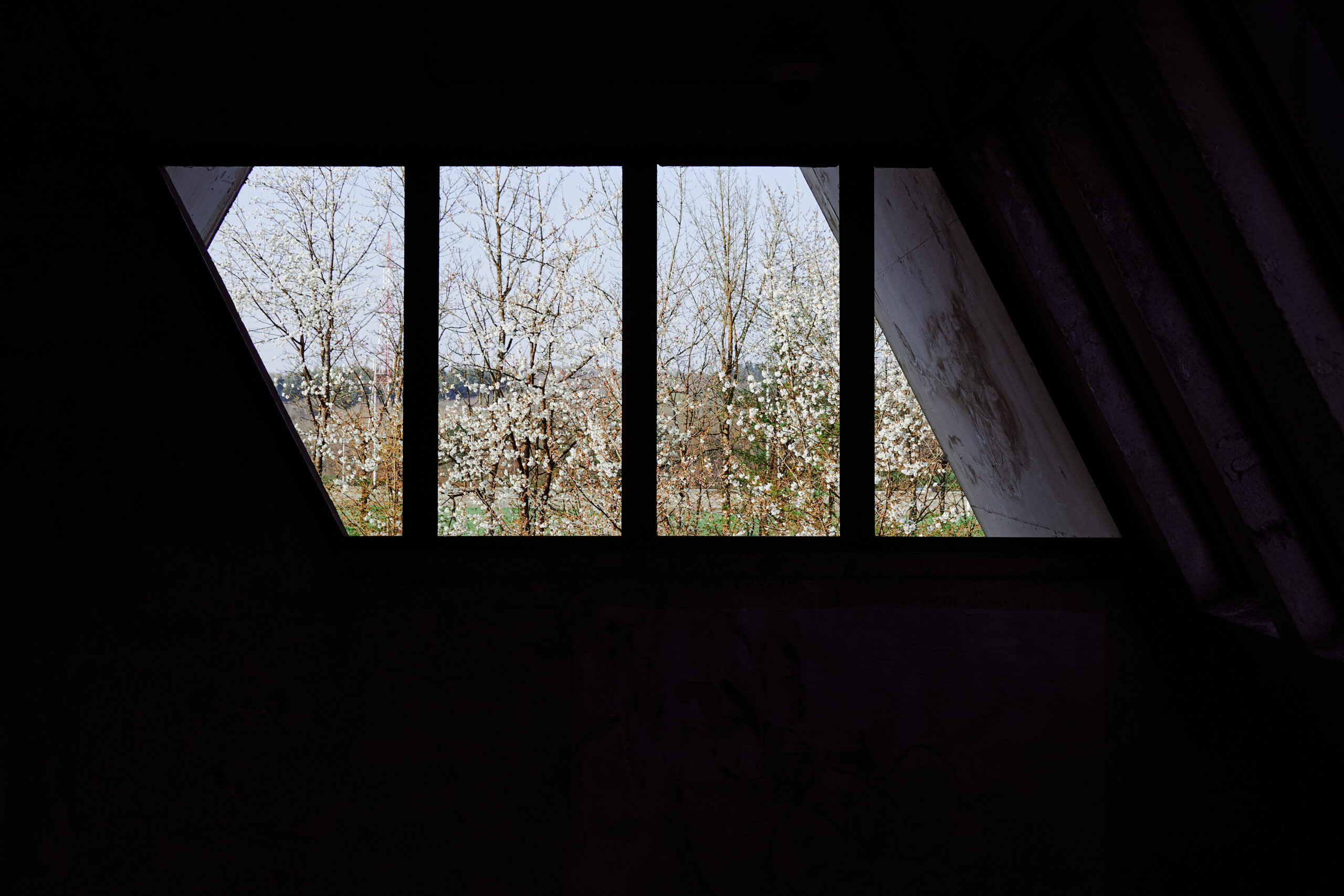
..This? Oh, never mind. No, no, it’s not a lost place. It’s a perfectly operational station of the Charleroi Metro. No, I’m not kidding – welcome to Leernes!
In the minds of the planners back in the day, this was probably to become a busy transport hub. With people parking their bikes, buses bringing comuters and picking others up and many passengers just arrive and leave by foot in the dense suburban nighbourhoods. None of it ever happened. The station is deserted, the only sounds are the singing birds, the constant humming from the nearby motorway and the noise of the tractor, ploughing the field vis-à-vis the station.
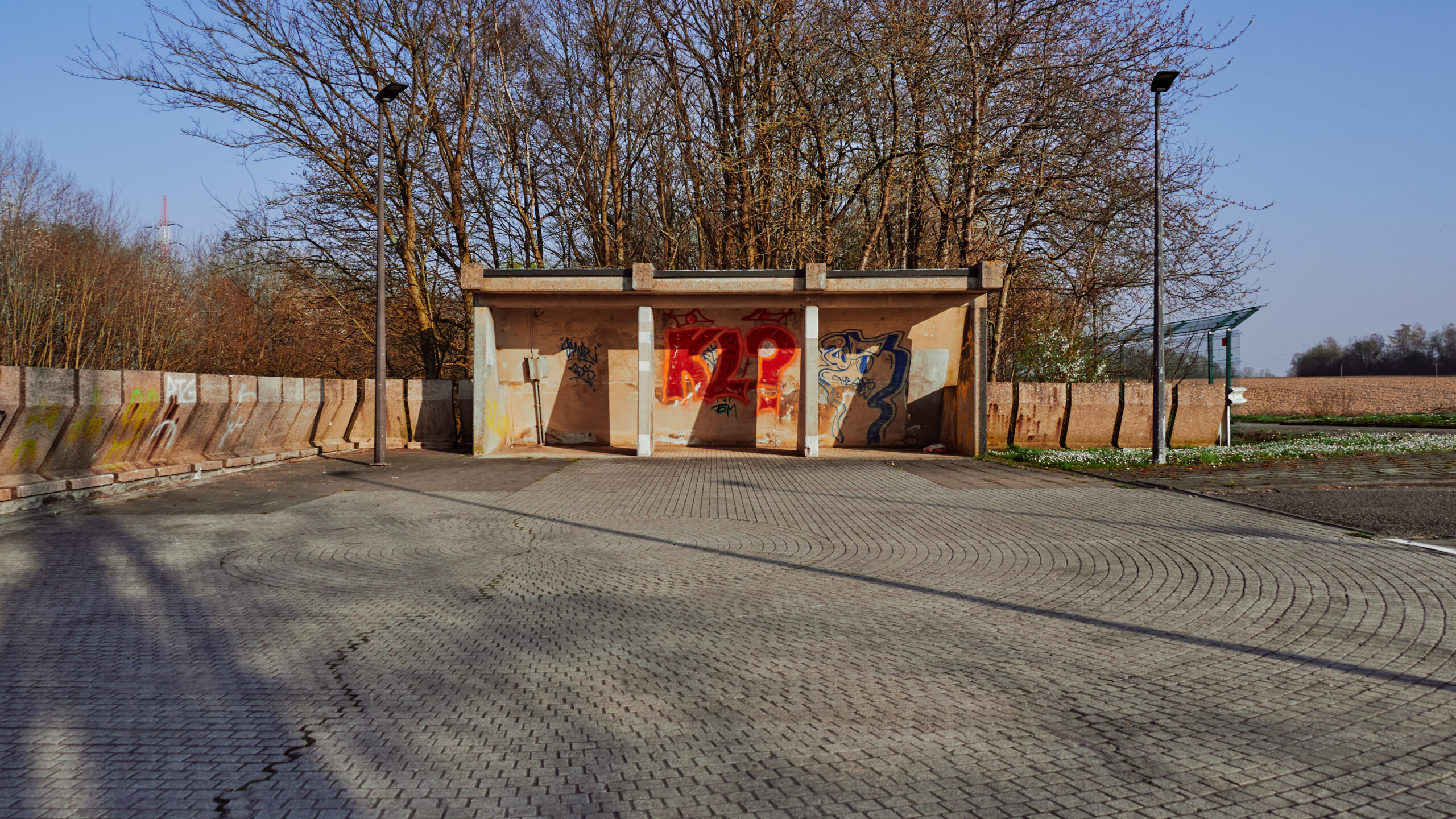
It’s probably here, in Leernes, where it becomes most obvious what the Charleroi metro is: An absurdely overdimensioned transport system, the result of dysfunctional politics and the delusive hope for a better future in a part of the country which was in full economic decline.
The contrast between the derelict brutalist station and this wonderful early spring afternoon got me in a strangly melancholic mood. I thought about how unfair wealth is distributed and about an alternative timeline, in which Charleroi would have managed the turnaround to a hip post-industrial artist city. But even in a scenario with a fast growing Charleroi, this uncoordinated ensemble of viaducts and tunnels would still be a terrible transportation system.
It’s a bit like with the fruits you forgot in your freezer for too long: There is a strange kind of beauty in decay.
Leernes station really is the perfect symbol for the whole metro of Charleroi. A huge monument to unfulfilled dreams, cast in conrete, forgotten and left to rot away in a small wood behind a motorway interchange.
A metro train arriving reminded us that we had to hurry up. Sunset was approaching fast and we wanted to see at least one more station.
At platform level. The stations on this branch have a consistent standard design. And all of them are in the same, bad shape. Incredibly enough, we spotted other passengers here! Which we strangely didn’t notice entering the station…
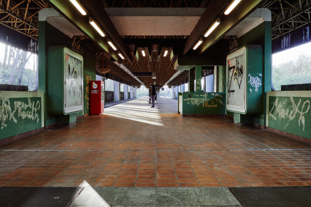
Our train arrives. I could have stayed here for hours and immerge even more in the strangely beautiful melancholic mood of this station. But our next stop promised to be at least as interesting…
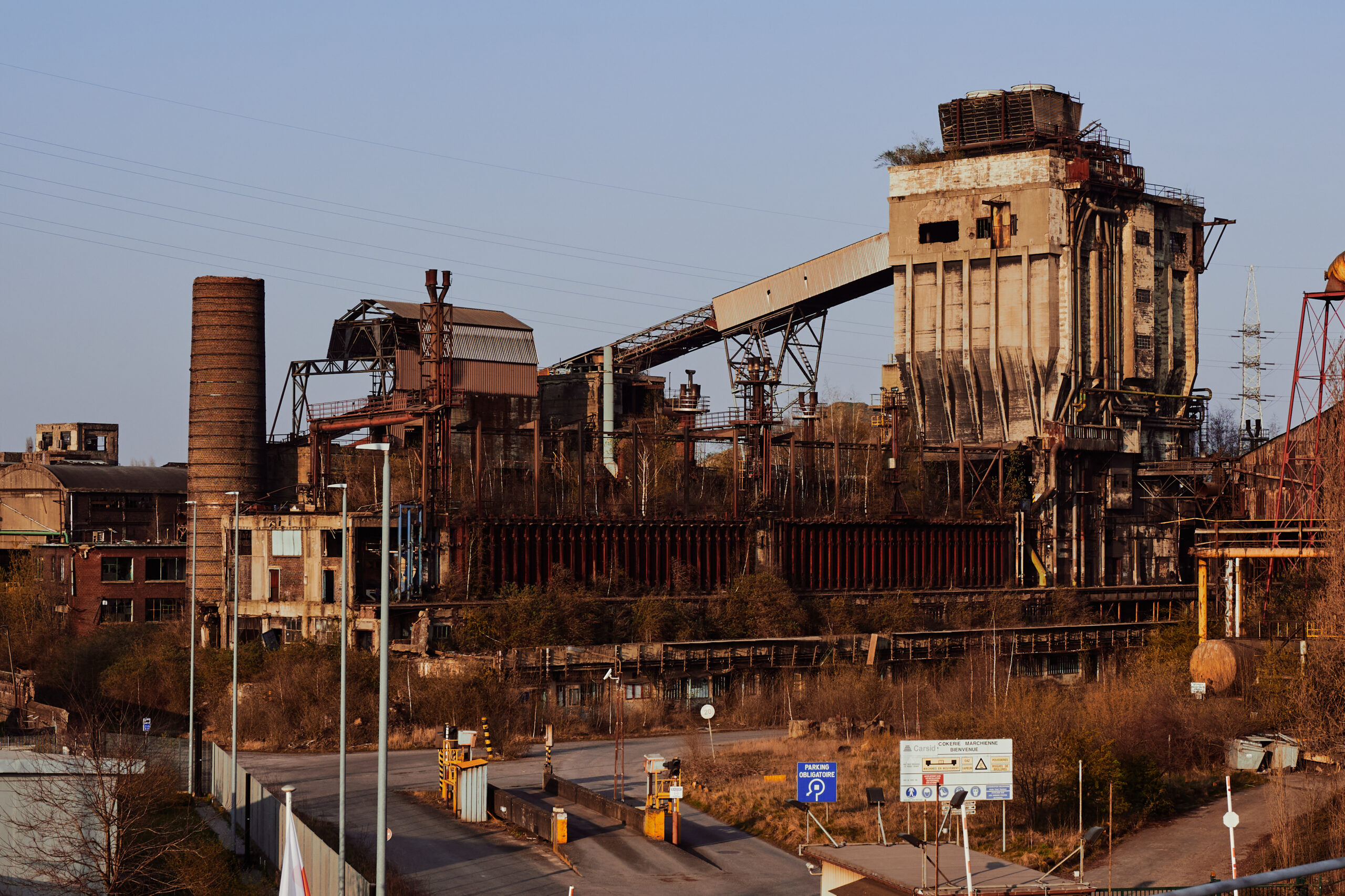
Providence! Did I promise too much?
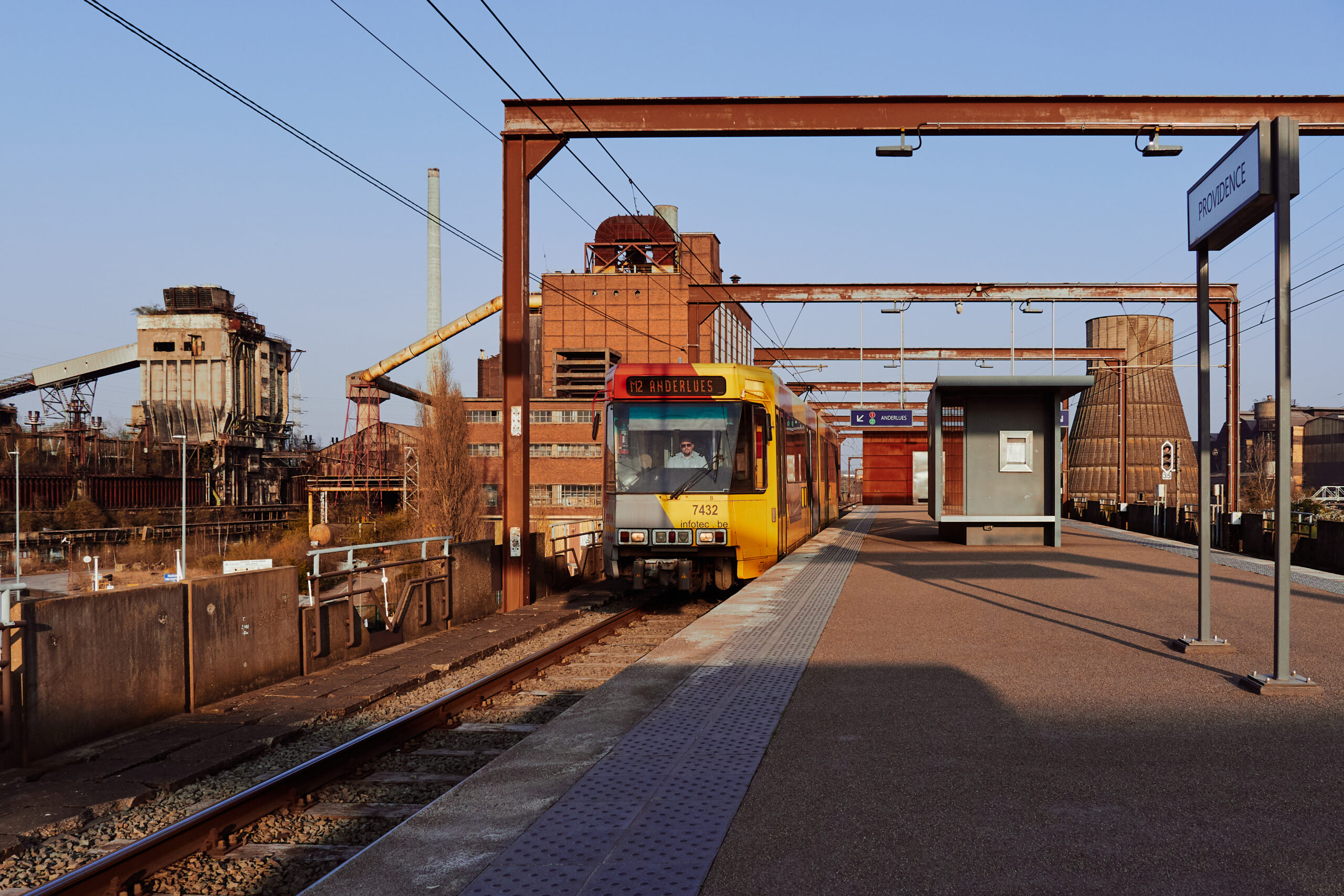
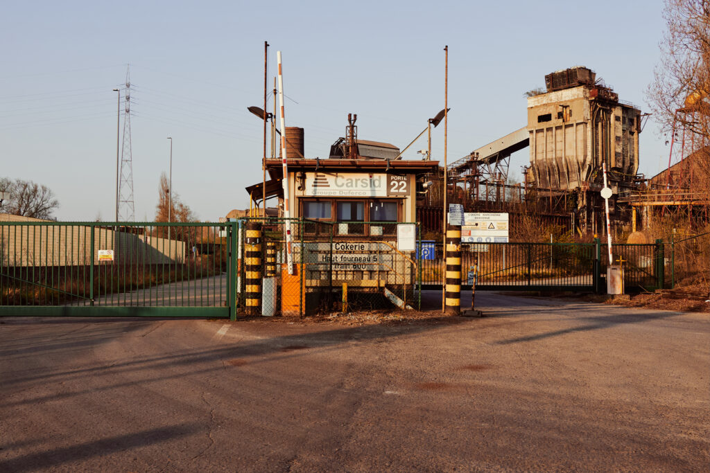
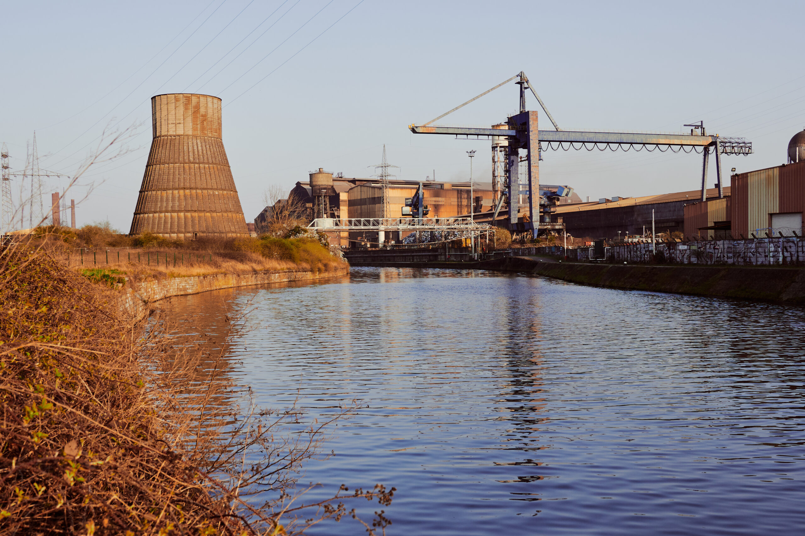
This area was the heart of Charleroi’s heavy industry. The blast furnaces of the „Forges de la Providence“ were active until the 2012, when the last thousand workers lost their job. The koking plant just next to the metro station shut down a few years earlier. Today, only a gas power plant and a concert venue remain in the vicinity of the station. The Accelor-Mittal site on the other side of river Sambre, the last active part of the steel industry in Charleroi, is not accessible from the metro because there is no bridge over the river.
Absurdely enough, out of all metro stations, they chose exactly this one to modernise.
There’s a strange kind of silence here, it feels a bit like the clam before a storm. As if the station was just waiting for the factory bells to announce the end of the shift and for hundreds of tired workers from the industries to stream onto the platform shortly afterwards. But it has been waiting in vain for more than ten years. In fact, I suspect that we are the last passengers here for today.
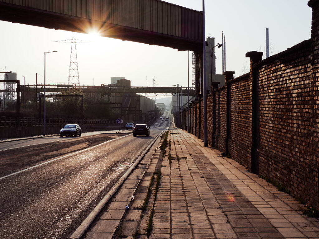
The station’s exit leads onto the busy westbound main road. A lot of cars rushing through, but apart from the street, the area is deserted. Not a single pedestrian around. We feel tiny and lost among the huge industrial ruins and the brutalist metro bridge. And I’m really curious where the driver of this single car parking under the metro bridge went to.
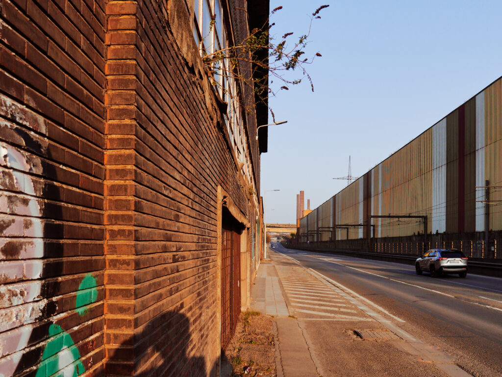
We decide to walk back to Charleroi instead of waiting another 30 minutes for the next metro. The evening sun lits the old derelict brick buildings in a beautiful warm light. Despite the many cars on the road, we feel like the last human beings on a distopian planet earth.
Impressions of a dead part of Charleroi.
Another sunset over a cheerless and forgotten part of the city is approaching. That’s another day done without the slightest sign of recovery.
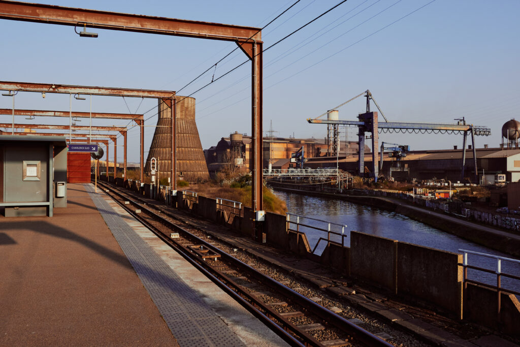
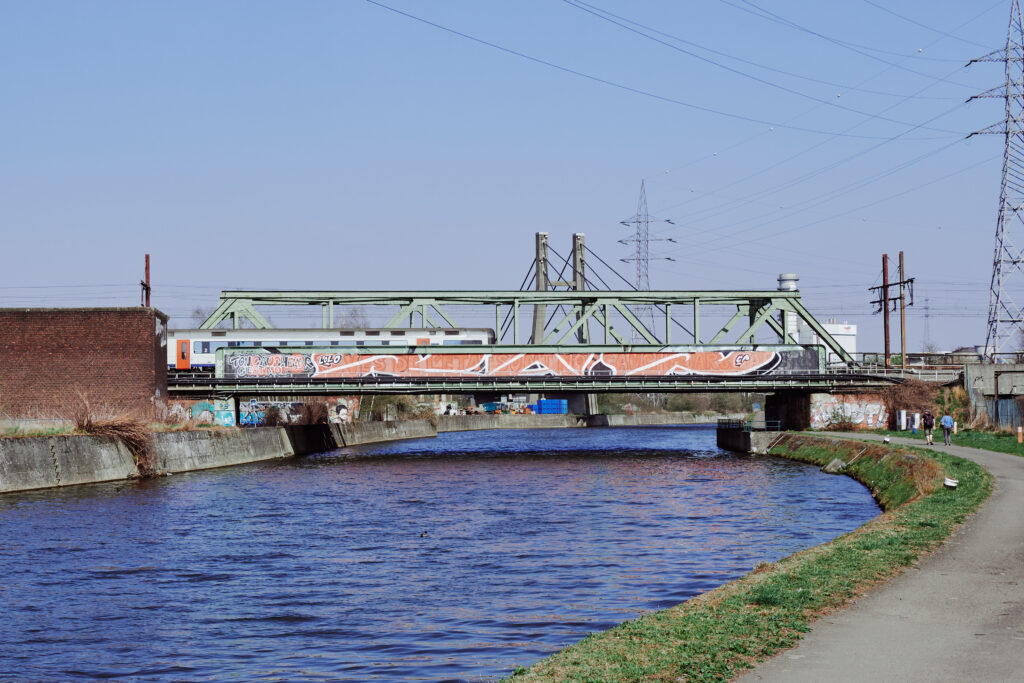
A metro train is approaching on the Damprémy viaduct, as we just cross the bridge over the narrow and short link between the Sambre and the Charleroi-Bruxelles canal, which originates here.
Metro crossing between industrial ruins in the sunset.
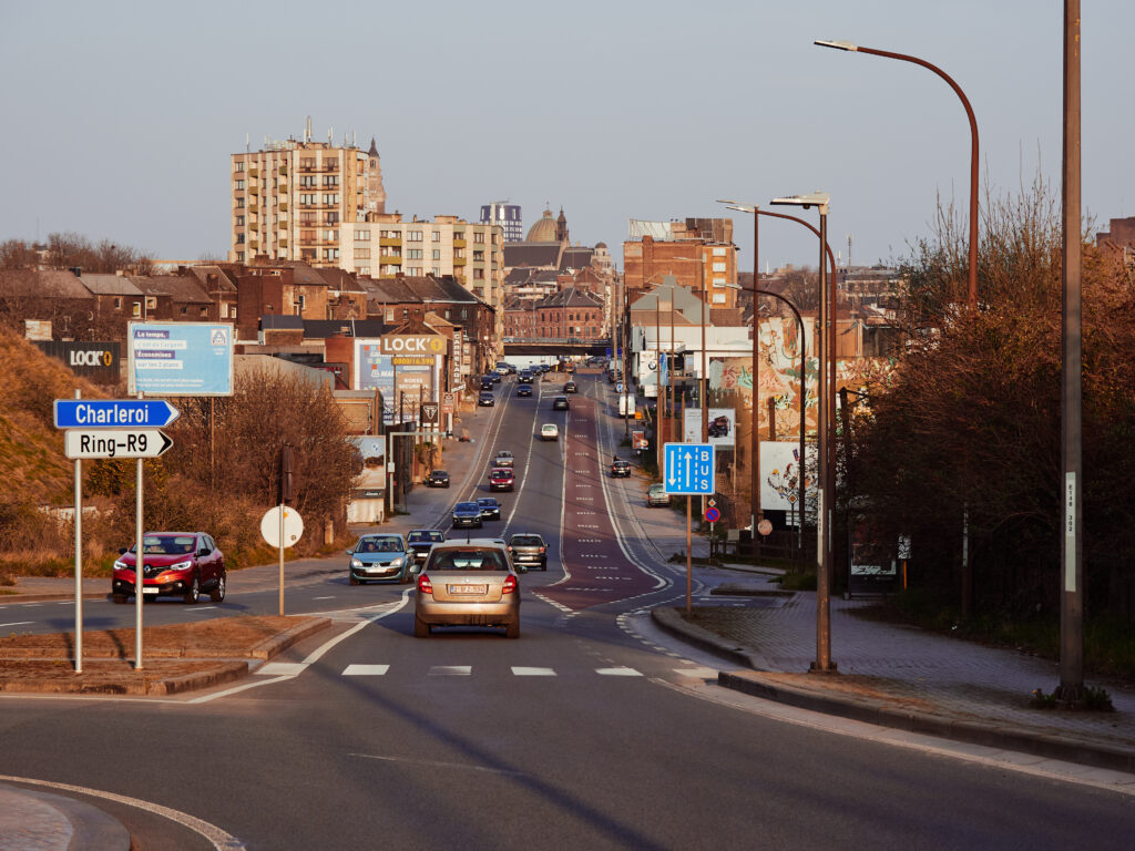
Finally, the city centre appeared on the horizon. Note the signpost to the motorway ring, simply saying „Ring-R9“, even if this is deep in the French speaking part of Belgium.
It is still not the most pleasant area here. I’m feeling a bit relieved, that there’s still bright daylight. It’s not the kind of neighbourhood you want to walk past in the dark…
Mining cities unite!
Finally, after we passed under the motorway bridge, we reached the city centre and Charleroi Ouest station.
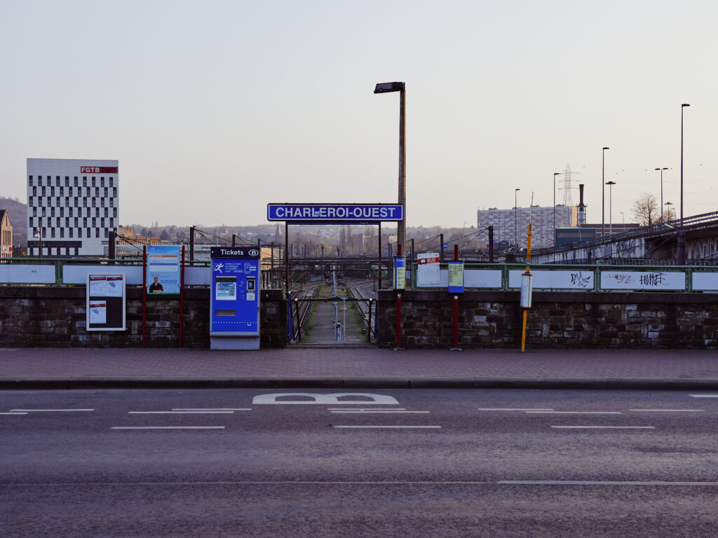
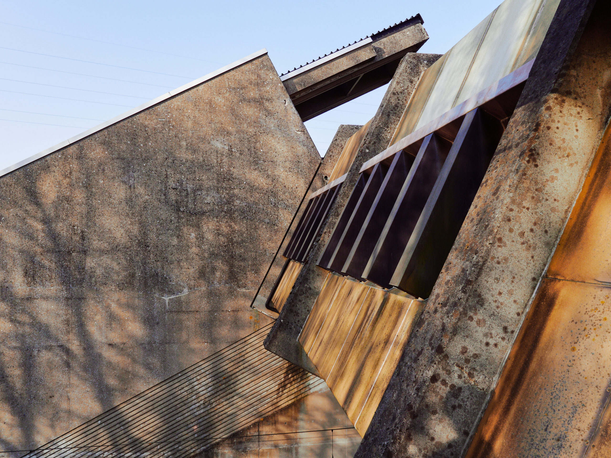
Just next to the SNCB tracks is the Metro station Ouest. Unlike the main line railway, it again is – surprise, surprise – completely #UnnecessarilyUnderground. An entire block of houses was demolished just to build the underground metro station and the parking lot here.
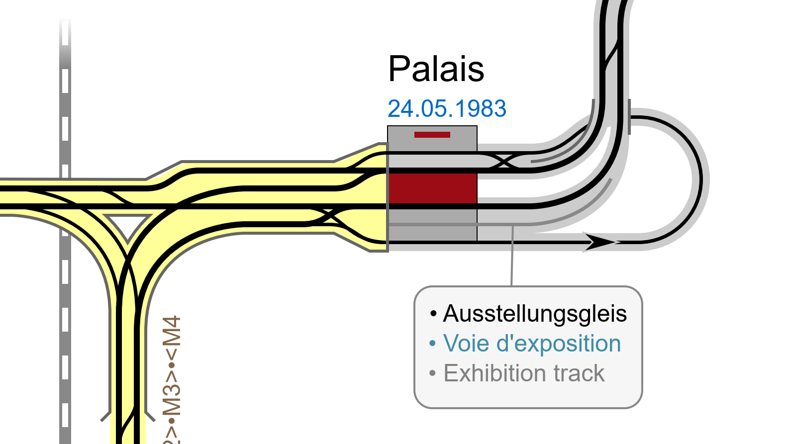
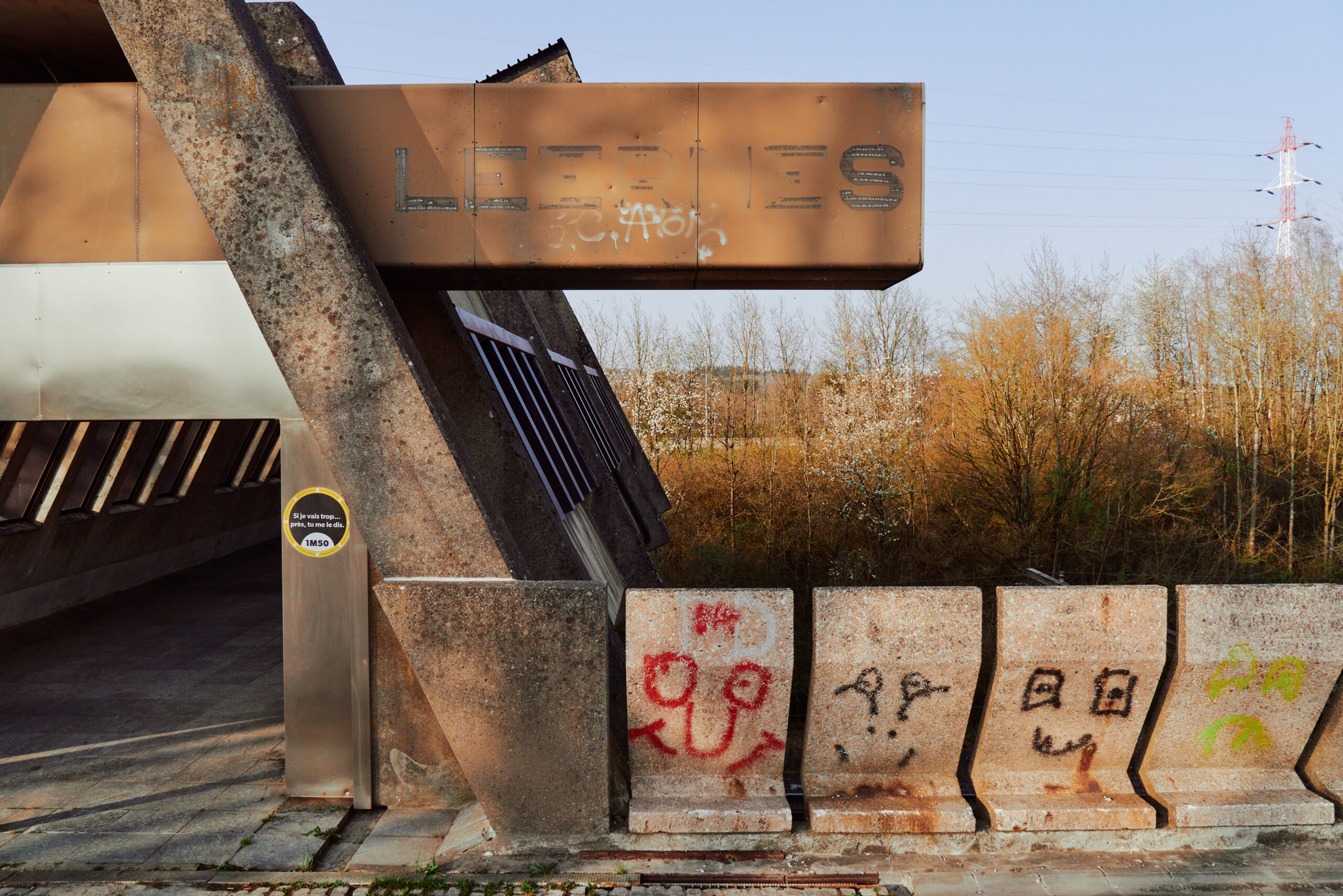
Oh, and if you turn around and look towards the north, you see this! Would you believe me, if I tell you that this is not another derelict industrial building, but the city’s cultural pride and joy? Yes, this is Charleroi’s Palais des Expositions! Currently under reconstruction, to be fair.
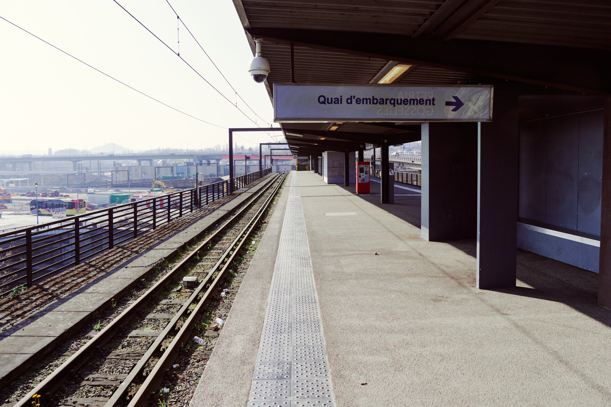
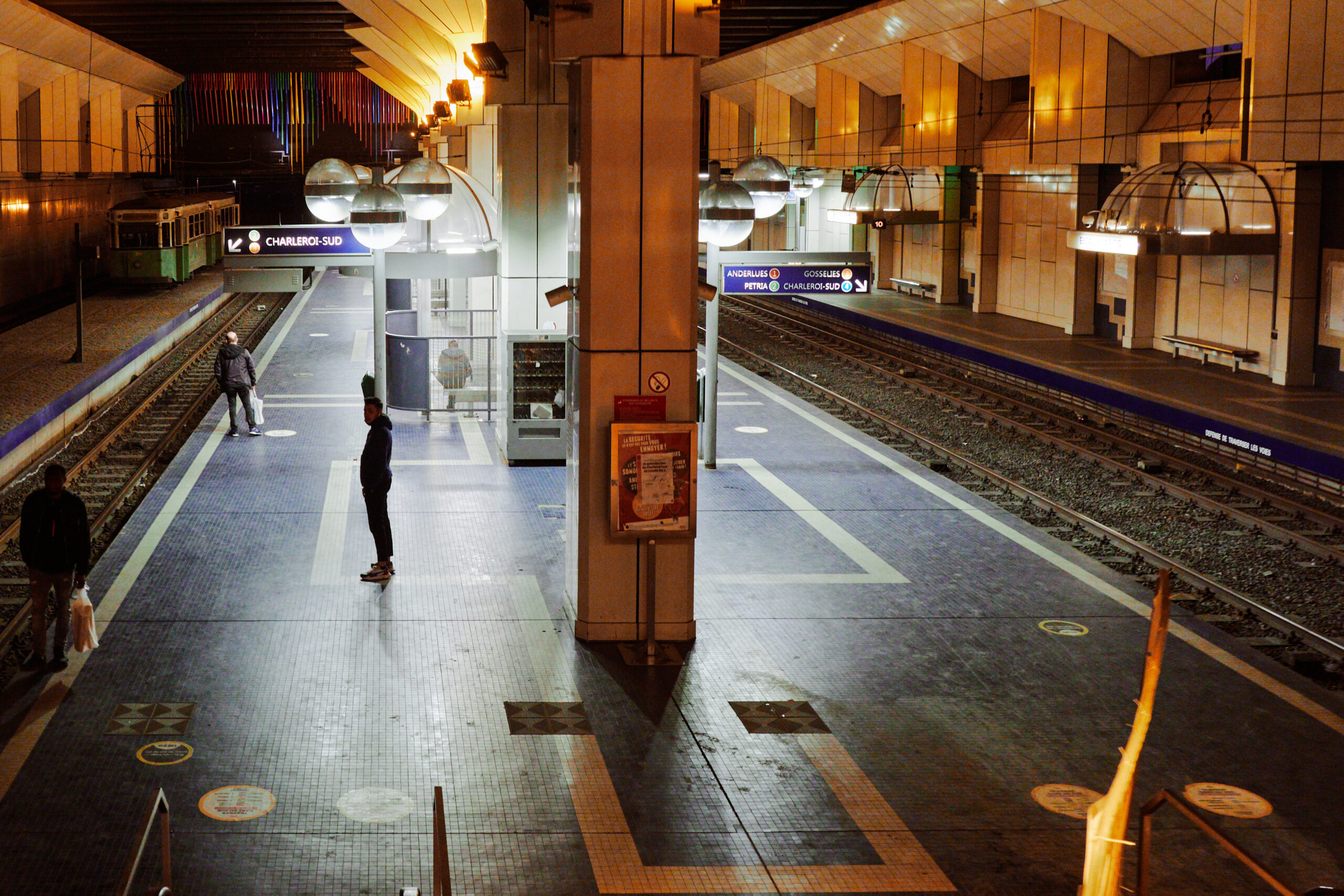
There was just enough time to do one last thing before the sun sets and the metro stops operations: To get on a metro covering the eastern part of the currently interrupted loop, between Waterloo and Tirou. So back to the southern station, where metros arriving from the eastern part of the loop terminate at a temporary stop.
The facades of the Ville-Basse facing the Charleroi-Sud station in the last bit of daylight. The waterway in front is not a canal but the actual river Sambre. Oh, and can you spot the large, windowless brick facade of the building slightly right from the middle, between the arches? Guess what: This is actually a pre-constructed but never completed part of the metro! 🤯
According to the original plans it would have passed through that house and than crossed the Sambre on a viaduct! Thank god this part of the ring was completed late enough, that they sensibly built the metro at ground level, using the bridge in the background.
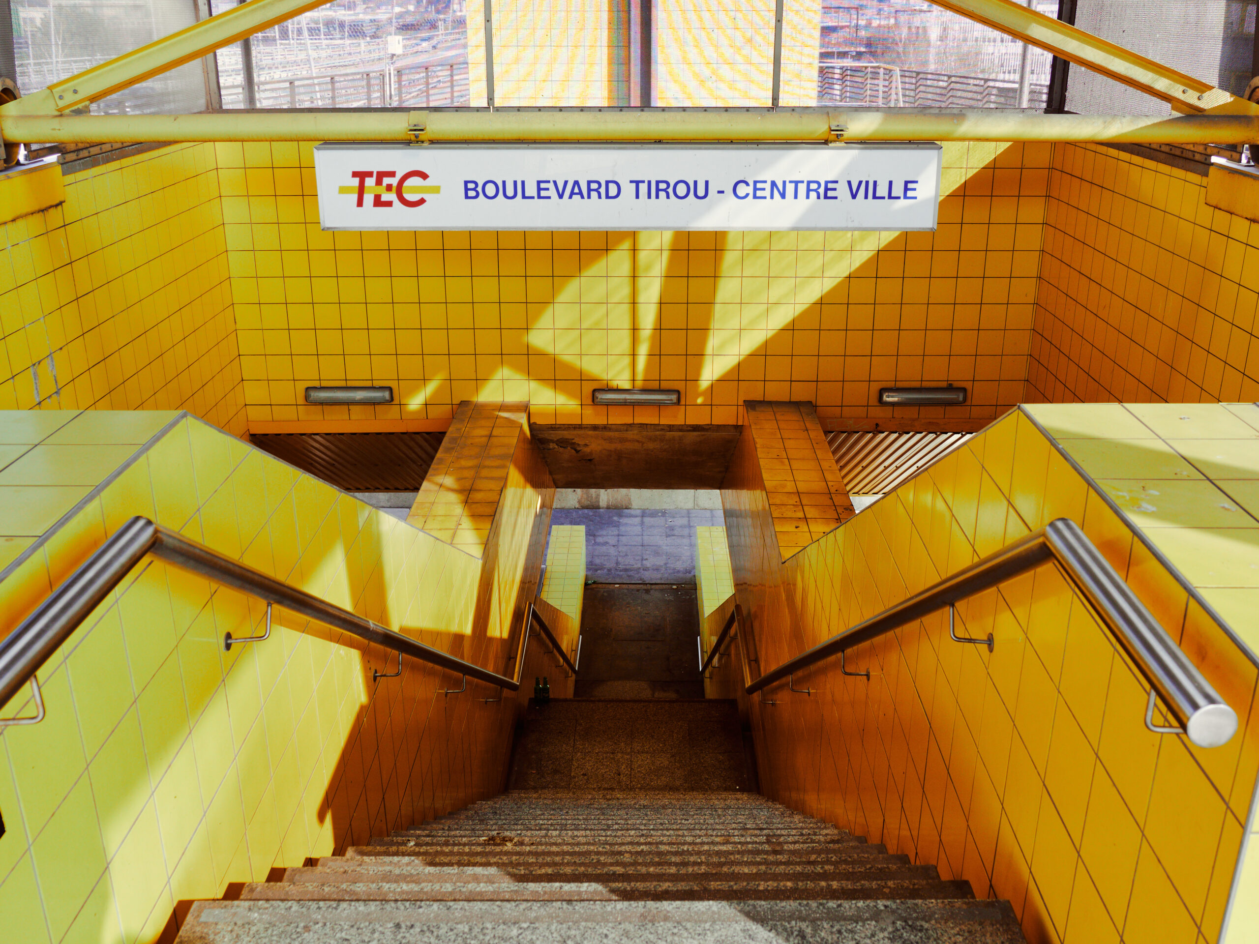
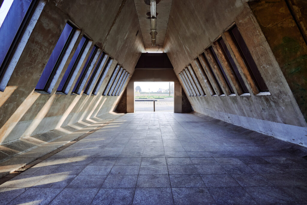
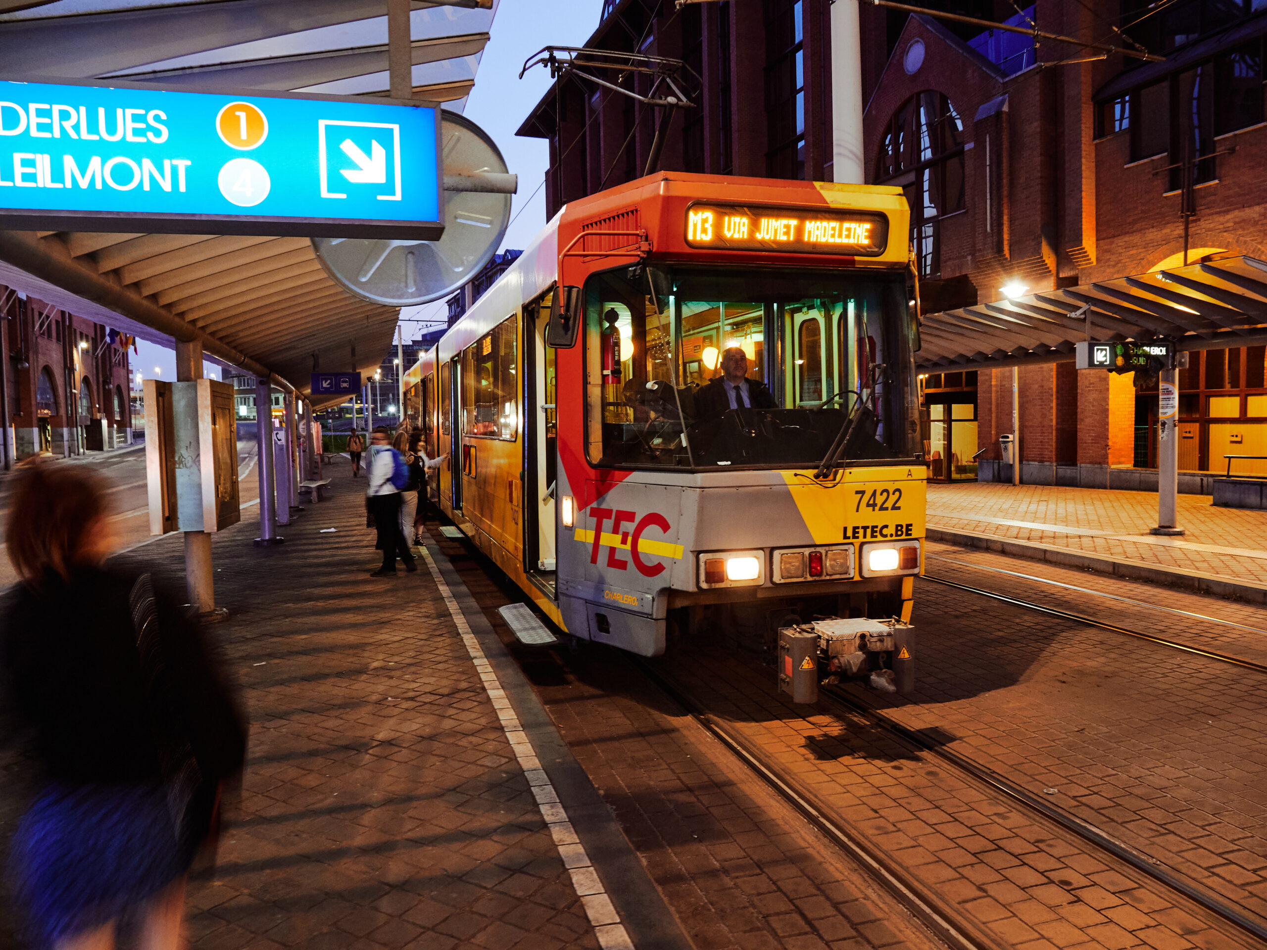
Tirou metro station. The newest and apart from Gare du Sud the only tram-like non-underground or non-elevated station in the centre. We board a M3 service for the last missing bit of the network.
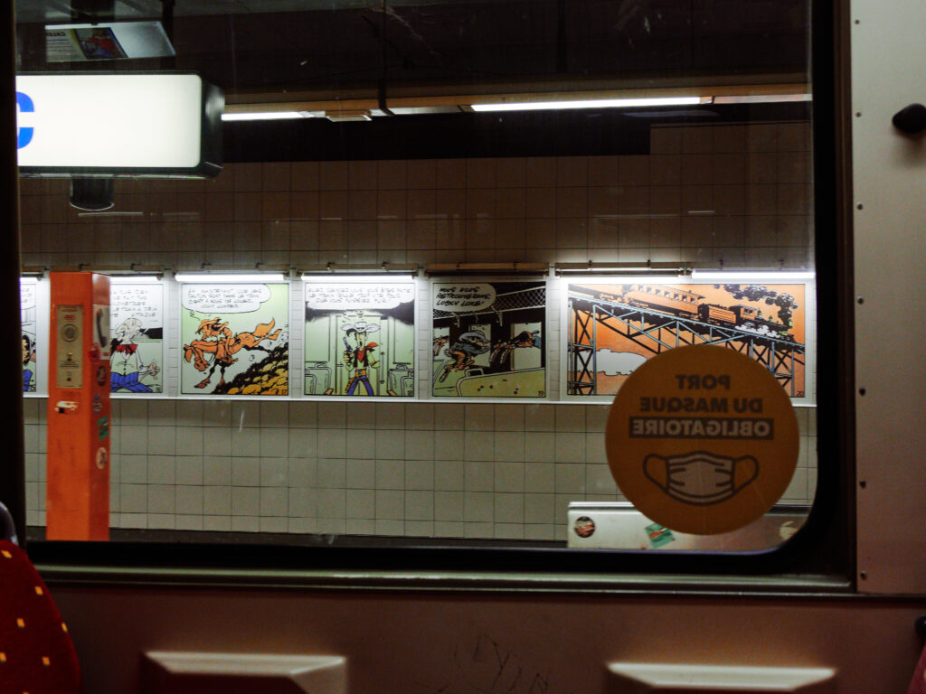
This part of the city ring was not finished until 1996, the last part to Tirou and Sud even opened only in 2012. The underground stations of Tirou and Parc are therefore considerably more modern looking than the other ones on the ring. In honour of Belgiums rich illustration history, they are decorated with comic characters and panels.
Arrival at Beaux-Arts. And oh, boy, does this station hit different at that time of the day. A couple of men were lurking around, suspiciously eyeballing every of the few passengers. I was starting to wonder whether the early closing hour of the metro (the last trains leave at about 20:00) is not because of missing money, but due to security issues in all these underground stations…
We hurried to get out of the station. On the intermediate level, a dealer was openly selling stuff to a customer. Hectic footsteps could be heard and a security guard followed by a corpulent TEC employee ran towards the dealer, shouting. Fierce verbal battles ensued and someone ran away. We left as quickly as we could.
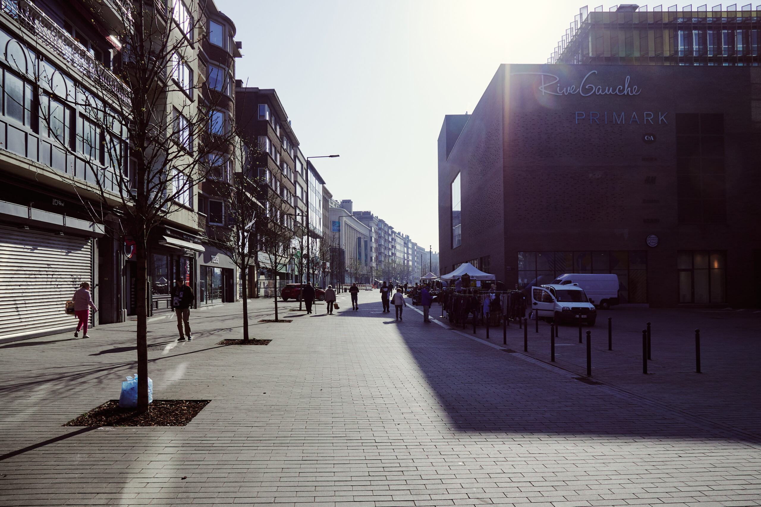
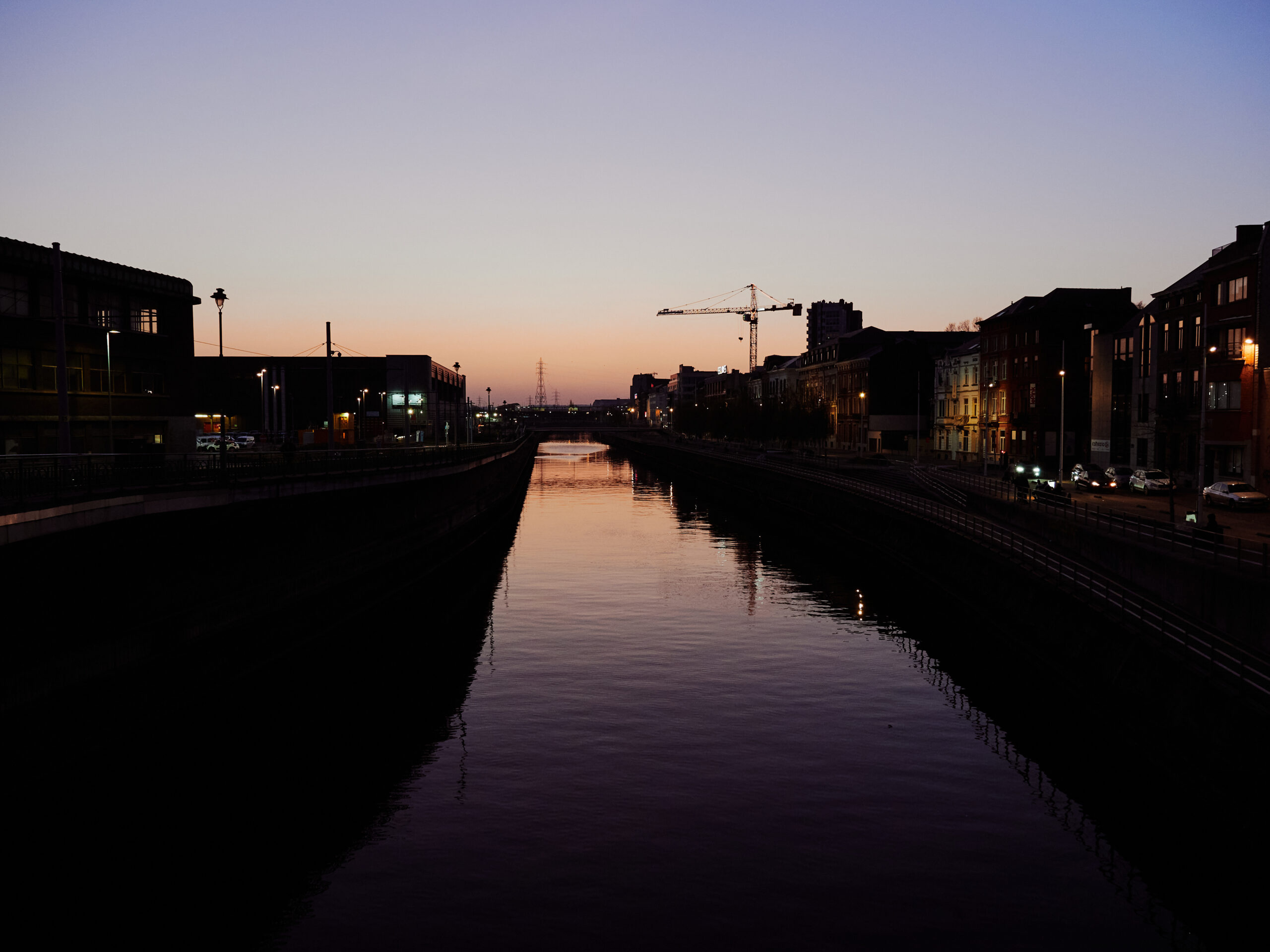
The river Sambre lies quiet in the last faint light of today. I wasn’t able to immediately process everything I saw. And by all, I don’t mean this utter failure of a metro network. It’s more the lack of prospects that is so obvious everywhere, the decay, the precarious situation of apparently a wide part of the population. I would never have imagined to find a city in this state so close to home. A visit to Charleroi puts your own life into perspective. I felt even more privileged than usual.
The quirky metro is fun to remember for transportation nerds like me. But what hit me like a brick was the tragedy of this city and its society. I hope and wish for the community here that the turnaround will finally succeed. That Charleroi will become an attractive, perhaps even somewhat hip post-industrial centre. A city in which only a few chimneys and a quirky metro as a symbol for the past will remind us of the hard decades.
🟥🟨
Update: The future looks brighter for Charleroi than it did when I first visited and wrote this thread. A lot of construction work is ongoing to upgrade public spaces. Industrial ruins are being demolished. The metro vehicles and stations modernised. And even the never opened «ghost line» to Centenaire is brought to live. And: The vibe changed. The long awaited turnaround for Charleroi might finally happen.
Comment
Building infrastructures comes with a high responsibility. I’m all pro investments in public transportation. But these infrastructures come with a high cost twice. First for the construction and then, once you’ve built them, they’re there to stay and devour a lot of money for maintenance and operation. Needless to say, that they require a fact-based potential analysis and need to be thoroughly planned in a forward-looking way – something which is every so often undermined by wrong political priorities and concrete-focused planners and engineers.
The Charleroi metro is a shining example for everything you could do wrong in transportation planning. It’s a memorial for failed public infrastructure planning; a curse cast in concrete in form of bridges and tunnels – a nightmare to maintain for something so far away from actual transport needs. It is probably fair to say that this metro brings very few added value for the community compared with could have been a more light weight transportation system.
It’s not that I envy Charleroi for its metro. But you can see it in the faces of the city and its inhabitants: This town has had some tough decades. Imagine what could have been done for the community here with the amount of money lost for the lunatic dreams of an oversized metro system. Politicians and planners had the opportunity to make a different decision, to propose different solutions. To invest the funds in projects that would have been of greater benefit to the population. That did not happen. The consequences are still being felt today.
Adrian Fuentes‘ excellent thread about the Charleroi metro which started my whole fascination with this system.
Gleisplanweb’s comprehensive map of the Charleroi system with a lot of additional information
The Tim Traveller’s funny and informative videos about the Métro de Charleroi